Geology Collection (#10)

"Exploring the Earth's Rich Tapestry: A Journey through Geology" William Smith Geological Map: Unveiling the intricate layers of our planet's history

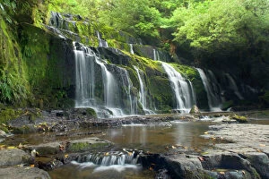
Background imageGeology Collection: Purakaunui Falls beautiful waterfall within dense temperate rainforest Catlins, Southland

Purakaunui Falls beautiful waterfall within dense temperate rainforest Catlins, Southland, South Island, New Zealand
SAS-754 Purakaunui Falls - beautiful waterfall within dense temperate rainforest Catlins, Southland, South Island, New Zealand Steffen & Alexandra Sailer Please note that prints are for personal

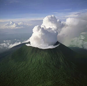
Background imageGeology Collection: Democratic Republic of Congo (DRC) - Aerial view of Africa, Mount Nyiragongo, Virunga Volcanoes

Democratic Republic of Congo (DRC) - Aerial view of Africa, Mount Nyiragongo, Virunga Volcanoes
AW-6561 Democratic Republic of Congo (DRC) - Aerial view of Africa Mount Nyiragongo, Virunga Volcanoes, Home of Mountain Gorilla

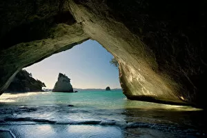
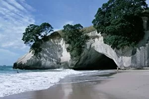
Background imageGeology Collection: Cathedral Cove by erosion artfully sculpted rock formation seen from the inside of a natural rock

Cathedral Cove by erosion artfully sculpted rock formation seen from the inside of a natural rock arch at Cathedral
SAS-816 Cathedral Cove - by erosion artfully sculpted rock formation seen from the inside of a natural rock arch at Cathedral Cov Cathedral Cove, Coromandel Peninsula, North Island

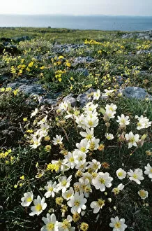
Background imageGeology Collection: Eire - Mountain Avens (Dryas octopetala) Hoary Rockrose (Helianthemum oelandicum)

Eire - Mountain Avens (Dryas octopetala) Hoary Rockrose (Helianthemum oelandicum)
ROG-6903 IRELAND - Eire. Mountain Avens (Dryas octopetala) and Hoary Rockrose (Helianthemum oelandicum) growing in Limestone Pavement The Burren. Co. Clare

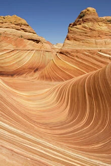
Background imageGeology Collection: USA - The Wave, a breathtaking work of art, naturally carved in beautiful red

USA - The Wave, a breathtaking work of art, naturally carved in beautiful red
TD-1853 The Wave, North Coyote Buttes North Coyote Buttes, Paria Canyon-Vermilion Cliffs Wilderness, Vermilion Cliffs National Monument, Arizona, USA A breathtaking work of art

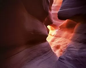
Background imageGeology Collection: Antelope Canyon

Antelope Canyon, Page, Arizona, United States of America, North America

Background imageGeology Collection: Beach, white chalk cliffs

Beach, white chalk cliffs, stacks and arches, Whitianga, Coromandel Peninsula, South Auckland, North Island, New Zealand, Pacific

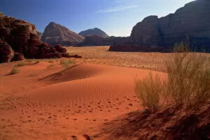
Background imageGeology Collection: The desert at Wadi Rum

The desert at Wadi Rum, Jordan, Middle East

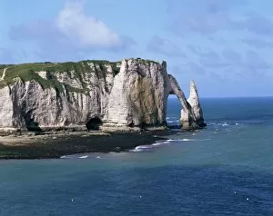
Background imageGeology Collection: Falaises (cliffs) and rocks near Etretat, Cote d Albatre, Haute Normandie

Falaises (cliffs) and rocks near Etretat, Cote d Albatre, Haute Normandie, France, Europe

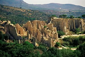
Background imageGeology Collection: Ille-sur-Tete, Les Orgues, Pyrenees-Orientales, Languedoc-Roussillon, France, Europe

Ille-sur-Tete, Les Orgues, Pyrenees-Orientales, Languedoc-Roussillon, France, Europe

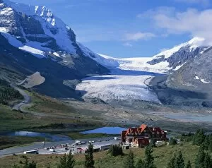
Background imageGeology Collection: Roadside building dwarfed by the Athabasca Glacier in the Jasper National Park

Roadside building dwarfed by the Athabasca Glacier in the Jasper National Park, UNESCO World Heritage Site, Alberta, Canada, North America

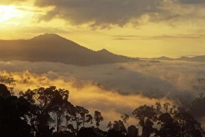
Background imageGeology Collection: Dawn over Bukit or Mt. Danum and the virgin dipterocarp rainforest canopy

Dawn over Bukit or Mt. Danum and the virgin dipterocarp rainforest canopy
Dawn over Bukit or Mt.Danum and the virgin dipterocarp rainforest canopy, Danum Valley, Sabah, Borneo, Asia

Background imageGeology Collection: Aerial view of Victoria Falls, Zimbabwe, Africa

Aerial view of Victoria Falls, Zimbabwe, Africa

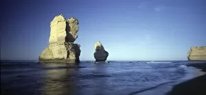
Background imageGeology Collection: Sandstone formation - From the Twelve Apostles, Port Campbell Na

Sandstone formation - From the Twelve Apostles, Port Campbell Na
JLR-63 Sandstone formation - From the Twelve Apostles, Port Campbell National Par South West cost of Victoria, Australia Jean-marc La Roque Please note that prints are personal display purposes only

Background imageGeology Collection: USA - Antelope Canyon - Navajo sandstone

USA - Antelope Canyon - Navajo sandstone
FG-5861 USA - Antelope Canyon - Navajo sandstone Arizona Francois Gohier Please note that prints are for personal display purposes only and may not be reproduced in any way

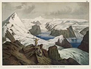
Background imageGeology Collection: Franz Josef Fjord and Peterman Mountain, Greenland

Franz Josef Fjord and Peterman Mountain, Greenland
View of the Franz Josef Fjord (named after the Emperor who helped to fund an expedition there) and the Peterman Mountain, with glacier, in north eastern Greenland

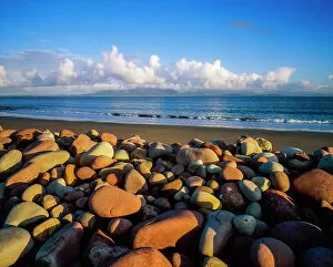
Background imageGeology Collection: Mulranny, Clew Bay, Co Mayo, Ireland

Mulranny, Clew Bay, Co Mayo, Ireland

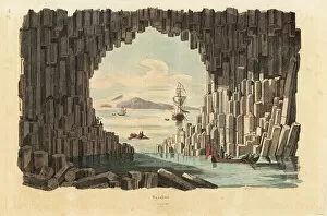
Background imageGeology Collection: Basalt columns in Fingals Cave, Staffa

Basalt columns in Fingals Cave, Staffa, Inner Hebrides, Scotland. Handcoloured steel engraving by Pfitzer from Felix-Edouard Guerin-Menevilles Dictionnaire Pittoresque d Histoire Naturelle
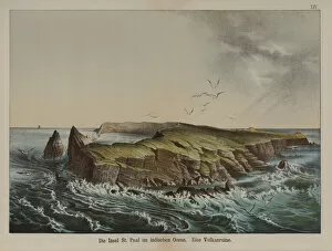
Background imageGeology Collection: Ile Saint-Paul, volcanic island in the Indian Ocean (colour litho)

Ile Saint-Paul, volcanic island in the Indian Ocean (colour litho)
3621003 Ile Saint-Paul, volcanic island in the Indian Ocean (colour litho) by German School, (19th century); Private Collection; (add.info.: Ile Saint-Paul, volcanic island in the Indian Ocean)

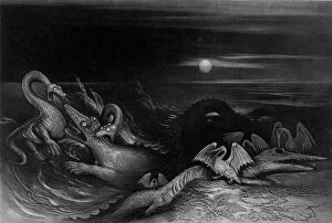
Background imageGeology Collection: Plesiosaurus battling Temnodontosaurus (Oligostinus), 1840 (engraving)

Plesiosaurus battling Temnodontosaurus (Oligostinus), 1840 (engraving)
3697027 Plesiosaurus battling Temnodontosaurus (Oligostinus), 1840 (engraving) by Martin, John (1789-1854); Private Collection; (add.info)

Background imageGeology Collection: Richard Kirwan (engraving)

Richard Kirwan (engraving)
815869 Richard Kirwan (engraving) by Irish School, (18th century); Private Collection; (add.info.: Richard Kirwan (1733-1812)

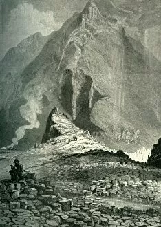
Background imageGeology Collection: The Giants Causeway, c1870

The Giants Causeway, c1870. Interlocking volcanic basalt columns at UNESCO World Heritage Site - the Giants Causeway, in County Antrim on the north coast of Northern Ireland

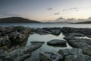
Background imageGeology Collection: Bagh a Deas (South Beach), with Sandray, Pabbay, Mingulay and Berneray in far distance

Bagh a Deas (South Beach), with Sandray, Pabbay, Mingulay and Berneray in far distance at sunset, Vatersay, Outer Hebrides, Scotland, United Kingdom, Europe

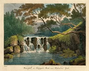
Background imageGeology Collection: Waterfall on Clapgate Beck, near Richmond, York, late 18th-early 19th century. Creator

Waterfall on Clapgate Beck, near Richmond, York, late 18th-early 19th century. Creator
Waterfall on Clapgate Beck, near Richmond, York, late 18th-early 19th century. River view in North Yorkshire

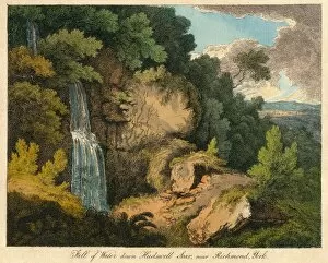
Background imageGeology Collection: Fall of Water down Hudswell Scar, near Richmond, York, 19th century? Creator: Unknown

Fall of Water down Hudswell Scar, near Richmond, York, 19th century? Creator: Unknown
Fall of Water down Hudswell Scar, near Richmond, York, 19th century? Waterfall in the Yorkshire Dales

Background imageGeology Collection: Small pool and geological formations found at Vermillion Cliffs National Monument, Arizona, USA

Small pool and geological formations found at Vermillion Cliffs National Monument, Arizona, USA
Vermilion Cliffs National Monument is located in Arizona, immediately south of the Utah state line. This National Monument, 293, 689 acres (118, 852 ha) in area, protects the Paria Plateau

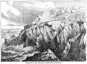
Background imageGeology Collection: Botallack Copper Mine, Cornwall - 1833 woodcut

Botallack Copper Mine, Cornwall - 1833 woodcut
Woodcut illustration from The Saturday Magazine, Volume 87, November 9th, 1833, an educational magazine under the Direction of the Committee of General Literature

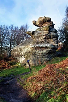
Background imageGeology Collection: Rocking-Stone

Rocking-Stone at Brimham Rocks near Pately Bridge in Yorkshire. This shows wind erosion of horizontally-bedded sedimentary rock

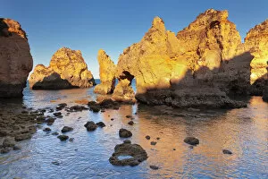
Background imageGeology Collection: Rocky coast at sunset, Ponta da Piedade Cape, near Lagos, Algarve, Portugal, Europe

Rocky coast at sunset, Ponta da Piedade Cape, near Lagos, Algarve, Portugal, Europe

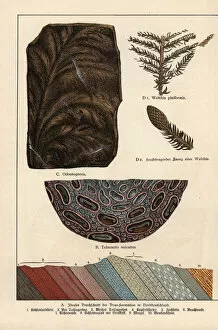
Background imageGeology Collection: Fern fossils from the Permian

Fern fossils from the Permian.. Chromolithograph from Dr. Fr. Rolles Geology and Paleontology section in Gotthilf Heinrich von Schuberts Natural History, Schreiber, Munich, 1886

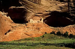
Background imageGeology Collection: USA, Arizona, Canyon de Chelly National Monument, Mummy Cave Ruin in Canyon del Muerto

USA, Arizona, Canyon de Chelly National Monument, Mummy Cave Ruin in Canyon del Muerto

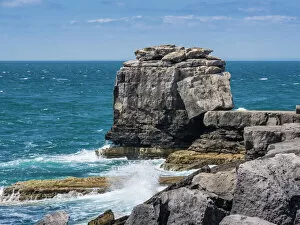
Background imageGeology Collection: Pulpit Rock Coastal Feature at Portland Bill, Isle of Portland, Jurassic Coast, UNESCO

Pulpit Rock Coastal Feature at Portland Bill, Isle of Portland, Jurassic Coast, UNESCO World Heritage Site, Dorset, England, United Kingdom, Europe

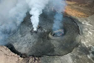
Background imageGeology Collection: Kilauea volcano, Big Island, Hawaii, United States

Kilauea volcano, Big Island, Hawaii, United States

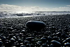
Background imageGeology Collection: Surf, black pebbles on the lava beach of Reynisfjara near Vik i Myrdal, South Coast, Iceland

Surf, black pebbles on the lava beach of Reynisfjara near Vik i Myrdal, South Coast, Iceland

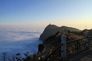
Background imageGeology Collection: Emei Shans Golden Summit and the Sea of Clouds

Emei Shans Golden Summit and the Sea of Clouds
Emei Shans Golden Summit (Jin Ding Peak) with the stunning sea of clouds and clear sky before sunset. Mount Emei is a mountain in Leshan City, Sichuan Province, China

Background imageGeology Collection: Cotopaxi Volcano 5897m summit, Cotopaxi National Park, Cotopaxi Province, Ecuador

Cotopaxi Volcano 5897m summit, Cotopaxi National Park, Cotopaxi Province, Ecuador, South America

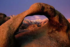
Background imageGeology Collection: Pre-Dawn View of Mount Whitney through the Alabama Hills Mobius Arch

Pre-Dawn View of Mount Whitney through the Alabama Hills Mobius Arch

Background imageGeology Collection: A Sawrian: cartoon on Gideon Mantell (1790-1852) the English geologist who discovered a suarian

A Sawrian: cartoon on Gideon Mantell (1790-1852) the English geologist who discovered a suarian, the Iguanodon, near Cuckfield, Sussex in 1820, and deduced from the teeth that it was a herbivore

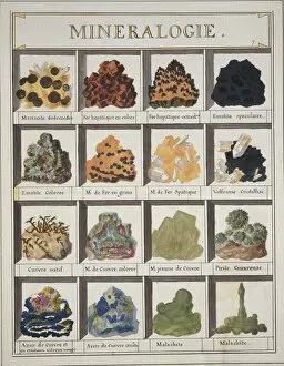
Background imageGeology Collection: Plate 7a from Histoire naturelle? (1789)

Plate 7a from Histoire naturelle? (1789)
Plate 7a, Mineralogie [unfinished] from Histoire naturelle: ou, Exposition des morceaux, les mieux choisis pour servir? (1789) by by Swebach Desfontaines

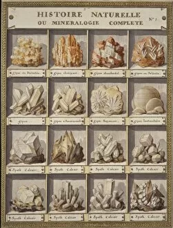
Background imageGeology Collection: Plate 1 from Histoire naturelle? (1789)

Plate 1 from Histoire naturelle? (1789)
Plate 1 Histoire Naturelle ou Mineralogie Complete, from Histoire naturelle: ou, Exposition des morceaux, les mieux choisis pour servir? (1789) by by Swebach Desfontaines

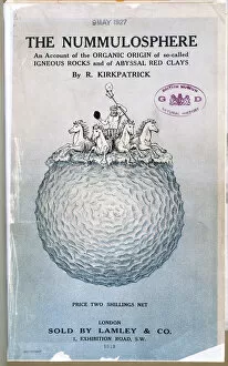
Background imageGeology Collection: The Nummulosphere Part I. Front Cover

The Nummulosphere Part I. Front Cover
An account of the organic origin of so-called igneous rocks and of abyssal red clays by Kirkpatrick, Randolph (1863-1950), London. 1913

Background imageGeology Collection: The Dancing Bear at Brimham Rocks near Summerbridge in Nidderdale, North Yorkshire, Yorkshire

The Dancing Bear at Brimham Rocks near Summerbridge in Nidderdale, North Yorkshire, Yorkshire, England, United Kingdom, Europe

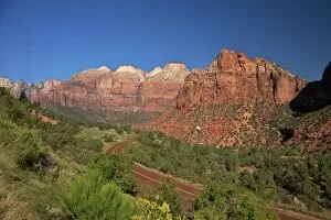
Background imageGeology Collection: Zion-Mount Carmel Highway, Zion National Park, Utah, United States of America, North America

Zion-Mount Carmel Highway, Zion National Park, Utah, United States of America, North America

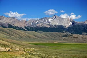
Background imageGeology Collection: Borah Peak (also known as Mount Borah) is the highest mountain in Idaho

Borah Peak (also known as Mount Borah) is the highest mountain in Idaho

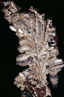
Background imageGeology Collection: Silver (Native Element) Ag Quincy Mine, Hancock, Michigan

Silver (Native Element) Ag Quincy Mine, Hancock, Michigan
KEL-1473 SILVER - native element. Ag Quincy Mine, Hancock, Michigan, USA Ken Lucas contact details: prints@ardea.com tel: +44 (0) 20 8318 1401

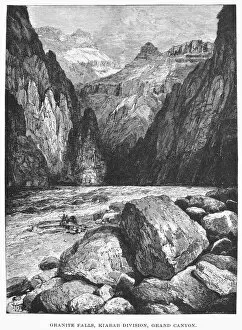
Background imageGeology Collection: THE COLORADO RIVER. Granite Falls, Kiabab Division, Grand Canyon. Wood engraving, 1870

THE COLORADO RIVER. Granite Falls, Kiabab Division, Grand Canyon. Wood engraving, 1870

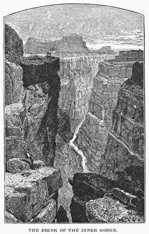
Background imageGeology Collection: THE COLORADO RIVER. The Brink of the Inner Gorge. Wood engraving, 1870

THE COLORADO RIVER. The Brink of the Inner Gorge. Wood engraving, 1870

Background imageGeology Collection: GRAND CANYON. The Colorado River. Wood engraving, 1870

GRAND CANYON. The Colorado River. Wood engraving, 1870


For sale as Licensed Images

Choose your image, Select your licence and Download the media

"Exploring the Earth's Rich Tapestry: A Journey through Geology" William Smith Geological Map: Unveiling the intricate layers of our planet's history, this map showcases the pioneering work of geologist William Smith. Derwent Water, with Blencathra behind: Nature's masterpiece in Cumbria, England reveals geological wonders that have shaped this breathtaking landscape over millions of years. View to the Seven Sisters from Seaford Head: Witnessing the dramatic cliffs and rolling waves along East Sussex's coast reminds us of nature's relentless force and its impact on shaping our world. Continental drift after 250 million years: Delving into deep time, we unravel how tectonic plates have shifted and continents have drifted apart, reshaping our planet as we know it today. Sunset at Uluru, Ayers Rock: The vibrant hues painting the sky above Australia's iconic monolith remind us of ancient geological processes that formed this majestic landmark over countless millennia. Malham Cove, Yorkshire Dales: Marvel at Mother Nature's artistry as water erodes limestone to create magnificent formations like this awe-inspiring cove in England’s picturesque countryside. Tryfan viewed from Glyder Fach in Snowdonia: Gazing upon Wales' rugged beauty unveils a tale written by glaciers and volcanic activity—a testament to Earth’s dynamic past etched across these towering peaks. Antique colored illustrations - Geological map of England and Wales: Step back in time with these vintage maps that guided early geologists through uncharted territories, unlocking secrets hidden beneath our feet. Durdle Door, Dorset: Carved by relentless waves over eons, this natural limestone arch stands proudly on Dorset’s Jurassic Coast—a living testament to Earth’s ongoing transformational journey. Geological map of Britain and Ireland.