Geology Collection (#11)

"Exploring the Earth's Rich Tapestry: A Journey through Geology" William Smith Geological Map: Unveiling the intricate layers of our planet's history

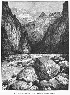
Background imageGeology Collection: THE COLORADO RIVER. Granite Falls, Kiabab Division, Grand Canyon. Wood engraving, 1870

THE COLORADO RIVER. Granite Falls, Kiabab Division, Grand Canyon. Wood engraving, 1870

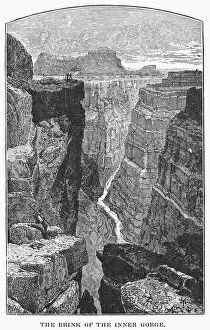
Background imageGeology Collection: THE COLORADO RIVER. The Brink of the Inner Gorge. Wood engraving, 1870

THE COLORADO RIVER. The Brink of the Inner Gorge. Wood engraving, 1870

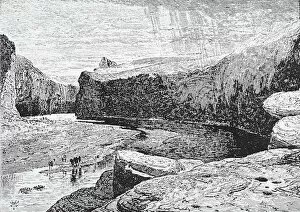
Background imageGeology Collection: GRAND CANYON. The Colorado River. Wood engraving, 1870

GRAND CANYON. The Colorado River. Wood engraving, 1870

Background imageGeology Collection: UTAH: GLEN CANYON. Wood engraving, late 19th century

UTAH: GLEN CANYON. Wood engraving, late 19th century

Background imageGeology Collection: Copper and magnesium sulphate

Copper and magnesium sulphate
Copper sulphate and magnesium sulphate crystals, polarised light micrograph

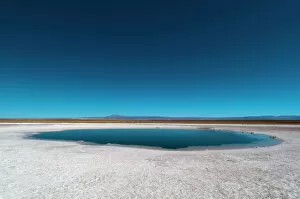
Background imageGeology Collection: Laguna Sejar, Salar de Atacama, Atacama Desert, Chile, South America

Laguna Sejar, Salar de Atacama, Atacama Desert, Chile, South America

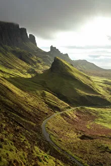
Background imageGeology Collection: Road ascending

Road ascending The Quiraing, Isle of Skye, Scotland, United Kingdom

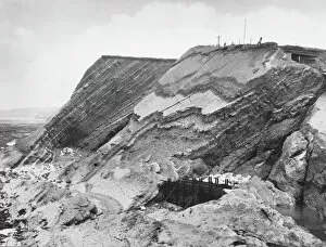
Background imageGeology Collection: Watchet Cliff Strata

Watchet Cliff Strata
The curious cliff strata at Watchet, Somerset, England

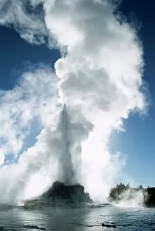
Background imageGeology Collection: Castle Geyser

Castle Geyser, Upper Geyser Basin, Yellowstone National Park, UNESCO World Heritage Site, Wyoming, United States of America (U.S.A.), North America

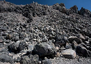
Background imageGeology Collection: Obsidian dome, geological site; at 8000 ft. Evidence of recent volcanic activity

Obsidian dome, geological site; at 8000 ft. Evidence of recent volcanic activity. on the east side of the Sierra Nevada
ROG-11943 Obsidian dome, geological site; at 8000 ft. Evidence of recent volcanic activity. on the east side of the Sierra Nevada, California

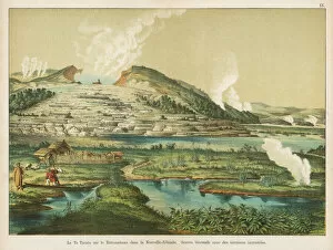
Background imageGeology Collection: Te Tarata hot springs, Rotomahana, New Zealand

Te Tarata hot springs, Rotomahana, New Zealand
View of the Te Tarata hot springs by Lake Rotomahana, North Island, New Zealand -- thermal springs with encrusted terraces

Background imageGeology Collection: Mont Blanc mountain range and Bionnassay glacier, St. Gervais, Haute-Savoie, French Alps

Mont Blanc mountain range and Bionnassay glacier, St. Gervais, Haute-Savoie, French Alps, France, Europe

Background imageGeology Collection: Dramatic coastal scenery near Trevose Head in North Cornwall, England, United Kingdom

Dramatic coastal scenery near Trevose Head in North Cornwall, England, United Kingdom, Europe

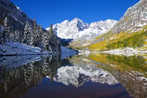
Background imageGeology Collection: USA, Colorado, Early Snow; Near Aspen, Landscape Of Maroon Lake And Maroon Bells In Distance

USA, Colorado, Early Snow; Near Aspen, Landscape Of Maroon Lake And Maroon Bells In Distance

Background imageGeology Collection: Charles Darwin, English naturalist, 1871

Charles Darwin, English naturalist, 1871. Darwin (1809-1882) was employed as naturalist on HMS Beagle from 1831-1836. He first made his name as a geologist

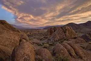
Background imageGeology Collection: Clouds at dawn over the rock formations, Alabama Hills, Inyo National Forest, California

Clouds at dawn over the rock formations, Alabama Hills, Inyo National Forest, California, United States of America, North America

Background imageGeology Collection: Halslon Reservoir, ash and gas cloud of the Holuhraun fissure eruption

Halslon Reservoir, ash and gas cloud of the Holuhraun fissure eruption, near the volcano Baroarbunga, highlands, Northeast Iceland, Iceland

Background imageGeology Collection: Rainbow Geyser, Rotorua, North Island, New Zealand, Pacific

Rainbow Geyser, Rotorua, North Island, New Zealand, Pacific

Background imageGeology Collection: Matterhorn, 4478m, Zermatt, Swiss Alps, Switzerland, Europe

Matterhorn, 4478m, Zermatt, Swiss Alps, Switzerland, Europe

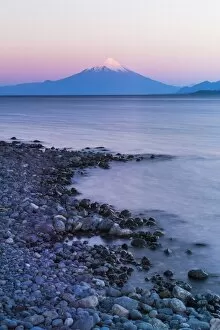
Background imageGeology Collection: Osorno Volcano (Volcan Osorno) and Llanquihue Lake, Puerto Varas, Chile Lake District

Osorno Volcano (Volcan Osorno) and Llanquihue Lake, Puerto Varas, Chile Lake District, Chile, South America

Background imageGeology Collection: Picture No. 11066873

Picture No. 11066873
Lower Antelope Canyon. Arizona, USA. Date:

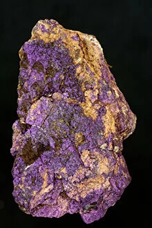
Background imageGeology Collection: Picture No. 11050115

Picture No. 11050115
Purpurite Maine, USA Date:

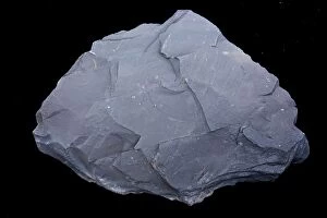
Background imageGeology Collection: Picture No. 11050106

Picture No. 11050106
Marcellus Shale natural gas bearing rock gas extracted using controversial fracking or hydraulic fracturing New York, USA Date:

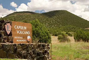
Background imageGeology Collection: USA, NM, Capulin Volcano National Monument. Extinct volcano, erupted fairly recently (56

USA, NM, Capulin Volcano National Monument. Extinct volcano, erupted fairly recently (56, 000+ years ago)

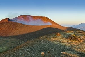
Background imageGeology Collection: Smoking 700m wide crater of Volcan Telica in the North West volcano chain

Smoking 700m wide crater of Volcan Telica in the North West volcano chain, one of the countrys most active volcanoes, Leon, Nicaragua, Central America

Background imageGeology Collection: The caldera of the Crater Lake National Park, Oregon, United States of America, North America

The caldera of the Crater Lake National Park, Oregon, United States of America, North America

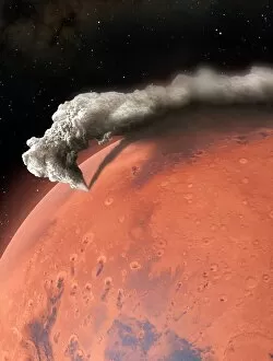
Background imageGeology Collection: Artwork of supervolcano erupting on Mars

Artwork of supervolcano erupting on Mars
Planetary scientists have concluded that Eden Patera, a Martian crater, is the remains of an ancient supervocanic eruption, the first of its kind on this planet

Background imageGeology Collection: Clay pit, St. Austell, Cornwall, England, United Kingdom, Europe

Clay pit, St. Austell, Cornwall, England, United Kingdom, Europe

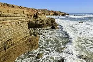
Background imageGeology Collection: Tide pool area in Cabrillo National Monument, San Diego, California, United States of America

Tide pool area in Cabrillo National Monument, San Diego, California, United States of America, North America

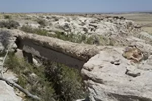
Background imageGeology Collection: Agate Bridge, a petrified log spanning ravine, Petrified Forest National Park, Arizona

Agate Bridge, a petrified log spanning ravine, Petrified Forest National Park, Arizona, United States of America, North America

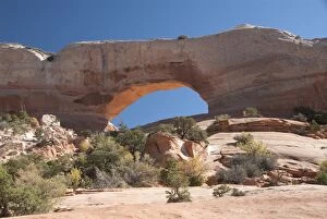
Background imageGeology Collection: Wilson Arch, near Moab, Utah, United States of America, North America

Wilson Arch, near Moab, Utah, United States of America, North America

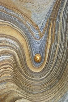
Background imageGeology Collection: Limpet shell on sandstone rock, Northumberland, Northeast England, United Kingdom, Europe

Limpet shell on sandstone rock, Northumberland, Northeast England, United Kingdom, Europe

Background imageGeology Collection: Waterfalls cascade down the karst limestone cliffs of the Cirque de Gavarnie

Waterfalls cascade down the karst limestone cliffs of the Cirque de Gavarnie, Pyrenees National Park, Hautes-Pyrenees, France, Europe

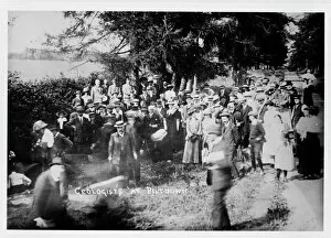
Background imageGeology Collection: Geologists at Piltdown

Geologists at Piltdown
Geologists Association party visiting the pit at Piltdown on 12 July 1913

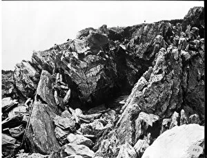
Background imageGeology Collection: Glacial rock, Halifax 1873

Glacial rock, Halifax 1873
A photograph taken during the voyage of H.M.S. Challenger (1872-1876), funded by the British Government for scientific purposes

Background imageGeology Collection: William Daniel Conybeare (1787-1857)

William Daniel Conybeare (1787-1857)
Portrait of William Daniel Conybeare, a distinguished English geologists. Drawing, charcoal on paper, artist unknown, c. 1824. Original held at the Natural History Museum, London

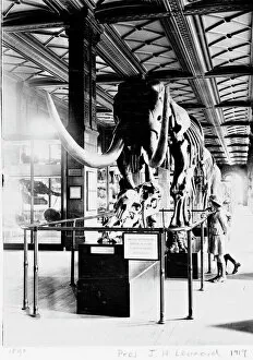
Background imageGeology Collection: Mastodon in Geological Gallery, December 1919

Mastodon in Geological Gallery, December 1919
The Guide Lecturer, John Henry Leonard, took this shot of two girls inspecting a primitive elephant or mastodon (Mammut americanus), in December 1919

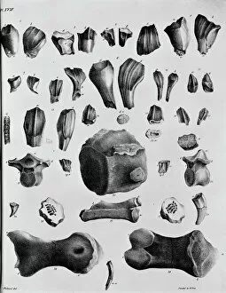
Background imageGeology Collection: Plate 17. Mantells Geology of Sussex

Plate 17. Mantells Geology of Sussex
Plate 17 from Illustrations of the Geology of Sussex, 1827 by G. A. Mantell

Background imageGeology Collection: Plate 19. Mantells Geology of Sussex

Plate 19. Mantells Geology of Sussex
Plate 19 from Illustrations of the Geology of Sussex, 1827 by G. A. Mantell

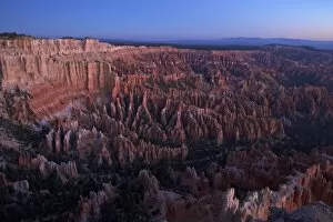
Background imageGeology Collection: Dawn from Bryce Point, Bryce Canyon National Park, Utah, United States of America, North America

Dawn from Bryce Point, Bryce Canyon National Park, Utah, United States of America, North America

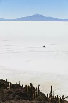
Background imageGeology Collection: Tourist jeep on Salar de Uyuni (Salt Flats of Uyuni) from Isla del Pescado (Fish Island)

Tourist jeep on Salar de Uyuni (Salt Flats of Uyuni) from Isla del Pescado (Fish Island), Potosi Department, Bolivia, South America

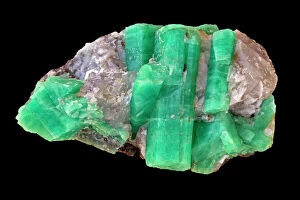
Background imageGeology Collection: Emerald - Green variety of Beryl - Be3Al2Si6O18 - Berylium aluminum silicate - green clor

Emerald - Green variety of Beryl - Be3Al2Si6O18 - Berylium aluminum silicate - green clor from trace of chromium
CAN-4440 Emerald - Green variety of Beryl - Be3Al2Si6O18 China Berylium aluminum silicate - green clor from trace of chromium - Important gem John Cancalosi contact details: prints@ardea.com tel

Background imageGeology Collection: Opal Boulder, Queensland Australia

Opal Boulder, Queensland Australia
KEL-1424 OPAL - Boulder, Queensland, Australia Ken Lucas contact details: prints@ardea.com tel: +44 (0) 20 8318 1401

Background imageGeology Collection: Cascades, Glacier National Park, Montana, United States of America, North America

Cascades, Glacier National Park, Montana, United States of America, North America

Background imageGeology Collection: CASTELL Y GWYNT

CASTELL Y GWYNT
An unusual rock formation, known as Castell y Gwynt ( Castle of the Winds ) on Glyder Fach, Snowdonia, Wales. Date: BC

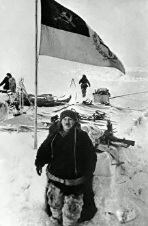
Background imageGeology Collection: Soviet Arctic explorer Papanin, 1937

Soviet Arctic explorer Papanin, 1937
Soviet Arctic explorer Ivan Papanin (1894-1986) in 1937 while commanding the first Soviet drifting station " North Pole-1". Expedition members and equipment are in the background


For sale as Licensed Images

Choose your image, Select your licence and Download the media

"Exploring the Earth's Rich Tapestry: A Journey through Geology" William Smith Geological Map: Unveiling the intricate layers of our planet's history, this map showcases the pioneering work of geologist William Smith. Derwent Water, with Blencathra behind: Nature's masterpiece in Cumbria, England reveals geological wonders that have shaped this breathtaking landscape over millions of years. View to the Seven Sisters from Seaford Head: Witnessing the dramatic cliffs and rolling waves along East Sussex's coast reminds us of nature's relentless force and its impact on shaping our world. Continental drift after 250 million years: Delving into deep time, we unravel how tectonic plates have shifted and continents have drifted apart, reshaping our planet as we know it today. Sunset at Uluru, Ayers Rock: The vibrant hues painting the sky above Australia's iconic monolith remind us of ancient geological processes that formed this majestic landmark over countless millennia. Malham Cove, Yorkshire Dales: Marvel at Mother Nature's artistry as water erodes limestone to create magnificent formations like this awe-inspiring cove in England’s picturesque countryside. Tryfan viewed from Glyder Fach in Snowdonia: Gazing upon Wales' rugged beauty unveils a tale written by glaciers and volcanic activity—a testament to Earth’s dynamic past etched across these towering peaks. Antique colored illustrations - Geological map of England and Wales: Step back in time with these vintage maps that guided early geologists through uncharted territories, unlocking secrets hidden beneath our feet. Durdle Door, Dorset: Carved by relentless waves over eons, this natural limestone arch stands proudly on Dorset’s Jurassic Coast—a living testament to Earth’s ongoing transformational journey. Geological map of Britain and Ireland.