
Instrument And Document Collection (#9)

"Exploring the World through Instruments and Documents

Background imageInstrument And Document Collection: Spherical plate, engraving by G. Zuliani taken from Tome I of the 'Newest Atlas'published in

Spherical plate, engraving by G. Zuliani taken from Tome I of the "Newest Atlas"published in Venice in 1777
3572498 Spherical plate, engraving by G. Zuliani taken from Tome I of the " Newest Atlas" published in Venice in 1777 by Antonio Zatta by Zuliani, G

Background imageInstrument And Document Collection: Farther and Hither Abruzzo, engraving by G. Zuliani taken from Tome II of the 'Newest

Farther and Hither Abruzzo, engraving by G. Zuliani taken from Tome II of the "Newest Atlas"published in
3572570 Farther and Hither Abruzzo, engraving by G. Zuliani taken from Tome II of the " Newest Atlas" published in Venice in 1783 by Antonio Zatta, Private Collection by Zuliani, G

Background imageInstrument And Document Collection: Land of Outagamie, Mascoutin, Illinois Indians and part of the Six Nations, engraving by G

Land of Outagamie, Mascoutin, Illinois Indians and part of the Six Nations, engraving by G
3572554 Land of Outagamie, Mascoutin, Illinois Indians and part of the Six Nations, engraving by G. Zuliani taken from Tome I of the " Newest Atlas" published in Venice in 1778 by Antonio

Background imageInstrument And Document Collection: Province of Surrey, engraving by G. Zuliani taken from Tome I of the 'Newest Atlas'published in

Province of Surrey, engraving by G. Zuliani taken from Tome I of the "Newest Atlas"published in Venice in
3572538 Province of Surrey, engraving by G. Zuliani taken from Tome I of the " Newest Atlas" published in Venice in 1779 by Antonio Zatta, Private Collection by Zuliani, G

Background imageInstrument And Document Collection: Governances of Anjou, Saumurois, Touraine and Poitou, Aunis and Saintonge with that of Anjoumois

Governances of Anjou, Saumurois, Touraine and Poitou, Aunis and Saintonge with that of Anjoumois, engraving by G
3572528 Governances of Anjou, Saumurois, Touraine and Poitou, Aunis and Saintonge with that of Anjoumois, engraving by G. Zuliani taken from Tome I of the " Newest Atlas" published in

Background imageInstrument And Document Collection: Island of Corsica divided into its provinces, engraving by G

Island of Corsica divided into its provinces, engraving by G. Zuliani taken from Tome II of the "Newest
3572573 Island of Corsica divided into its provinces, engraving by G. Zuliani taken from Tome II of the " Newest Atlas" published in Venice in 1782 by Antonio Zatta

Background imageInstrument And Document Collection: Land area of the State of the Veneto: area of Rovigo, engraving by G

Land area of the State of the Veneto: area of Rovigo, engraving by G. Zuliani taken from Tome II of the "Newest
3572563 Land area of the State of the Veneto: area of Rovigo, engraving by G. Zuliani taken from Tome II of the " Newest Atlas" published in Venice in 1782 by Antonio Zatta

Background imageInstrument And Document Collection: Land of the Cherokees with the western part of North Carolina and Virginia, engraving by G

Land of the Cherokees with the western part of North Carolina and Virginia, engraving by G
3572557 Land of the Cherokees with the western part of North Carolina and Virginia, engraving by G. Zuliani taken from Tome I of the " Newest Atlas" published in Venice in 1778 by Antonio

Background imageInstrument And Document Collection: Pennsylvania, New York, southern New Jersey, with the western part of Connecticut

Pennsylvania, New York, southern New Jersey, with the western part of Connecticut
3572555 Pennsylvania, New York, southern New Jersey, with the western part of Connecticut, Massachusetts Bay and Land of the Iroquois, engraving by G

Background imageInstrument And Document Collection: Province of Kent, engraving by G. Zuliani taken from Tome I of the 'Newest Atlas'published in

Province of Kent, engraving by G. Zuliani taken from Tome I of the "Newest Atlas"published in Venice in 1779
3572539 Province of Kent, engraving by G. Zuliani taken from Tome I of the " Newest Atlas" published in Venice in 1779 by Antonio Zatta, Private Collection by Zuliani, G

Background imageInstrument And Document Collection: Governances of Langedoc, Foix and Roussillon with Rouergue, engraving by G

Governances of Langedoc, Foix and Roussillon with Rouergue, engraving by G
3572535 Governances of Langedoc, Foix and Roussillon with Rouergue, engraving by G. Zuliani taken from Tome I of the " Newest Atlas" published in Venice in 1777 by Antonio Zatta

Background imageInstrument And Document Collection: Governances of Bourgogne, Franca Contea and Lyons, engraving by G

Governances of Bourgogne, Franca Contea and Lyons, engraving by G. Zuliani taken from Tome I of the "Newest
3572532 Governances of Bourgogne, Franca Contea and Lyons, engraving by G. Zuliani taken from Tome I of the " Newest Atlas" published in Venice in 1777 by Antonio Zatta

Background imageInstrument And Document Collection: Governances of Berri, Nivernois, Marche, Bourbon and Auvergne, engraving by G

Governances of Berri, Nivernois, Marche, Bourbon and Auvergne, engraving by G
3572527 Governances of Berri, Nivernois, Marche, Bourbon and Auvergne, engraving by G. Zuliani taken from Tome I of the " Newest Atlas" published in Venice in 1776 by Antonio Zatta

Background imageInstrument And Document Collection: Governances of Guyenne and Guascogne with that of Bearn and Lower Navarre, engraving by G

Governances of Guyenne and Guascogne with that of Bearn and Lower Navarre, engraving by G
3572525 Governances of Guyenne and Guascogne with that of Bearn and Lower Navarre, engraving by G. Zuliani taken from Tome I of the " Newest Atlas" published in Venice in 1776 by Antonio

Background imageInstrument And Document Collection: The Governances of the Ile de France and Orleans, engraving by G

The Governances of the Ile de France and Orleans, engraving by G. Zuliani taken from Tome I of the "Newest
3572523 The Governances of the Ile de France and Orleans, engraving by G. Zuliani taken from Tome I of the " Newest Atlas" published in Venice in 1776 by Antonio Zatta

Background imageInstrument And Document Collection: Monument to Tommaso Rangone, bronze, Jacopo Sansovino (1486-1570), Church of S. Giuliano, Venice

Monument to Tommaso Rangone, bronze, Jacopo Sansovino (1486-1570), Church of S. Giuliano, Venice Venice Church of S. Giuliano Statue Late Renaissance, Renaissance


For sale as Licensed Images

Choose your image, Select your licence and Download the media

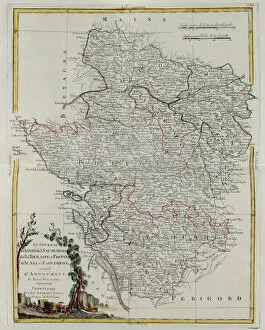
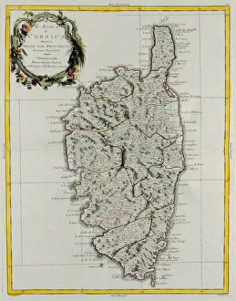
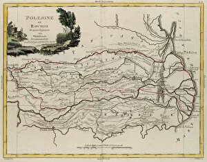
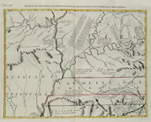
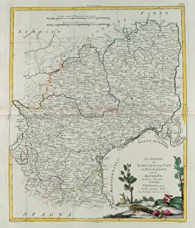
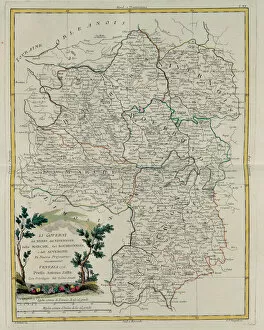
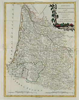
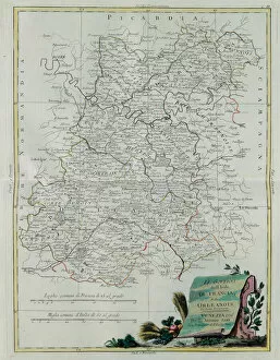
"Exploring the World through Instruments and Documents: A Glimpse into History" Step back in time with these captivating engravings from the private collection of Antonio Zatta. Delve into the intricate details of a world divided, as depicted by renowned cartographer G. Zuliani. Embark on a journey to Iceland, where its districts come alive before your eyes. This engraving from Tome III of the "Newest Atlas" showcases the stunning beauty and unique topography that define this Nordic island nation. Venture further north to Hudson Bay, Land of Labrador, and Greenland. As you study this engraving from Tome I, immerse yourself in the vastness of these Arctic regions and their adjacent islands - a testament to nature's grandeur. Travel southward to Southern Scotland, where counties unfold like pages in a storybook. The meticulous detail captured by Zuliani in this engraving from Tome I transports you to an era when borders were etched upon maps with precision. Cross over to Ireland's provinces of Ulster and Leinster through another remarkable engraving from Tome I. Discover their rich history and cultural heritage as you trace their boundaries on this antique map - a true collector's gem. Next, explore Lorraine, Barr, and Alsace - governances brought vividly to life by Zuliani's artistry. This enchanting depiction offers glimpses into an era when political divisions shaped landscapes and societies alike. Continue your voyage across Europe as Spain and Portugal reveal themselves through intricately engraved provincial divisions. From Andalusia to Galicia, experience the diversity that defines these kingdoms while marveling at Zuliani's craftsmanship. Journey westward towards America; its main states beckon with promises of adventure. This 1776 engraving captures not only geographical features but also historical significance - witness how nations took shape amidst untamed frontiers. Expand your horizons even further with a world map that provides a comprehensive overview of the globe.