Latitude Collection (#2)

"Exploring the World Through Latitude: A Journey of Maps and Topography" Step back in time to 1768 with James Craig's Map of New Town, Edinburgh, Scotland

Background imageLatitude Collection: 1864, Garnier Map of Pairs, France w-Monuments, topography, cartography, geography

1864, Garnier Map of Pairs, France w-Monuments, topography, cartography, geography
1864, Garnier Map of Pairs, France w-Monuments

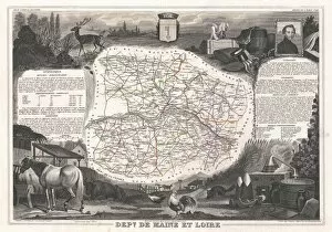
Background imageLatitude Collection: 1852, Levasseur Map of the Department De Maine et Loire, France, topography, cartography

1852, Levasseur Map of the Department De Maine et Loire, France, topography, cartography
1852, Levasseur Map of the Department De Maine et Loire, France

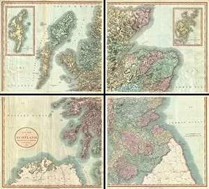
Background imageLatitude Collection: 1801, Cary Map of Scotland, 4 Sheets, John Cary, 1754 - 1835, English cartographer

1801, Cary Map of Scotland, 4 Sheets, John Cary, 1754 - 1835, English cartographer

Background imageLatitude Collection: Diagram showing the behaviour of a magnetic needle

Diagram showing the behaviour of a magnetic needle
5309963 Diagram showing the behaviour of a magnetic needle; (add.info.: Diagram showing the behaviour of a magnetic needle and the difference between true)

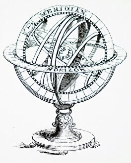
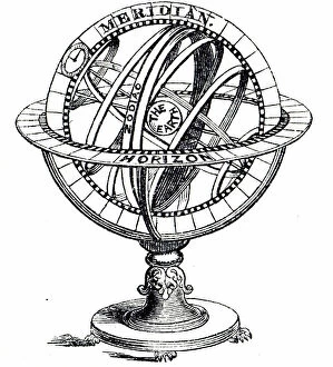
Background imageLatitude Collection: An armillary sphere

An armillary sphere
3740718 An armillary sphere; (add.info.: Illustration depicting an armillary sphere. An armillary sphere is a model of objects in the sky consisting of a spherical framework of rings)

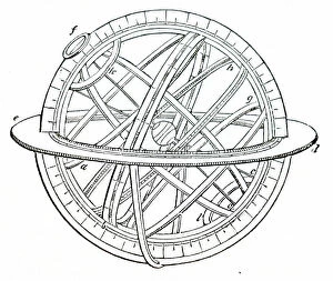
Background imageLatitude Collection: An armillary sphere

An armillary sphere
3740716 An armillary sphere; (add.info.: Illustration depicting an armillary sphere. An armillary sphere is a model of objects in the sky consisting of a spherical framework of rings)

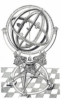
Background imageLatitude Collection: Engraving depicting an equatorial circle, 17th century

Engraving depicting an equatorial circle, 17th century
5309479 Engraving depicting an equatorial circle, 17th century; (add.info.: Engraving depicting an equatorial circle. Dated 17th century 01/02/1602); Universal History Archive/UIG

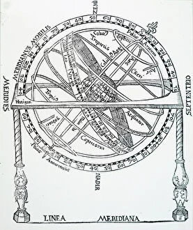
Background imageLatitude Collection: Engraving depicting an armillary sphere, a model of objects in the sky (on the celestial sphere)

Engraving depicting an armillary sphere, a model of objects in the sky (on the celestial sphere)
5309270 Engraving depicting an armillary sphere, a model of objects in the sky (on the celestial sphere), consisting of a spherical framework of rings, centred on Earth or the Sun

Background imageLatitude Collection: An armillary sphere

An armillary sphere
3740717 An armillary sphere; (add.info.: Illustration depicting an armillary sphere. An armillary sphere is a model of objects in the sky consisting of a spherical framework of rings)

Background imageLatitude Collection: An armillary sphere

An armillary sphere
3740714 An armillary sphere; (add.info.: Illustration depicting an armillary sphere. An armillary sphere is a model of objects in the sky consisting of a spherical framework of rings)

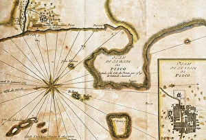
Background imageLatitude Collection: Peru, South America, 18th century

Peru, South America, 18th century
3618319 Peru, South America, 18th century; (add.info.: Peru, South America, 18th century. Plane of the inlet of Pisco, located on the coast of Peru, at 13 degrees 40 austral latitude)

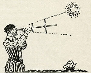
Background imageLatitude Collection: A fifteenth century navigator using a cross-staff. An instrument used to determine angles

A fifteenth century navigator using a cross-staff. An instrument used to determine angles
3058535 A fifteenth century navigator using a cross-staff. An instrument used to determine angles, for example the angle between the horizon and the sun to calculate a vessel's latitude

Background imageLatitude Collection: Visit the Zoo

Visit the Zoo
Andreas Magnusson

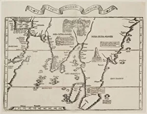
Background imageLatitude Collection: 16th century, antique, archival, bangladesh, banner, bay of bengal, border, cartography

16th century, antique, archival, bangladesh, banner, bay of bengal, border, cartography, ceylon, country, document, geography, historic, historical, india, indian ocean, latitude, legend, map

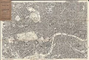
Background imageLatitude Collection: 1899 Bacon Pocket Plan Or Map Of London Topography

1899 Bacon Pocket Plan Or Map Of London Topography
1899, Bacon Pocket Plan or Map of London

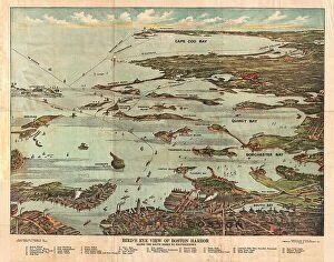
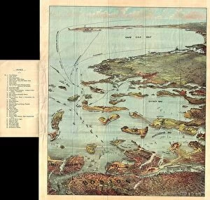
Background imageLatitude Collection: 1899 View Map Of Boston Harbor From Boston To Cape Cod And Provincetown

1899 View Map Of Boston Harbor From Boston To Cape Cod And Provincetown
1899, View Map of Boston Harbor from Boston to Cape Cod and Provincetown

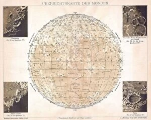
Background imageLatitude Collection: 1898 Brockhaus Map Of The Moon Topography Cartography

1898 Brockhaus Map Of The Moon Topography Cartography
1898, Brockhaus Map of the Moon

Background imageLatitude Collection: 1895 U.S. Coast Survey Map Of The Chesapeake Bay Around Annapolis

1895 U.S. Coast Survey Map Of The Chesapeake Bay Around Annapolis
1895, U.S. Coast Survey Map of the Chesapeake Bay around Annapolis

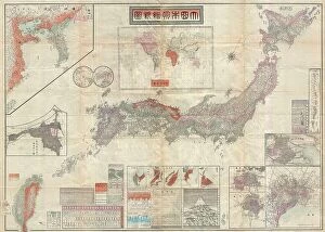
Background imageLatitude Collection: 1895 Meiji 28 Japanese Map Of Imperial Japan With Taiwan

1895 Meiji 28 Japanese Map Of Imperial Japan With Taiwan
1895, Meiji 28 Japanese Map of Imperial Japan with Taiwan

Background imageLatitude Collection: 1898 Walker Trolley Map And View Of New England Centered On Boston

1898 Walker Trolley Map And View Of New England Centered On Boston
1898, Walker Trolley Map and View of New England centered on Boston

Background imageLatitude Collection: 1893 U.S. Coast Survey Nautical Chart Or Map Of The Chesapeake Bay And Delaware Bay

1893 U.S. Coast Survey Nautical Chart Or Map Of The Chesapeake Bay And Delaware Bay
1893, U.S. Coast Survey Nautical Chart or Map of the Chesapeake Bay and Delaware Bay

Background imageLatitude Collection: 1897 Walker View Of Boston Harbor Topography

1897 Walker View Of Boston Harbor Topography
1897, Walker View of Boston Harbor

Background imageLatitude Collection: 1892 Scientific American Map And View Of New York City

1892 Scientific American Map And View Of New York City
1892, Scientific American Map and View of New York City

Background imageLatitude Collection: 1894 Colton Map Of Maine Topography Cartography

1894 Colton Map Of Maine Topography Cartography
1894, Colton Map of Maine

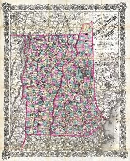
Background imageLatitude Collection: 1892 Colton Pocket Map Of Vermont And New Hampshire

1892 Colton Pocket Map Of Vermont And New Hampshire
1892, Colton Pocket Map of Vermont and New Hampshire

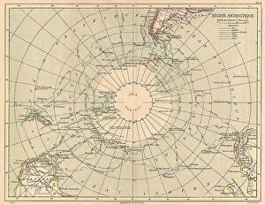
Background imageLatitude Collection: 1890 Hachette Map Of Antarctica Topography Cartography

1890 Hachette Map Of Antarctica Topography Cartography
1890, Hachette Map of Antarctica

Background imageLatitude Collection: 1890 View Map Of Boston Habor From Boston To Cape Cod And Provincetown

1890 View Map Of Boston Habor From Boston To Cape Cod And Provincetown
1890, View Map of Boston Habor from Boston to Cape Cod and Provincetown

Background imageLatitude Collection: 1886 Telescopic View And Map Of The Moon Topography

1886 Telescopic View And Map Of The Moon Topography
1886, Telescopic View and Map of the Moon

Background imageLatitude Collection: 1888 Topographic Survey Map Of The United States

1888 Topographic Survey Map Of The United States
1888, Topographic Survey Map of the United States

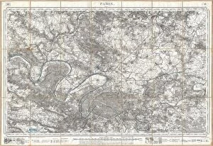
Background imageLatitude Collection: 1886 Depot De La Guerre Pocket Map Of Paris And Environs

1886 Depot De La Guerre Pocket Map Of Paris And Environs
1886, Depot de la Guerre Pocket Map of Paris and Environs

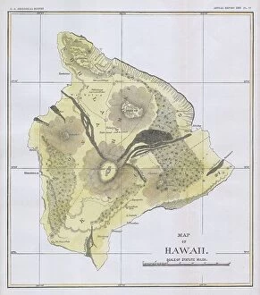
Background imageLatitude Collection: 1883 U.S.G.S. Map Of The Island Of Hawaii Topography

1883 U.S.G.S. Map Of The Island Of Hawaii Topography
1883, U.S.G.S. Map of the Island of Hawaii

Background imageLatitude Collection: 1884 Drew Pocket Map Of Florida Topography Cartography

1884 Drew Pocket Map Of Florida Topography Cartography
1884, Drew Pocket Map of Florida

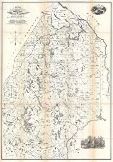
Background imageLatitude Collection: 1881 Thomas Sedgwick Steele Map Of Maine Topography

1881 Thomas Sedgwick Steele Map Of Maine Topography
1881, Thomas Sedgwick Steele Map of Maine

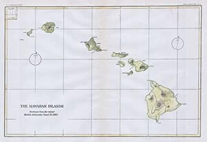
Background imageLatitude Collection: 1883 U.S.G.S. Map Of The Hawaiian Islands Topography

1883 U.S.G.S. Map Of The Hawaiian Islands Topography
1883, U.S.G.S. Map of the Hawaiian Islands

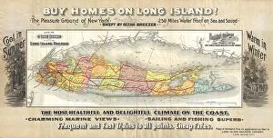
Background imageLatitude Collection: 1891 Long Island Railroad Real Estate Map Of Long Island

1891 Long Island Railroad Real Estate Map Of Long Island
1891, Long Island Railroad Real Estate Map of Long Island

Background imageLatitude Collection: Guilmin Map Of Paris France Monuments Topography

Guilmin Map Of Paris France Monuments Topography
Guilmin Map of Paris, France, Monuments

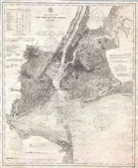
Background imageLatitude Collection: 1910 U.S. Coast Survey Nautical Chart Or Map Of New York City And Harbor

1910 U.S. Coast Survey Nautical Chart Or Map Of New York City And Harbor
1910, U.S. Coast Survey Nautical Chart or Map of New York City and Harbor

Background imageLatitude Collection: 1907 Geological Survey Map Of San Francisco Peninsula After 1906 Earthquake

1907 Geological Survey Map Of San Francisco Peninsula After 1906 Earthquake
1907, Geological Survey Map of San Francisco Peninsula after 1906 Earthquake

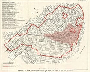
Background imageLatitude Collection: 1907 Geological Survey Map Of San Francisco After 1906 Earthquake

1907 Geological Survey Map Of San Francisco After 1906 Earthquake
1907, Geological Survey Map of San Francisco after 1906 Earthquake

Background imageLatitude Collection: 1904 Clason Map Or View Of The Gilpin Colorado Gold And Mineral Belt

1904 Clason Map Or View Of The Gilpin Colorado Gold And Mineral Belt
1904, Clason Map or View of the Gilpin Colorado Gold and Mineral Belt

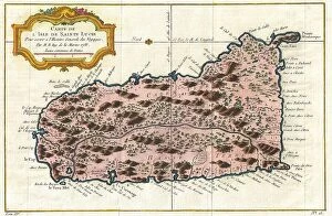
Background imageLatitude Collection: 1758 Bellin Map Of Saint Lucia Sainte Lucie West Indies

1758 Bellin Map Of Saint Lucia Sainte Lucie West Indies
1758, Bellin Map of Saint Lucia, Sainte Lucie, West Indies

Background imageLatitude Collection: Norbegia And Gottia Topography Cartography Geography

Norbegia And Gottia Topography Cartography Geography
Norbegia and Gottia

Background imageLatitude Collection: 1874 Mitchell Map Of Pennsylvania Topography

1874 Mitchell Map Of Pennsylvania Topography
1874, Mitchell Map of Pennsylvania

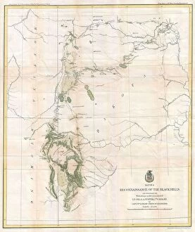
Background imageLatitude Collection: 1874 Ludlow And Custer Map Of The Black Hills

1874 Ludlow And Custer Map Of The Black Hills
1874, Ludlow and Custer Map of The Black Hills

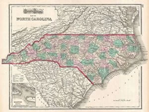
Background imageLatitude Collection: 1874 Gray Map Of North Carolina Topography Cartography

1874 Gray Map Of North Carolina Topography Cartography
1874, Gray Map of North Carolina

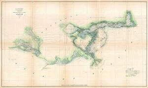
Background imageLatitude Collection: 1873 U.S. Coast Survey Map Of The Delta Of The Mississippi River

1873 U.S. Coast Survey Map Of The Delta Of The Mississippi River
1873, U.S. Coast Survey Map of the Delta of the Mississippi River

Background imageLatitude Collection: 1873 U.S. Coast Survey Chart Or Map Of The Chesapeake Bay And Delaware Bay

1873 U.S. Coast Survey Chart Or Map Of The Chesapeake Bay And Delaware Bay
1873, U.S. Coast Survey Chart or Map of the Chesapeake Bay and Delaware Bay

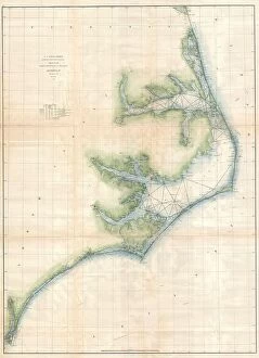
Background imageLatitude Collection: 1873 U.S. Coast Survey Chart Or Map Of The Carolina Coast

1873 U.S. Coast Survey Chart Or Map Of The Carolina Coast
1873, U.S. Coast Survey Chart or Map of the Carolina Coast


For sale as Licensed Images

Choose your image, Select your licence and Download the media

"Exploring the World Through Latitude: A Journey of Maps and Topography" Step back in time to 1768 with James Craig's Map of New Town, Edinburgh, Scotland. This intricate depiction showcases the birth of a new city, highlighting its topography and layout. Fast forward to 1794, where Delisle's Map takes us on an adventure through Southern Ancient Greece, Greek Isles, and Crete. Discover the stunning landscapes that shaped this ancient civilization. In 1886, a Telescopic View and Map of the Moon mesmerizes with its detailed cartography. Explore lunar topography as you delve into the mysteries of our celestial neighbor. Traveling to Costa Rica brings us a Vector Map that captures the beauty of this Central American gem. From lush rainforests to pristine beaches, uncover nature's wonders within its borders. An Antique map reveals Russia's rich history and vast territories. Marvel at how geography has shaped this mighty nation throughout centuries. Ptolemy's Map of the World from AD 150 transports us back in time when cartographers were pioneers in mapping our planet. Witness their early understanding of landmasses and geographical features. Witness mankind's triumphs as a spacecraft lands on the Moon accompanied by a lunar map. Explore uncharted territory through advanced technology while appreciating both artistry and science. Journey to 1658 with Visscher's Map showcasing North America and South America’s diverse topographies. Immerse yourself in these continents' varied landscapes from towering mountains to sprawling plains. The Colton Map from 1855 invites exploration across Scandinavia - Norway, Sweden, Finland - revealing their enchanting natural beauty through meticulous cartographic details. Spruner's Map takes us back even further – before Peloponnesian War – unveiling Greece’s captivating topography during ancient times. Trace historical paths etched upon rugged terrains that once witnessed great conflicts.