
Low Road Collection (#2)
"Exploring the Low Road: Unveiling Hidden Gems across Sheffield, Suffolk, West Norfolk, East Riding of Yorkshire, North Yorkshire


For sale as Licensed Images
Choose your image, Select your licence and Download the media
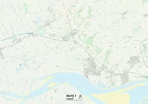
"Exploring the Low Road: Unveiling Hidden Gems across Sheffield, Suffolk, West Norfolk, East Riding of Yorkshire, North Yorkshire, Kennet and Kirklees" Embark on a captivating journey along the enchanting Low Road that winds through picturesque landscapes and unveils hidden treasures. Starting in Sheffield S35 0 Map, this scenic route takes you through Suffolk NR35 2 Map where charming villages await to be discovered. As you venture further into West Norfolk PE34 4 Map and West Norfolk PE33 9 Map, immerse yourself in the tranquility of nature as rolling hills and lush greenery surround you. The peacefulness continues as you make your way to East Riding of Yorkshire HU15 2 Map where breathtaking vistas unfold at every turn. Prepare to be captivated by the beauty of North Yorkshire YO17 8 Map with its idyllic countryside dotted with quaint cottages. Delightful surprises await in North Yorkshire YO12 5 Map and North Yorkshire YO7 2 Map as historic landmarks stand proudly amidst stunning landscapes. Continue your exploration towards Kennet SN10 4 Map where ancient ruins whisper stories from centuries past. Finally, reach Kirklees WF12 0 Map, WF13 3Map, and WF12-8Map where vibrant communities thrive against a backdrop of rolling hills. The Low Road beckons adventurers seeking an off-the-beaten-path experience; it is a gateway to unspoiled beauty and cultural richness that lies beyond conventional tourist routes. So grab your map and embark on an unforgettable journey along the mystical Low Road – uncovering hidden gems one destination at a time.