Maps Collection (page 7)

Maps have always been a fascinating window into the past, allowing us to explore and understand the world as it once was

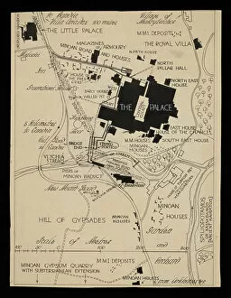
Background imageMaps Collection: Map of Knossos buildings surrounding the Palace, circa 1903

Map of Knossos buildings surrounding the Palace, circa 1903
7310021 Map of Knossos buildings surrounding the Palace, circa 1903 by Fyfe, Theodore (1875-1945); 31x100 cm; Ashmolean Museum, University of Oxford

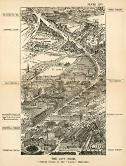
Background imageMaps Collection: London in 1888: The City Road, Finsbury Circus to the 'Angel'Islington (engraving)

London in 1888: The City Road, Finsbury Circus to the "Angel"Islington (engraving)
7188742 London in 1888: The City Road, Finsbury Circus to the " Angel" Islington (engraving) by English School, (19th century); Private Collection; (add.info.: The City Road)

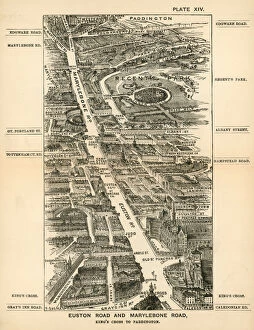
Background imageMaps Collection: London in 1888: Euston Road and Marylebone Road, Kings Cross to Paddington (engraving)

London in 1888: Euston Road and Marylebone Road, Kings Cross to Paddington (engraving)
7188740 London in 1888: Euston Road and Marylebone Road, Kings Cross to Paddington (engraving) by English School, (19th century); Private Collection; (add.info.: Euston Road and Marylebone Road)

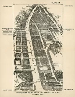
Background imageMaps Collection: London in 1888: Tottenham Court Road and Hampstead Road, to Camden Town (engraving)

London in 1888: Tottenham Court Road and Hampstead Road, to Camden Town (engraving)
7188738 London in 1888: Tottenham Court Road and Hampstead Road, to Camden Town (engraving) by English School, (19th century); Private Collection; (add.info.: Tottenham Court Road and Hampstead Road)

Background imageMaps Collection: Map: City of Glasgow, drawn and engraved by G H Swanston, Edinburgh (colour litho)

Map: City of Glasgow, drawn and engraved by G H Swanston, Edinburgh (colour litho)
6004702 Map: City of Glasgow, drawn and engraved by G H Swanston, Edinburgh (colour litho) by English School, (19th century); Private Collection; (add.info.: City of Glasgow)

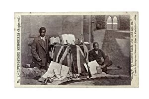
Background imageMaps Collection: James Chuma and Abdullah Susi with David Livingstone artefacts, Newstead Abbey, England

James Chuma and Abdullah Susi with David Livingstone artefacts, Newstead Abbey, England
622820 James Chuma and Abdullah Susi with David Livingstone artefacts, Newstead Abbey, England, June 1874 (albumen print) by Allen, R

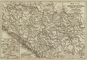
Background imageMaps Collection: Map of the Herzegovina, Bosnia, Servia and Montenegro (engraving)

Map of the Herzegovina, Bosnia, Servia and Montenegro (engraving)
1105886 Map of the Herzegovina, Bosnia, Servia and Montenegro (engraving) by European School, (19th century); Private Collection; (add.info.: Map of the Herzegovina, Bosnia, Servia and Montenegro)

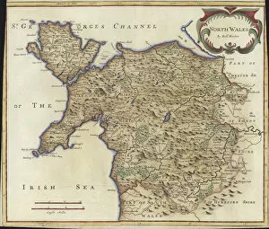
Background imageMaps Collection: Map of North Wales (colour engraving)

Map of North Wales (colour engraving)
979824 Map of North Wales (colour engraving) by Morden, Robert (fl.1682-1703); Private Collection; (add.info.: Map of North Wales)

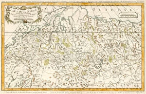
Background imageMaps Collection: MAP / RUSSIA / SIBERIA C1760

MAP / RUSSIA / SIBERIA C1760
Siberia and adjacent regions : St Petersburg and Moscow are on the far left, Irkutsk centre low right Date: circa 1760

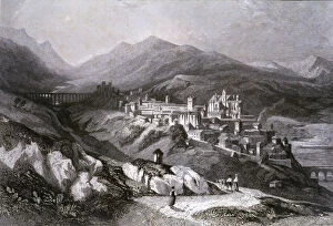
Background imageMaps Collection: View of the city of Plasencia (Caceres), engraving in Voyage Pittoresque en

View of the city of Plasencia (Caceres), engraving in Voyage Pittoresque en Espagne et en Portugal, 1840, by Emile Begin

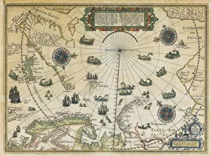
Background imageMaps Collection: Map of Willem Barentsz Third Voyage, 1598. Artist: Claesz, Cornelis (ca. 1551-1609)

Map of Willem Barentsz Third Voyage, 1598. Artist: Claesz, Cornelis (ca. 1551-1609)
Map of Willem Barentsz Third Voyage, 1598. Private Collection

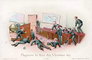
Background imageMaps Collection: Schoolboys and teacher on a Christmas card

Schoolboys and teacher on a Christmas card
Misbehaving schoolboys surprised by their teacher on a Christmas card. Date: circa 1890s

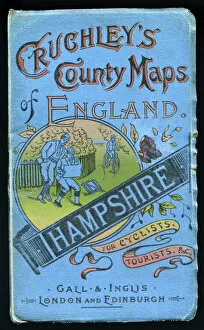
Background imageMaps Collection: Cover design, county map of Hampshire

Cover design, county map of Hampshire for cyclists and tourists, in a series entitled Cruchleys County Maps of England, published by Gall & Inglis of London and Edinburgh. Date: early 20th century

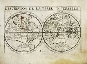
Background imageMaps Collection: Description de la Terre Universelle (1667). Map

Description de la Terre Universelle (1667). Map. Engraving

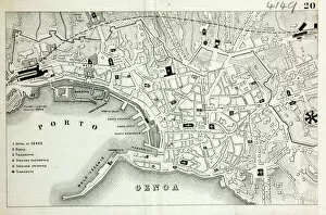
Background imageMaps Collection: Map of Genoa

Map of Genoa
Map of the city of Genoa, Italy Date: 19th century

Background imageMaps Collection: MAP / ASIA 1763

MAP / ASIA 1763
Map of Asia Date: 1763

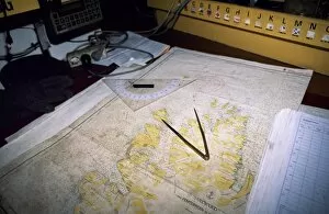
Background imageMaps Collection: Map of northern Spitsbergen in the Noordelichts chart room

Map of northern Spitsbergen in the Noordelichts chart room

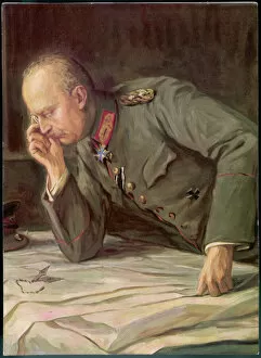
Background imageMaps Collection: Ludendorff and Maps

Ludendorff and Maps
GENERAL EFW VON LUDENDORFF Der Feldherr Ludendorff studies plans of the battlefield

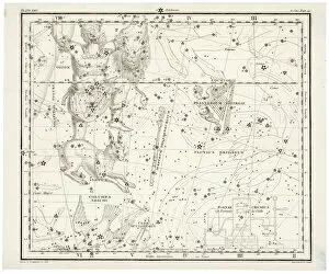
Background imageMaps Collection: Whittaker Star Map 24

Whittaker Star Map 24
Including Orion and Lepus

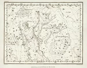
Background imageMaps Collection: Whittaker Star Maps 7

Whittaker Star Maps 7
Including Bootes

Background imageMaps Collection: WW1 - Royal Air Force - Pilots and Observers mark targets

WW1 - Royal Air Force - Pilots and Observers mark targets
WW1 - Royal Air Force - Pilots and Observers mark enemy german targets and positions. Date: circa 1918

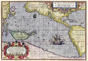
Background imageMaps Collection: Maris Pacifici by Ortelius (1589). One of the first printed maps to show the Pacific Ocean

Maris Pacifici by Ortelius (1589). One of the first printed maps to show the Pacific Ocean:

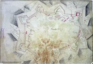
Background imageMaps Collection: Map of Olivenza

Map of Olivenza
Olivenza, fortress and defence works, Spain c. 1801 Date: c. 1801

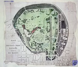
Background imageMaps Collection: Regents Park

Regents Park
Plan of the Regents Park Estate, London 1820 Date: 1820

Background imageMaps Collection: World Map / Overland India

World Map / Overland India
The overland routes from England to India, compared with sea routes

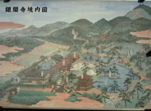
Background imageMaps Collection: Ginkaku-ji Silver Temple plan, Kyoto, Kansai, Japan, Asia

Ginkaku-ji Silver Temple plan, Kyoto, Kansai, Japan, Asia

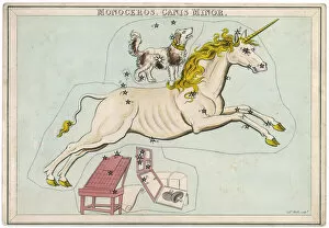
Background imageMaps Collection: Canis Minor Star Map

Canis Minor Star Map
The constellation of the Unicorn and Canis Minor

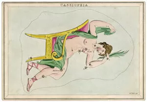
Background imageMaps Collection: Cassiopeia Star Map

Cassiopeia Star Map
The constellation of Cassiopeia, wife of Cepheus, king of Ethiopia, and mother of Andromeda

Background imageMaps Collection: Cepheus Star Map

Cepheus Star Map
The northern constellation of Cepheus, king of Ethiopia, husband of Cassiopeia and father of Andromeda

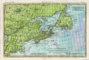
Background imageMaps Collection: Map / N America / Canada

Map / N America / Canada
The east coast of North America from New York to Newfoundland, showing habitats of Eskimaux, native American peoples, and the French colonies of Acadie, etc

Background imageMaps Collection: Map / Asia / Jerusalem 14C

Map / Asia / Jerusalem 14C
Map of Jerusalem during Ibn Batutas travels

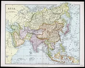
Background imageMaps Collection: MAP / ASIA C1877

MAP / ASIA C1877
Map of Asia

Background imageMaps Collection: MAP / ASIA 1827

MAP / ASIA 1827
Map of Asia

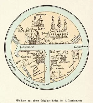
Background imageMaps Collection: World Map / Leipzig Codex

World Map / Leipzig Codex
A German map of the world, showing various cities, rivers and seas

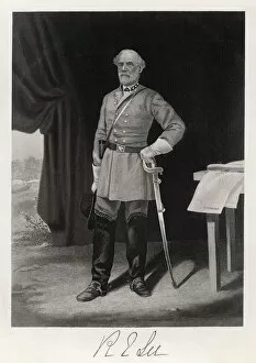
Background imageMaps Collection: Robert E Lee / T Nast

Robert E Lee / T Nast
ROBERT EDWARD LEE American Confederate general

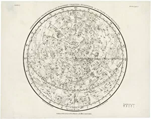
Background imageMaps Collection: Whittaker Star Map 28

Whittaker Star Map 28
The Southern Hemisphere, with its Zodiac signs

Background imageMaps Collection: Whittaker Star Maps 4

Whittaker Star Maps 4
Including Auriga

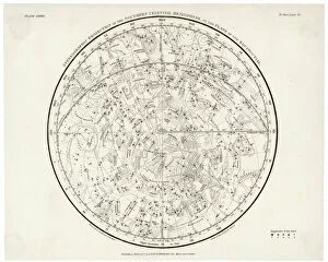
Background imageMaps Collection: Whittaker / Star Map 1

Whittaker / Star Map 1
The Northern hemisphere, including the signs of the Zodiac

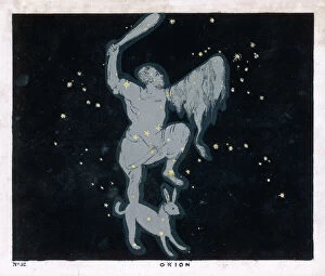
Background imageMaps Collection: BLUNT / ORION / 52 / 1849

BLUNT / ORION / 52 / 1849
The constellation of Orion, one of the most brilliant in the heavens

Background imageMaps Collection: MAPS / WORLD / 1827

MAPS / WORLD / 1827
World map

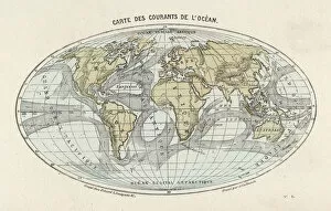
Background imageMaps Collection: Maps / World / Currents

Maps / World / Currents
World map of the ocean currents

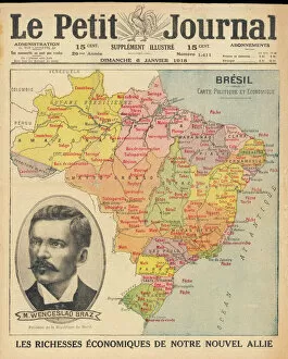
Background imageMaps Collection: Brazil & Bras Portrait

Brazil & Bras Portrait
A map of Brazil with a portrait of its then president Venceslau Bras. Brazil had declared war on Germany in 1917 during World War One

Background imageMaps Collection: Whittaker / Scorpio / Libra

Whittaker / Scorpio / Libra
Including the signs of Scorpio and Libra

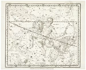
Background imageMaps Collection: Whittaker / Aquarius / Capri

Whittaker / Aquarius / Capri
Including the signs of Aquarius and Capricorn

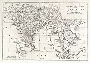
Background imageMaps Collection: Map / Asia / East Indies

Map / Asia / East Indies
India and its neighbours : note that Burma is named India beyond the Ganges

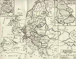
Background imageMaps Collection: Map of Europe according to the Peace Treaties 1918 - 1924. From The Evolution of Modern Europe

Map of Europe according to the Peace Treaties 1918 - 1924. From The Evolution of Modern Europe, 1453 - 1932, published 1933

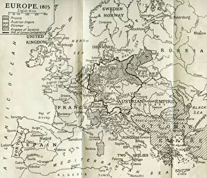
Background imageMaps Collection: Map of Europe in 1815. From The Evolution of Modern Europe, 1453 - 1932, published 1933

Map of Europe in 1815. From The Evolution of Modern Europe, 1453 - 1932, published 1933


For sale as Licensed Images

Choose your image, Select your licence and Download the media

Maps have always been a fascinating window into the past, allowing us to explore and understand the world as it once was. From the intricate details of an ancient Greek map to the vibrant landscapes of Jamaica, each map tells its own unique story. Take a journey back in time with a Map of Ancient Greece, where you can trace the footsteps of philosophers and warriors alike. Discover the birthplace of democracy and marvel at the city-states that shaped Western civilization. Venture further across continents with Maps showcasing the vastness of empires like Britain's. Explore territories under British rule through a Map of the British Empire or delve into Asia's history with a Map highlighting the mighty Mongol Empire. Uncover remnants of one of history's greatest civilizations with a Map depicting the grandeur and reach of Rome. Witness how this powerful empire spanned across Europe, Africa, and Asia, leaving behind an indelible mark on human history. During times filled with turmoil and conflict, maps served as crucial tools for understanding war efforts. The Daily Mail War Map from World War I provides insights into battlefronts while WW2 posters display strategic plans like never before - including those detailing activities specific to divisions such as 52 (Lowland) Division or mapping out positions held by troops in The British Army. Closer to home lies Isle Of Wight - its beauty captured perfectly on a detailed map inviting exploration along its stunning coastline. Meanwhile, travel even further east to discover ancient Persian splendor through an intricately designed Persian Empire map. For those seeking nostalgia or tracing ancestral roots, immerse yourself in Cornwall C1857's historical charm via an antique map capturing its essence during that era. From ancient civilizations to modern-day conflicts and everything in between – they can not just pieces of paper but gateways into our collective pasts. They hold stories waiting to be unraveled by curious minds eager for knowledge about our ever-changing world throughout time.