Navigational Equipment Collection (#15)

"Unveiling the Past: Navigational Equipment Guides Us Through History" Exploring ancient civilizations

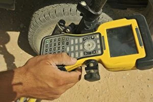
Background imageNavigational Equipment Collection: U. S. Air Force technician using a global positioning system device

U. S. Air Force technician using a global positioning system device
June 25, 2010 - U.S. Air Force technician uses a GPS to mark positions for a cement paver to finish a runway at Camp Dwyer, Afghanistan

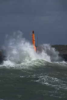
Background imageNavigational Equipment Collection: Strong waves with spray in a storm at the pier of Hvide Sande, Jutland, Denmark, Europe

Strong waves with spray in a storm at the pier of Hvide Sande, Jutland, Denmark, Europe

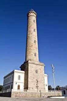
Background imageNavigational Equipment Collection: Faro de Chipiona, tallest lighthouse in Spain and one of the tallest worldwide, 69 metres

Faro de Chipiona, tallest lighthouse in Spain and one of the tallest worldwide, 69 metres, Andalucia, Spain, Europe

Background imageNavigational Equipment Collection: Lighthouse of Westerhever in winter, St. Peter-Ording, Eiderstedt Peninsula

Lighthouse of Westerhever in winter, St. Peter-Ording, Eiderstedt Peninsula, district of Nordfriesland, Schleswig-Holstein, Germany, Europe

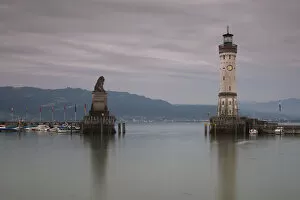
Background imageNavigational Equipment Collection: Harbour entrance of Lindau on Lake Constance with the old lighthouse and the Bavarian lion statue

Harbour entrance of Lindau on Lake Constance with the old lighthouse and the Bavarian lion statue, Bavaria, Germany, Europe

Background imageNavigational Equipment Collection: Hemispherical

Hemispherical
Circa 1580, A Hemispherical, made by Hyeroimus Vulperica, in 1580, part of a complete collection of 16th century astronomical

Background imageNavigational Equipment Collection: Ocean liner with tug boats

Ocean liner with tug boats
UNITED STATES - CIRCA 1950s: Ocean liner with tug boats. (Photo by George Marks/Retrofile/Getty Images)

Background imageNavigational Equipment Collection: Navigational map, by Jacopo Russo, 1528

Navigational map, by Jacopo Russo, 1528
North (Top) view of a navigational map of Europe and the Middle East by Jacopo Russo 1528, Messina. Sicily. Showing Switzerland, Italy; Balkans and Hungary

Background imageNavigational Equipment Collection: Navigational map, by Jacopo Russo, 1529

Navigational map, by Jacopo Russo, 1529
South (Top) view of a navigational map of Europe and the Middle East by Jacopo Russo 1528, Messina. Sicily. Showing Switzerland, Italy; Balkans and Hungary

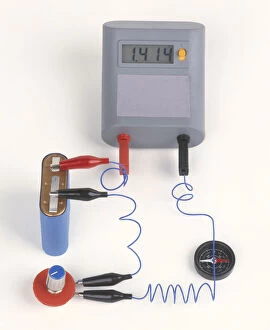
Background imageNavigational Equipment Collection: Experiment showing effect of electromagnetism on compass needle, using ammeter, battery

Experiment showing effect of electromagnetism on compass needle, using ammeter, battery, variable resistor, compass, wires

Background imageNavigational Equipment Collection: Gyroscope used as navigational device for ships, early 20th century

Gyroscope used as navigational device for ships, early 20th century

Background imageNavigational Equipment Collection: Compasses arranged around a coil of current-carrying wire, a type of electromagnet called a solenoid

Compasses arranged around a coil of current-carrying wire, a type of electromagnet called a solenoid

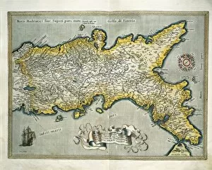
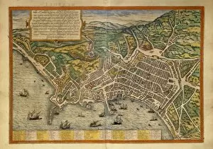
Background imageNavigational Equipment Collection: Map of the Kingdom of Naples, Italy, from Theatrum Orbis Terrarum by Abraham Ortelius, 1528-1598

Map of the Kingdom of Naples, Italy, from Theatrum Orbis Terrarum by Abraham Ortelius, 1528-1598, 1570
Cartography, Italy, 16th century. Map of the Kingdom of Naples, from Theatrum Orbis Terrarum by Abraham Ortelius (1528-1598), Antwerp, 1570

Background imageNavigational Equipment Collection: Map of Gallo Island and adjoining coast

Map of Gallo Island and adjoining coast
Cartography, South America, 15th century. Gallo Island and the adjoining coast

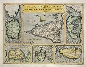
Background imageNavigational Equipment Collection: Map of Mediterranean Islands, from Theatrum Orbis Terrarum by Abraham Ortelius, 1528-1598, 1570

Map of Mediterranean Islands, from Theatrum Orbis Terrarum by Abraham Ortelius, 1528-1598, 1570
Cartography, 16th century. Map of Mediterranean Islands, from Theatrum Orbis Terrarum by Abraham Ortelius (1528-1598), Antwerp, 1570

Background imageNavigational Equipment Collection: Map from Civitates Orbis Terrarum by Georg Braun, 1541-1622 and Franz Hogenberg, 1540-1590

Map from Civitates Orbis Terrarum by Georg Braun, 1541-1622 and Franz Hogenberg, 1540-1590, engraving
Cartography, 16th century. From Civitates Orbis Terrarum by Georg Braun (1541-1622) and Franz Hogenberg (1540-1590), Cologne

Background imageNavigational Equipment Collection: Map of Bavaria, Germany, from Theatrum Orbis Terrarum by Abraham Ortelius, 1528-1598, 1570

Map of Bavaria, Germany, from Theatrum Orbis Terrarum by Abraham Ortelius, 1528-1598, 1570
Cartography, Germany, 16th century. Map of Bavaria, from Theatrum Orbis Terrarum by Abraham Ortelius (1528-1598), Antwerp, 1570

Background imageNavigational Equipment Collection: Map of Munich, Ingolstadt, Freising, Nordlingen, Regensburg and Straubing, Germany

Map of Munich, Ingolstadt, Freising, Nordlingen, Regensburg and Straubing, Germany
Cartography, Germany, 16th century. Munich, Ingolstadt, Freising, Nordlingen, Regensburg and Straubing. From Civitates Orbis Terrarum by Georg Braun (1541-1622) and Franz Hogenberg (1540-1590)

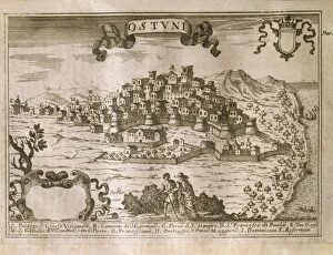
Background imageNavigational Equipment Collection: Map of Ostuni, Brindisi

Map of Ostuni, Brindisi
Cartography, Italy, 17th century. Map of Ostuni, Brindisi

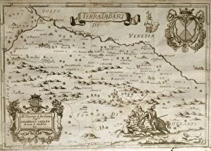
Background imageNavigational Equipment Collection: Map of The Territory of Bari, by Giovan Battista Pacichelli, engraving, 1702

Map of The Territory of Bari, by Giovan Battista Pacichelli, engraving, 1702
Cartography, Italy, 18th century. The Territory of Bari. From The Kingdom of Naples in perspective by Giovan Battista Pacichelli, 1702. Engraving

Background imageNavigational Equipment Collection: Map of Switzerland, from Theatrum Orbis Terrarum by Abraham Ortelius, 1528-1598, 1570

Map of Switzerland, from Theatrum Orbis Terrarum by Abraham Ortelius, 1528-1598, 1570
Cartography, 16th century. Map of Switzerland, from Theatrum Orbis Terrarum by Abraham Ortelius (1528-1598), Antwerp, 1570

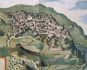
Background imageNavigational Equipment Collection: Map of Narni, from Theatrum civitatum et admirandorum Italiae by Joan Blaeu, engraving

Map of Narni, from Theatrum civitatum et admirandorum Italiae by Joan Blaeu, engraving
Cartography, Italy, 17th century. Map of Narni, from Theatrum civitatum et admirandorum Italiae by Joan Blaeu. Engraving

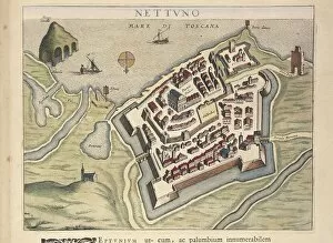
Background imageNavigational Equipment Collection: Map of Nettuno, from Theatrum civitatum et admirandorum Italiae, by Joan Blaeu, engraving

Map of Nettuno, from Theatrum civitatum et admirandorum Italiae, by Joan Blaeu, engraving
Cartography, Italy, 17th century. Map of Nettuno, from Theatrum civitatum et admirandorum Italiae by Joan Blaeu. Engraving

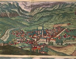
Background imageNavigational Equipment Collection: City of Bressanone, from Civitates Orbis Terrarum by Georg Braun, 1541-1622 and Franz Hogenberg

City of Bressanone, from Civitates Orbis Terrarum by Georg Braun, 1541-1622 and Franz Hogenberg, 1540-1590, engraving
Cartography, 16th century. The City of Bressanone. From Civitates Orbis Terrarum by Georg Braun (1541-1622) and Franz Hogenberg (1540-1590), Cologne. Engraving

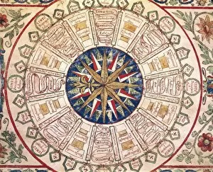
Background imageNavigational Equipment Collection: Ioannes Superantius, Portolan chart, wind rose, detail

Ioannes Superantius, Portolan chart, wind rose, detail
Cartography, 16th century. Ioannes Superantius, Portolan chart, wind rose. Detail

Background imageNavigational Equipment Collection: The Astronomer by Jan Vermeer, oil on canvas, 1668

The Astronomer by Jan Vermeer, oil on canvas, 1668
Jan Vermeer (1632-1675), The Astronomer, 1668, oil on canvas, 51 x 45 cm. Detail: Globe

Background imageNavigational Equipment Collection: Map of Cherasco, Cuneo and its surroundings, 1720

Map of Cherasco, Cuneo and its surroundings, 1720
Cartography, Italy, 18th century. Map of Cherasco, Cuneo and its surroundings in 1720

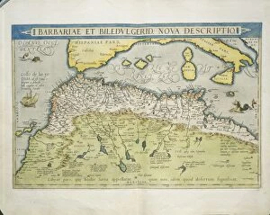
Background imageNavigational Equipment Collection: Map of Northern Africa, from Theatrum Orbis Terrarum by Abraham Ortelius, 1528-1598, 1570

Map of Northern Africa, from Theatrum Orbis Terrarum by Abraham Ortelius, 1528-1598, 1570
Cartography, 16th century. Map of Northern Africa, from Theatrum Orbis Terrarum by Abraham Ortelius (1528-1598), Antwerp, 1570

Background imageNavigational Equipment Collection: Ferrara at the time of the Marquis Nicolo Zoppo d Este, 1338

Ferrara at the time of the Marquis Nicolo Zoppo d Este, 1338
Cartography, Italy, 17th century. Ferrara at the time of the Marquis NicolA

Background imageNavigational Equipment Collection: Map of city, from Civitates Orbis Terrarum by Georg Braun, 1541-1622 and Franz Hogenberg

Map of city, from Civitates Orbis Terrarum by Georg Braun, 1541-1622 and Franz Hogenberg, 1540-1590, engraving
Cartography, Netherlands, 16th century. Map of Amsterdam. From Civitates Orbis Terrarum by Georg Braun (1541-1622) and Franz Hogenberg (1540-1590), Cologne. Engraving

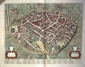
Background imageNavigational Equipment Collection: Map of Viterbo from Theatrum civitatum et admirandorum Italiae, by Joan Blaeu, engraving

Map of Viterbo from Theatrum civitatum et admirandorum Italiae, by Joan Blaeu, engraving
Cartography, Italy, 17th century. Map of Viterbo, from Theatrum civitatum et admirandorum Italiae by Joan Blaeu. Engraving

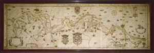
Background imageNavigational Equipment Collection: Map of The Po River from Colorno to Piacenza, by Smeraldo Smeraldi, 1605

Map of The Po River from Colorno to Piacenza, by Smeraldo Smeraldi, 1605
Cartography, Italy, 17th century. The Po River from Colorno to Piacenza. Map by Smeraldo Smeraldi, 1605

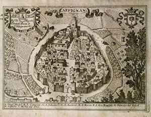
Background imageNavigational Equipment Collection: Map of Carpignano Salentino, Lecce

Map of Carpignano Salentino, Lecce
Cartography, Italy, 17th century. Map of Carpignano Salentino, Lecce

Background imageNavigational Equipment Collection: Rio de ll Plate, Silver River and the Parana Basin in Paraguay, from Willem Blaeus Atlas, 1658

Rio de ll Plate, Silver River and the Parana Basin in Paraguay, from Willem Blaeus Atlas, 1658
Cartography, Paraguay, 17th century. Rio de ll Plate ( Silver River) and the ParanA

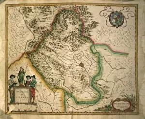
Background imageNavigational Equipment Collection: Province of Vicenza from Theatrum civitatum et admirandorum Italiae, by Joan Blaeu, engraving

Province of Vicenza from Theatrum civitatum et admirandorum Italiae, by Joan Blaeu, engraving
Cartography, Italy, 17th century. Province of Vicenza. From Theatrum civitatum et admirandorum Italiae by Joan Blaeu. Engraving

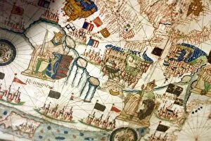
Background imageNavigational Equipment Collection: Catalan Atlas of Charles V of France, attributed to Abraham and Jafuda Cresques Mallorca, 1375

Catalan Atlas of Charles V of France, attributed to Abraham and Jafuda Cresques Mallorca, 1375
Cartography, 14th century. Catalan Atlas of Charles V of France. Attributed to Abraham and Jafuda Cresques Mallorca (1375 approx). Copy of the original kept at the French National Library, Paris

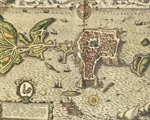
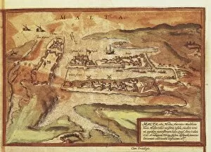
Background imageNavigational Equipment Collection: Map of the island of Malta, from Civitates Orbis Terrarum by Georg Braun

Map of the island of Malta, from Civitates Orbis Terrarum by Georg Braun, 1541-1622 and Franz Hogenberg, 1540-1590
Cartography, Germany, 16th century. Map of the island of Malta. From Civitates Orbis Terrarum by Georg Braun (1541-1622) and Franz Hogenberg (1540-1590), Cologne. Engraving

Background imageNavigational Equipment Collection: Map of Eastern Canada and Newfoundland, drawing by Vincenzo Maria Coronelli, 1692

Map of Eastern Canada and Newfoundland, drawing by Vincenzo Maria Coronelli, 1692
Cartography, 17th century. Map of Eastern Canada and Newfoundland, drawn by Vincenzo Maria Coronelli in 1692

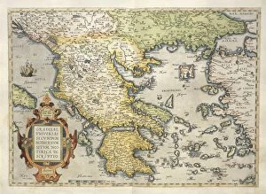
Background imageNavigational Equipment Collection: Map of Greece, from Theatrum Orbis Terrarum by Abraham Ortelius, 1528-1598, 1570

Map of Greece, from Theatrum Orbis Terrarum by Abraham Ortelius, 1528-1598, 1570
Cartography, 16th century. Map of Greece, from Theatrum Orbis Terrarum by Abraham Ortelius (1528-1598), Antwerp, 1570

Background imageNavigational Equipment Collection: Maps of Seville, Cadiz and Malaga, Spain, from Civitates Orbis Terrarum by Georg Braun

Maps of Seville, Cadiz and Malaga, Spain, from Civitates Orbis Terrarum by Georg Braun, 1541-1622 and Franz Hogenberg
Cartography, Spain, 16th century. Maps of Seville, Cadiz and Malaga. From Civitates Orbis Terrarum by Georg Braun (1541-1622) and Franz Hogenberg (1540-1590), Cologne. Engraving

Background imageNavigational Equipment Collection: Map of Russia, from Theatrum Orbis Terrarum by Abraham Ortelius, 1528-1598, 1570

Map of Russia, from Theatrum Orbis Terrarum by Abraham Ortelius, 1528-1598, 1570
Cartography, 16th century. Map of Russia, from Theatrum Orbis Terrarum by Abraham Ortelius (1528-1598), Antwerp, 1570

Background imageNavigational Equipment Collection: Map of Gallipoli, from Civitates Orbis Terrarum by Georg Braun, 1541-1622 and Franz Hogenberg

Map of Gallipoli, from Civitates Orbis Terrarum by Georg Braun, 1541-1622 and Franz Hogenberg, 1540-1590, engraving
Cartography, Italy, 16th century. The City of Gallipoli. From Civitates Orbis Terrarum by Georg Braun (1541-1622) and Franz Hogenberg (1540-1590), Cologne. Engraving

Background imageNavigational Equipment Collection: Map of Rapolla, Potenza

Map of Rapolla, Potenza
Cartography, Italy, 17th century. Map of Rapolla, Potenza

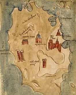
Background imageNavigational Equipment Collection: Greece, Chios Island, Chio Scio, drawing from the Latin manuscript, by Insularium Arcipelagi

Greece, Chios Island, Chio Scio, drawing from the Latin manuscript, by Insularium Arcipelagi
Cartography, Greece, 17th century. Chios Island ( Chio Scio). Drawing from the Latin manuscript, Insularium Arcipelagi

Background imageNavigational Equipment Collection: Map of Bermuda islands

Map of Bermuda islands
Cartography, 16th century. Bermuda islands

Background imageNavigational Equipment Collection: Map of Greater New York, USA, color lithography by Charles Hart, 1897

Map of Greater New York, USA, color lithography by Charles Hart, 1897
Cartography, United States of America, 19th century - Greater New York. Color lithography by Charles Hart, 1897

Background imageNavigational Equipment Collection: Santo Domingo map and Charles Baltazars estate, by Julien Fevret di Saint-Mesmin, watercolour

Santo Domingo map and Charles Baltazars estate, by Julien Fevret di Saint-Mesmin, watercolour
Cartography, America, 18th-19th centuries. Santo Domingo, map and map of Charles Baltazars estate. Watercolor by Julien Fevret di Saint-Mesmin


For sale as Licensed Images

Choose your image, Select your licence and Download the media

"Unveiling the Past: Navigational Equipment Guides Us Through History" Exploring ancient civilizations: An antique map of the Roman Empire reveals their vast territories and navigational prowess. Tracing Anglo-Saxon roots: Delve into history with an antique map showcasing Britain under the Anglo Saxons, a captivating glimpse into early English heritage. Byzantine marvels in ink: Step back in time as a 9th-century map of the Byzantine Empire unfolds its intricate details, guiding us through this remarkable era. Unraveling Liverpool's maritime legacy: A fascinating 19th-century antique map takes us on a journey through Liverpool and Birkenhead, England, offering insights into their rich nautical history. Ireland's enchanting landscapes mapped: Discover Ireland's allure through an exquisite antique map that showcases its diverse geography and invites exploration. Scottish Isles beckon adventurers: Embark on a virtual voyage to Jura, Mull, Argyll, Islay with a stunning 19th-century antique map that captures Scotland's rugged beauty. Charting New Zealand's discovery: Travel back to 1873 with an extraordinary antique map of New Zealand; witness how explorers navigated these uncharted lands centuries ago. The allure of vintage cartography continues: Immerse yourself in nostalgia with an enchanting vintage map of Magna Graecia - relish its timeless charm and historical significance. Island paradise revealed - Cyprus unveiled. Explore this Mediterranean gem as you trace your fingers across an alluringly detailed vintage map capturing Cyprus' unique essence. Saint Lucia whispers tales from yesteryears: Transport yourself to the Caribbean island paradise as you explore a mesmerizing 19th-century antique map depicting Saint Lucia’s vibrant past. The road less traveled across America awaits.