Navigational Equipment Collection (#8)

"Unveiling the Past: Navigational Equipment Guides Us Through History" Exploring ancient civilizations

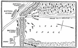
Background imageNavigational Equipment Collection: Battle of Big Bethel

Battle of Big Bethel
Vintage engraving from 1863 of a map of the Battle of Big Bethel also known as the Battle of Bethel Church or Great Bethel was an American Civil War battle that took place on June 10, 1861

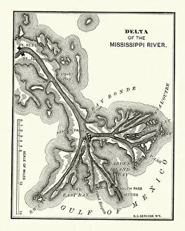
Background imageNavigational Equipment Collection: Map of the Delta of the Mississippi river, 19th Century

Map of the Delta of the Mississippi river, 19th Century
Vintage engraving of a Map of the Delta of the Mississippi river, 19th Century

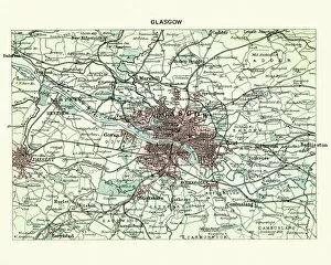
Background imageNavigational Equipment Collection: Antique map, Scotland, City of Glasgow 19th Century

Antique map, Scotland, City of Glasgow 19th Century
Vintage engraving of a Antique map, Scotland, City of Glasgow 19th Century

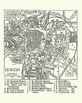
Background imageNavigational Equipment Collection: Map of Leipzig, Germany, 19th Century

Map of Leipzig, Germany, 19th Century
Vintage engraving of a Map of Leipzig, Germany, 19th Century

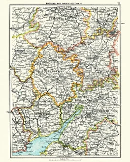
Background imageNavigational Equipment Collection: Antique map, Hereford, Worester, Monmouth, Gloucester, Shropshire, 19th Century

Antique map, Hereford, Worester, Monmouth, Gloucester, Shropshire, 19th Century
Antique map, Hereford, Worester, Monmouth, Gloucester, Shropshire, England and Wales 19th Century

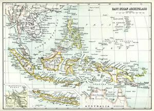
Background imageNavigational Equipment Collection: Antique map of East Indian Archipelago

Antique map of East Indian Archipelago, including, the Phillippines, Papua New Guinea, Borneo and Java from 1891. With Detail of Batavia (Jakarta)

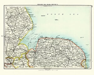
Background imageNavigational Equipment Collection: Antique map, Lincoln and Norfolk, England 19th Century

Antique map, Lincoln and Norfolk, England 19th Century
Vintage engraving of a Antique map, Lincoln and Norfolk, England 19th Century

Background imageNavigational Equipment Collection: Antique map, Leicester, Warwick, Northampton, Oxford, Buckingham 19th Century

Antique map, Leicester, Warwick, Northampton, Oxford, Buckingham 19th Century
Vintage engraving of a Antique map, Leicester, Warwick, Northampton, Oxford, Buckingham. England 19th Century

Background imageNavigational Equipment Collection: Antique map, Lancashire, Cheshire, Stafford, Liverpool, 19th Century

Antique map, Lancashire, Cheshire, Stafford, Liverpool, 19th Century
Vintage engraving of a Antique map, Lancashire, Cheshire, Stafford, Liverpool, Shropshire, Derby, England 19th Century

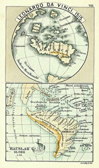
Background imageNavigational Equipment Collection: Antique Map by Leonardo Da Vinci

Antique Map by Leonardo Da Vinci 1515 and the Hauslab Globe

Background imageNavigational Equipment Collection: Antique Map of South West England, Somerset, Devon, 1891

Antique Map of South West England, Somerset, Devon, 1891
Antique Map of South West England, Somerset, Devon with a detail of Plymouth, Devonport and the Sound, 1891

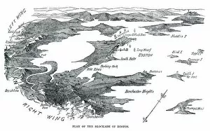
Background imageNavigational Equipment Collection: Blockade of Boston

Blockade of Boston
Vintage engraving from 1861 showing the Plan of the Blockade of Boston during the American Revolutionary War

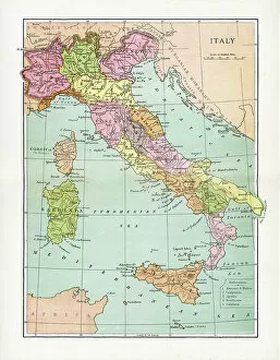
Background imageNavigational Equipment Collection: Antique Map of Italy

Antique Map of Italy
Vintage map of Italy, from 1894

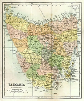
Background imageNavigational Equipment Collection: Antique Map of Tasmania

Antique Map of Tasmania
Antique map of Tasmania from 1867

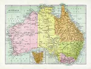
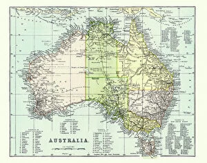
Background imageNavigational Equipment Collection: Antique Map of Australia

Antique Map of Australia
Vintage map of Australia, from 1894

Background imageNavigational Equipment Collection: Antique Map of Australia Late 19th Century

Antique Map of Australia Late 19th Century
Antique Map of Australia in the late 19th Century

Background imageNavigational Equipment Collection: Antique Map of Victoria, Australia

Antique Map of Victoria, Australia
Antique map of the State of Victoria, Australia, from 1867

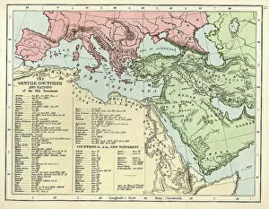
Background imageNavigational Equipment Collection: Old Testament Map

Old Testament Map
Vintage biblical map from 1879 showing the gentile countries and nations of the Old Testament

Background imageNavigational Equipment Collection: After School; Apres l'Ecole, c. 1916 (oil on canvas)

After School; Apres l'Ecole, c. 1916 (oil on canvas)
653582 After School; Apres l'Ecole, c. 1916 (oil on canvas) by Valtat, Louis (1869-1952); 65x81 cm; Private Collection; (add.info.: After School; Apres l'Ecole. Louis Valtat (1869-1952)

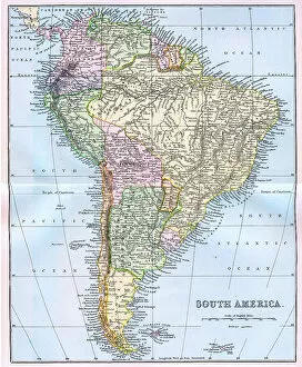
Background imageNavigational Equipment Collection: Map of South America 19th Century

Map of South America 19th Century
Vintage map of South America from the 19th Century

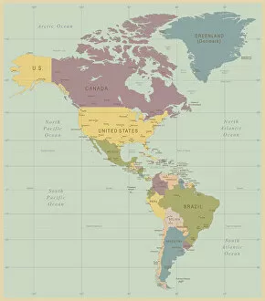
Background imageNavigational Equipment Collection: Vintage Map of North and South America

Vintage Map of North and South America
534055040

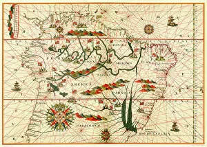
Background imageNavigational Equipment Collection: Map of South America

Map of South America, from a Spanish Atlas, 1582

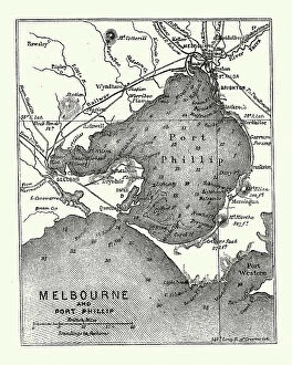
Background imageNavigational Equipment Collection: Map of Melbourne and Port Phillip, Australia, 19th Century

Map of Melbourne and Port Phillip, Australia, 19th Century
Vintage engraving of Map of Melbourne and Port Phillip, Australia, 19th Century

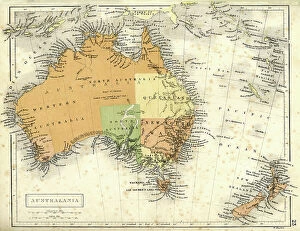
Background imageNavigational Equipment Collection: Antique map of Australia and New Zealand

Antique map of Australia and New Zealand
Vintage map of Australia and New Zealand in 1861

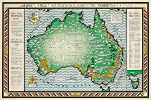
Background imageNavigational Equipment Collection: A Map of Australia, 1930 (colour litho)

A Map of Australia, 1930 (colour litho)
1198399 A Map of Australia, 1930 (colour litho) by Gill, Leslie MacDonald (Max) (1884-1947); 102x153 cm; Private Collection; (add.info.: Gill)

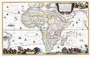
Background imageNavigational Equipment Collection: Map of Africa, c. 1696 (hand-coloured engraving)

Map of Africa, c. 1696 (hand-coloured engraving)
986318 Map of Africa, c.1696 (hand-coloured engraving) by Danckerts, Cornelis III (1664-1717); 59x96 cm; Private Collection; (add.info.: Map of Africa. Cornelis Danckerts III (1664-1717)

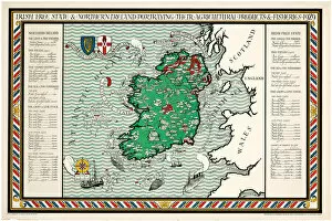
Background imageNavigational Equipment Collection: A Map of the Irish Free State & Northern Ireland, 1929 (colour litho)

A Map of the Irish Free State & Northern Ireland, 1929 (colour litho)
1198397 A Map of the Irish Free State & Northern Ireland, 1929 (colour litho) by Gill, Leslie MacDonald (Max) (1884-1947); 102x153 cm; Private Collection; (add.info.: Gill)

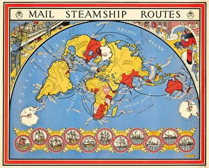
Background imageNavigational Equipment Collection: Poster advertising mail steamship routes, 1937 (colour litho)

Poster advertising mail steamship routes, 1937 (colour litho)
1198395 Poster advertising mail steamship routes, 1937 (colour litho) by Gill, Leslie MacDonald (Max) (1884-1947); 102x127 cm; Private Collection; (add.info.: Gill)

Background imageNavigational Equipment Collection: Undergound map of London, 1926 (colour litho)

Undergound map of London, 1926 (colour litho)
1198177 Undergound map of London, 1926 (colour litho) by Gossop, Reginald Percy (1876-1951); 101x126 cm; Private Collection; (add.info.: Gossop)

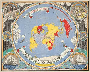
Background imageNavigational Equipment Collection: Cable & Wireless Great Circle Map, 1945 (colour litho)

Cable & Wireless Great Circle Map, 1945 (colour litho)
1198175 Cable & Wireless Great Circle Map, 1945 (colour litho) by Gill, Leslie MacDonald (Max) (1884-1947); 102x127 cm; Private Collection; (add.info.: Gill)

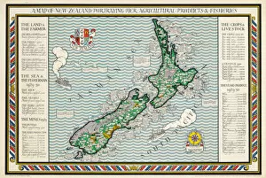
Background imageNavigational Equipment Collection: A Map of New Zealand, 1931 (colour litho)

A Map of New Zealand, 1931 (colour litho)
1198398 A Map of New Zealand, 1931 (colour litho) by Gill, Leslie MacDonald (Max) (1884-1947); 102x153 cm; Private Collection; (add.info.: Gill)

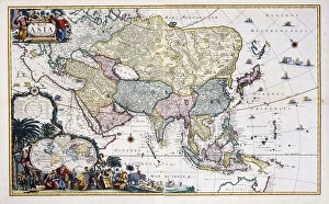
Background imageNavigational Equipment Collection: Map of Asia, c. 1696 (hand-coloured engraving)

Map of Asia, c. 1696 (hand-coloured engraving)
986317 Map of Asia, c.1696 (hand-coloured engraving) by Danckerts, Cornelis III (1664-1717); 59x96 cm; Private Collection; (add.info.: Map of Asia. Cornelis Danckerts III (1664-1717)

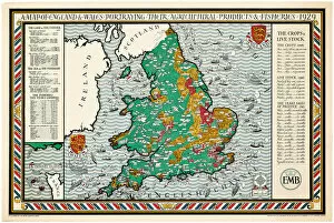
Background imageNavigational Equipment Collection: A Map of England and Wales, 1928 (colour litho)

A Map of England and Wales, 1928 (colour litho)
1198396 A Map of England and Wales, 1928 (colour litho) by Gill, Leslie MacDonald (Max) (1884-1947); 102x153 cm; Private Collection; (add.info.: Gill)

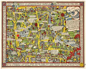
Background imageNavigational Equipment Collection: Peter Pan Map of South Kensington, 1923 (colour litho)

Peter Pan Map of South Kensington, 1923 (colour litho)
1198360 Peter Pan Map of South Kensington, 1923 (colour litho) by Gill, Leslie MacDonald (Max) (1884-1947); 101x127 cm; Private Collection; (add.info.: Gill)

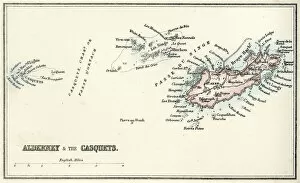
Background imageNavigational Equipment Collection: Map of Alderney and the Casquets

Map of Alderney and the Casquets
" Vintage map from 1880 of Alderney and the Casquets. Alderney is the most northerly of the Channel Islands. It is part of the Bailiwick of Guernsey, a British Crown dependency
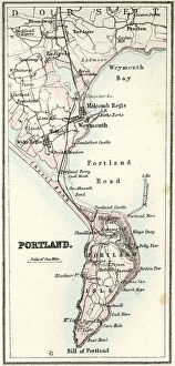
Background imageNavigational Equipment Collection: Map of Portland

Map of Portland
" Vintage map from 1880 of Portland a limestone tombolo or tied island, 6 kilometres long by 2.4 kilometres wide, in the English Channel."

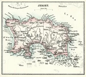
Background imageNavigational Equipment Collection: Map of Jersey

Map of Jersey
" Vintage engraving from 1880 of Jersey a British Crown Dependency off the coast of Normandy, France. As well as the island of Jersey itself
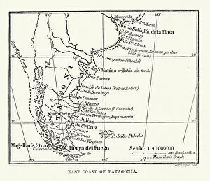
Background imageNavigational Equipment Collection: Antique Map of the East Coast of Patagonia

Antique Map of the East Coast of Patagonia in the 16th Century

Background imageNavigational Equipment Collection: Portrait of a Gentleman, standing three-quarter length, Wearing a White Waistcoat

Portrait of a Gentleman, standing three-quarter length, Wearing a White Waistcoat
1765043 Portrait of a Gentleman, standing three-quarter length, Wearing a White Waistcoat, a Red Fur-Lined Cloak and Red Breeches, Pointing to a Map on a Table

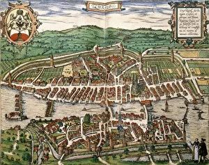
Background imageNavigational Equipment Collection: Map of Zurich, 1575 (hand-coloured engraving)

Map of Zurich, 1575 (hand-coloured engraving)
1195383 Map of Zurich, 1575 (hand-coloured engraving) by German School, (16th century); Private Collection; Photo eChristies Images; German, out of copyright

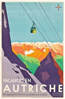
Background imageNavigational Equipment Collection: Poster advertising vacations in Austria, (colour lithograph)

Poster advertising vacations in Austria, (colour lithograph)
1197988 Poster advertising vacations in Austria, (colour lithograph) by Austrian School, (20th century); 95x62 cm; Private Collection; Photo eChristies Images; Austrian, out of copyright

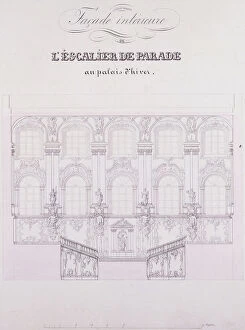
Background imageNavigational Equipment Collection: Interior frontage of the Parade Stairs at the Winter Palace;Facade interieure de l

Interior frontage of the Parade Stairs at the Winter Palace;Facade interieure de l
1195482 Interior frontage of the Parade Stairs at the Winter Palace; Facade interieure de l Escalier de Parade au Palais d Hiver

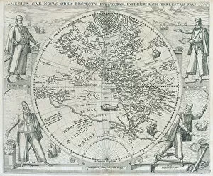
Background imageNavigational Equipment Collection: A map of the Americas, 1590-1601 (engraving)

A map of the Americas, 1590-1601 (engraving)
1195461 A map of the Americas, 1590-1601 (engraving) by Bry, Theodor de (1528-98) & Bry, Johann Theodor de (1561-1623); 35x25 (folio size) cm; Private Collection; (add.info.: Bry)

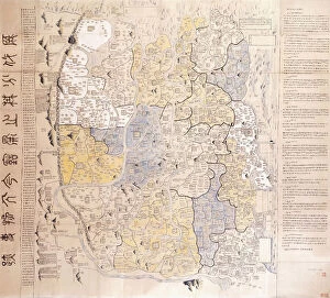
Background imageNavigational Equipment Collection: (An administrative) Map of the 13 Provinces of the North and South Capitals (of China

(An administrative) Map of the 13 Provinces of the North and South Capitals (of China
986466 (An administrative) Map of the 13 Provinces of the North and South Capitals (of China), c.1712 (black ink and colours on paper) by Chinese School (18th century)

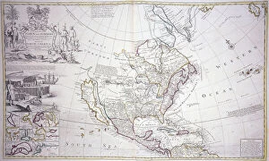
Background imageNavigational Equipment Collection: A Double-Page Map of North America, c. 1708-20 (hand-coloured engraving)

A Double-Page Map of North America, c. 1708-20 (hand-coloured engraving)
986383 A Double-Page Map of North America, c.1708-20 (hand-coloured engraving) by English School, (18th century); 66x54 cm; Private Collection; (add.info.: A Double-Page Map of North America)

Background imageNavigational Equipment Collection: Map of the Island of Mallorca, 1785 (hand-coloured engraving)

Map of the Island of Mallorca, 1785 (hand-coloured engraving)
986325 Map of the Island of Mallorca, 1785 (hand-coloured engraving) by Spanish School, (18th century); 121x160 cm; Private Collection; (add.info)

Background imageNavigational Equipment Collection: Geographical Map of the Theatre of War, showing the Kingdom of Hungary in the main

Geographical Map of the Theatre of War, showing the Kingdom of Hungary in the main
986323 Geographical Map of the Theatre of War, showing the Kingdom of Hungary in the main, 1771 (hand-coloured engraving.) by German School

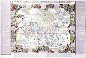
Background imageNavigational Equipment Collection: Map of Asia, 1740 (hand-coloured engraving)

Map of Asia, 1740 (hand-coloured engraving)
986320 Map of Asia, 1740 (hand-coloured engraving) by Fer, Nicolas de (1646-1720); 104x156 cm; Private Collection; (add.info.: Map of Asia; L Asie.... Nicolas de Fer (1646-1720)


For sale as Licensed Images

Choose your image, Select your licence and Download the media

"Unveiling the Past: Navigational Equipment Guides Us Through History" Exploring ancient civilizations: An antique map of the Roman Empire reveals their vast territories and navigational prowess. Tracing Anglo-Saxon roots: Delve into history with an antique map showcasing Britain under the Anglo Saxons, a captivating glimpse into early English heritage. Byzantine marvels in ink: Step back in time as a 9th-century map of the Byzantine Empire unfolds its intricate details, guiding us through this remarkable era. Unraveling Liverpool's maritime legacy: A fascinating 19th-century antique map takes us on a journey through Liverpool and Birkenhead, England, offering insights into their rich nautical history. Ireland's enchanting landscapes mapped: Discover Ireland's allure through an exquisite antique map that showcases its diverse geography and invites exploration. Scottish Isles beckon adventurers: Embark on a virtual voyage to Jura, Mull, Argyll, Islay with a stunning 19th-century antique map that captures Scotland's rugged beauty. Charting New Zealand's discovery: Travel back to 1873 with an extraordinary antique map of New Zealand; witness how explorers navigated these uncharted lands centuries ago. The allure of vintage cartography continues: Immerse yourself in nostalgia with an enchanting vintage map of Magna Graecia - relish its timeless charm and historical significance. Island paradise revealed - Cyprus unveiled. Explore this Mediterranean gem as you trace your fingers across an alluringly detailed vintage map capturing Cyprus' unique essence. Saint Lucia whispers tales from yesteryears: Transport yourself to the Caribbean island paradise as you explore a mesmerizing 19th-century antique map depicting Saint Lucia’s vibrant past. The road less traveled across America awaits.