
Piadyshev Vasilii Petrovich Collection
Vasilii Petrovich Piadyshev: Pioneering Cartographer of 19th-Century Russia (1820-1822) Discover the remarkable work of Russian cartographer Vasilii Petrovich Piadyshev


For sale as Licensed Images
Choose your image, Select your licence and Download the media
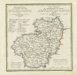
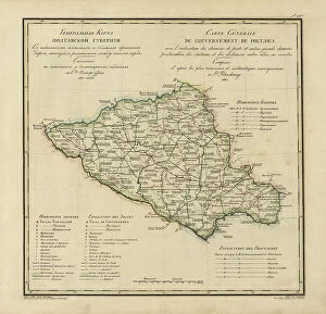
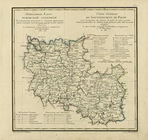
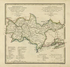
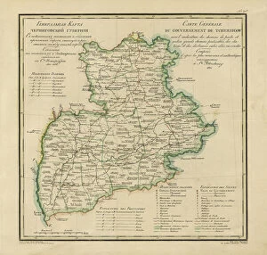
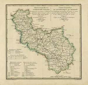
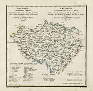
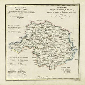
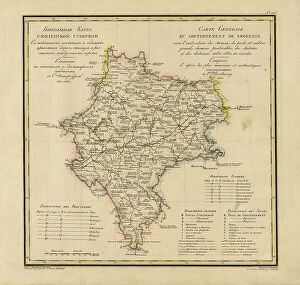
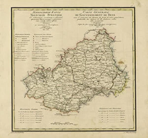
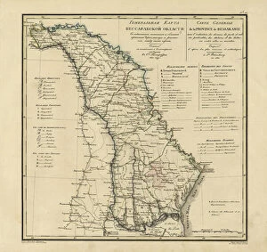
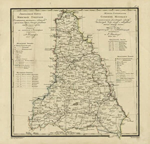
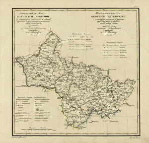
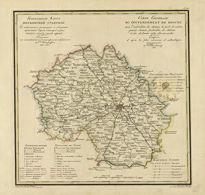
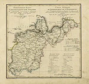
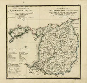
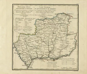
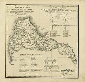
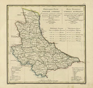
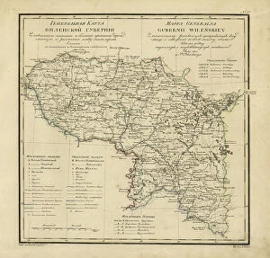
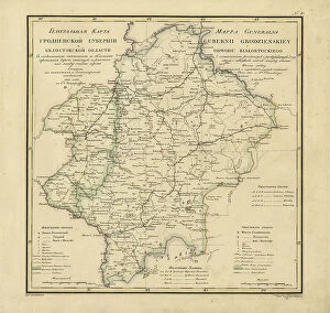
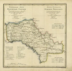
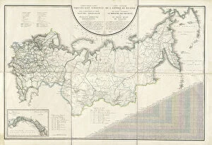
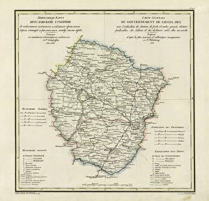
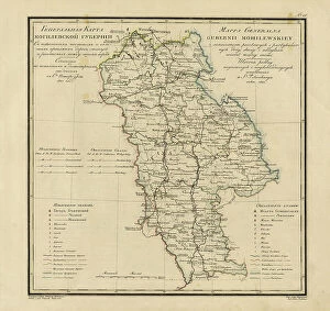
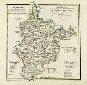
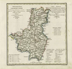
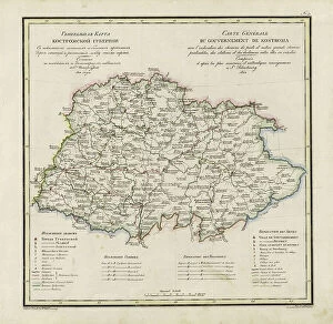
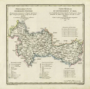
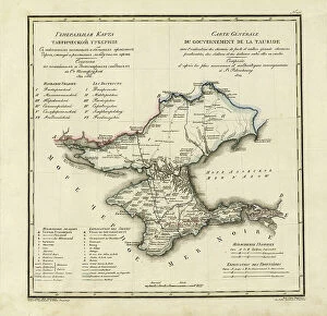
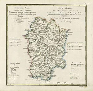
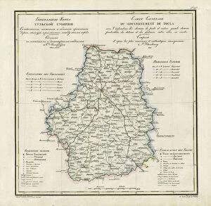
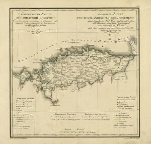
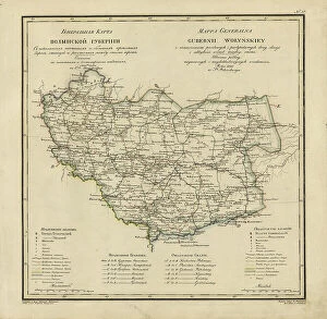
Vasilii Petrovich Piadyshev: Pioneering Cartographer of 19th-Century Russia (1820-1822) Discover the remarkable work of Russian cartographer Vasilii Petrovich Piadyshev, whose detailed and comprehensive maps of various Russian provinces significantly contributed to the development of Russia's transportation infrastructure. Between 1820 and 1822, Piadyshev and his collaborators Faleleef, Iwanoff, and Ieremin produced a series of 'General Maps' showcasing postal and major roads, stations, and distances in provinces such as Kaluga, Poltava, Pskov, Ekaterinoslav, Chernigov, Kharkiv, Vladimir, Kursk, Moscow, Tver, Novgorod, and Bessarabia. These maps, which include the provinces of Moscow, Tver, and Novgorod created with Faleleef, and the rest with Iwanoff and Ieremin, were instrumental in improving communication and commerce across Russia. Piadyshev's meticulous work paved the way for more accurate and detailed maps, enhancing the understanding of Russia's vast territories and facilitating the growth of the Russian Empire.