
Pink Winds Collection
"Unveiling the Mysteries of Pink Winds: Tracing Ancient Maps and Manuscripts" Step into a world where ancient manuscripts and maps come alive


For sale as Licensed Images
Choose your image, Select your licence and Download the media
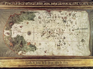
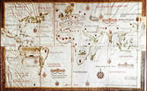
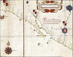
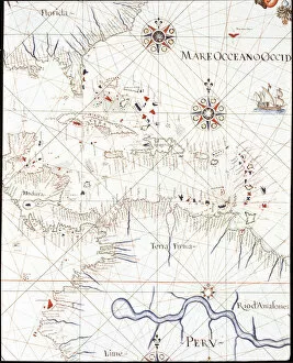
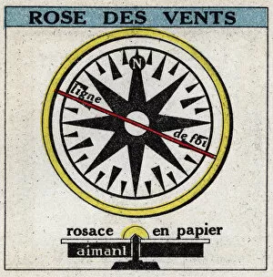
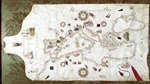
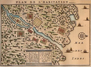
"Unveiling the Mysteries of Pink Winds: Tracing Ancient Maps and Manuscripts" Step into a world where ancient manuscripts and maps come alive, revealing the secrets of pink winds. In a 16th-century planisphere, climatic zones are meticulously depicted, showcasing the diverse nature of our planet's weather patterns. As we delve deeper into history, a detailed portulan of Castellini transports us to California's coast, where a majestic galleon sails gracefully through the cerulean waters. Journeying further across time and space, another portulan presents us with an intricate map of the Mediterranean Sea and its enchanting coastline. The delicate rose des vents adorning "Le theatre du monde ou Nouvel atlas" captivates our imagination as it guides explorers through uncharted territories. A glimpse at a 1571 map unveils Mexico's western coast and Southern California in all their splendor. The West Indies beckon us with their allure - from Florida to Honduras, Cuba to Peru - these tropical paradises have long fascinated adventurers seeking new horizons. But what exactly are these pink winds? An anonymous illustration from 1925 reveals that Earth's magnetism holds the key. A wind rose emerges before our eyes, illustrating how magnetic forces shape atmospheric currents that sweep across continents. Returning to the Mediterranean Sea on a mesmerizing portolan from 1563, we witness sailors relying on wind roses for navigation amidst treacherous waters. Francois Leguat takes us even further on his map depicting Rodrigues Island – Le plan de l'île – where settlers sought solace in this remote paradise. Finally, at the heart of it all lies an extraordinary wind rose positioned in the middle of the Western Hemisphere. Its thirty-two points symbolize not only cardinal directions but also untold stories waiting to be discovered by intrepid souls like ours.