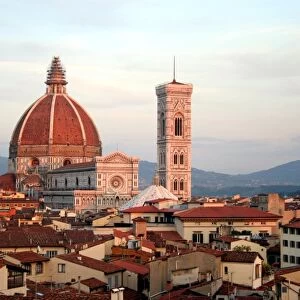
Home > Europe > Italy > Tuscany > Florence
Planisphere showing the different climatic zones (manuscript, 16th century)
")
![]()
Wall Art and Photo Gifts from Fine Art Finder
Planisphere showing the different climatic zones (manuscript, 16th century)
LRI4649065 Planisphere showing the different climatic zones (manuscript, 16th century) by Homen, Lopo (16th century); Istituto e Museo di Storia della Scienza, Florence, Italy; (add.info.: Planisphere by Portuguese cartographer Lopo Homem (16th century): it shows the different climatic zones, Argentina is represented for the first time - Florence Istituto e Museo di Storia della Scienza); Luisa Ricciarini
Media ID 25154042
© Luisa Ricciarini / Bridgeman Images
Argentine Argentinian Geographical Map Latinamerica Pink Winds Planisphere Southamerica America Continent Americhe Latine America
FEATURES IN THESE COLLECTIONS
> Europe
> Italy
> Tuscany
> Florence
> Europe
> Portugal
> Related Images
> Fine Art Finder
> Artists
> Simeon Fort
> Maps and Charts
> Early Maps
> Maps and Charts
> Italy
EDITORS COMMENTS
This 16th-century manuscript print, titled "Planisphere showing the different climatic zones" takes us back in time to explore the world as it was perceived during this era. Created by Portuguese cartographer Lopo Homem, this planisphere offers a unique glimpse into the geographical understanding of that period. The map showcases various climatic zones across the globe, providing valuable insights into how people conceptualized and categorized different regions based on their climate. Notably, this particular edition marks Argentina's first representation on a map, making it an important historical artifact. Displayed at the Istituto e Museo di Storia della Scienza in Florence, Italy, this piece is a testament to both scientific exploration and artistic craftsmanship. The intricate details and delicate colors bring life to each corner of the map while highlighting South America's significance within Latin America. As we gaze upon this remarkable artwork by Luisa Ricciarini, we are transported back to a time when cartography was still evolving. It serves as a reminder of humanity's continuous quest for knowledge about our planet and its diverse climates.
MADE IN THE USA
Safe Shipping with 30 Day Money Back Guarantee
FREE PERSONALISATION*
We are proud to offer a range of customisation features including Personalised Captions, Color Filters and Picture Zoom Tools
SECURE PAYMENTS
We happily accept a wide range of payment options so you can pay for the things you need in the way that is most convenient for you
* Options may vary by product and licensing agreement. Zoomed Pictures can be adjusted in the Cart.