Strata Collection (#4)

"Unveiling Earth's Layers: Exploring the Marvels of Strata" Discovering the Blueprint

Background imageStrata Collection: Section of a part of the cone of the Mountain of Somma, 1776

Section of a part of the cone of the Mountain of Somma, 1776
Section of a part of the cone of the Mountain of Somma, Plate XV, from Campi Phlegraei: Observations on the Volcanoes of the Two Sicilies, by Sir William Hamilton (1730-1803)

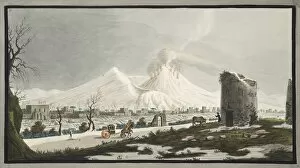
Background imageStrata Collection: Cone of Venus covered with snow, 1776

Cone of Venus covered with snow, 1776
Cone of Venus covered with snow, Plate V, from Campi Phlegraei: Observations on the Volcanoes of the Two Sicilies, by Sir William Hamilton (1730-1803), published 1776 (hand coloured engraving). 1

Background imageStrata Collection: Temple of Serapis at Puzzuoli in 1183, Charles Lyell (1853). Artist: Charles Lyell

Temple of Serapis at Puzzuoli in 1183, Charles Lyell (1853). Artist: Charles Lyell
Temple of Serapis at Puzzuoli in 1183, Charles Lyell (1853). Frontispiece of the ninth edition of Principles of Geology, Charles Lyell, London, 1853, showing how it had slowly subsided

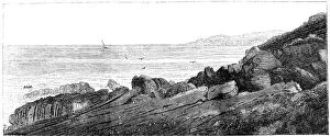
Background imageStrata Collection: Strata of red sandstone, slightly inclined, Siccar Point, Berwickshire 1852. Artist: Charles Lyell

Strata of red sandstone, slightly inclined, Siccar Point, Berwickshire 1852. Artist: Charles Lyell
Strata of red sandstone, slightly inclined, Siccar Point, Berwickshire 1852. It is illustrating nonconformable strata, and so long time scale

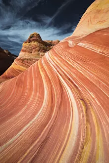
Background imageStrata Collection: The Wave, Coyote Buttes, Paria-Vermilion Cliffs Wilderness, Arizona

The Wave, Coyote Buttes, Paria-Vermilion Cliffs Wilderness, Arizona

Background imageStrata Collection: USA, Arizona, Grand Canyon. The Grand Canyon, a UNESCO World Heritage Site, view

USA, Arizona, Grand Canyon. The Grand Canyon, a UNESCO World Heritage Site, view from the south rim

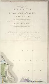
Background imageStrata Collection: William Smiths Geological Map

William Smiths Geological Map. Fig. 9 from Delineation of Strata of England and Wales (1815) by William Smith

Background imageStrata Collection: First geological map of Britain, 1815 C016 / 5681

First geological map of Britain, 1815 C016 / 5681
First geological map of Britain, detail of the South East of England (figure 6). This map was published in 1815 by British geologist William Smith (1769-1839)

Background imageStrata Collection: First geological map of Britain, 1815 C016 / 5680

First geological map of Britain, 1815 C016 / 5680
First geological map of Britain showing a detail of the north west coast. This map was published in 1815 by British geologist William Smith (1769-1839)

Background imageStrata Collection: ERS25516WT75

ERS25516WT75
The lighthouse at Langness on the Isle Of Man

Background imageStrata Collection: NA

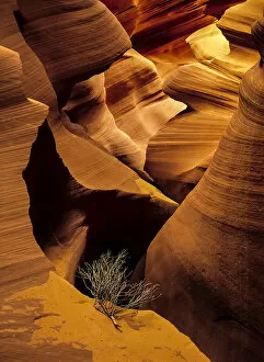
NA
Eroded sandstone and a tumbleweed branch in a slot canyon

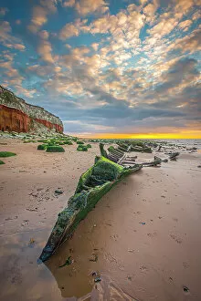
Background imageStrata Collection: BAL03920052

BAL03920052
The wreck of the Sheraton on Hunstanton beach

Background imageStrata Collection: BAL01221003

BAL01221003
Hunstanton beach at sunset

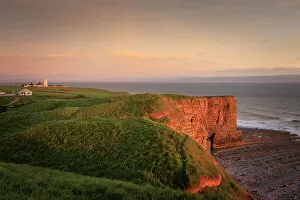
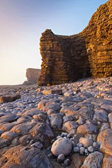
Background imageStrata Collection: CWN08821415

CWN08821415
Nash Point Lighthouse near St Donats at sunset

Background imageStrata Collection: JBO12913WT04

JBO12913WT04
The Mittens of Monument Valley with a dead tree

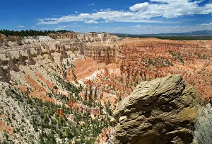
Background imageStrata Collection: JBO12913WT01

JBO12913WT01
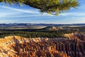
A view of Bryce Canyon from Inspiration Point

Background imageStrata Collection: CWN08821093

CWN08821093
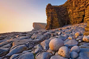
Cliffs at Nash Point

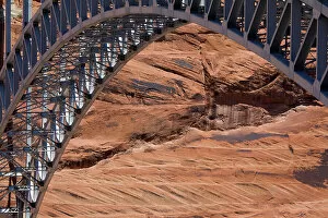
Background imageStrata Collection: JBO8513WT57

JBO8513WT57
A bridge across Glen Canyon

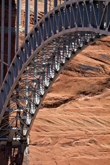
Background imageStrata Collection: JBO8513WT56

JBO8513WT56
A bridge across Glen Canyon

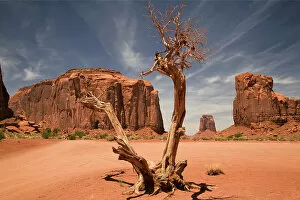
Background imageStrata Collection: JBO8513WT48

JBO8513WT48
A blasted tree in the North Window of Monument Valley

Background imageStrata Collection: JBO8513WT43

JBO8513WT43
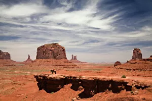
A lone ranger stands before the buttes of Monument Valley

Background imageStrata Collection: CWN08821119

CWN08821119
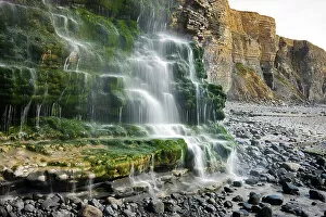
Cliff Waterfall on Dunraven Bay

Background imageStrata Collection: CWN08821094

CWN08821094
Cliffs at Nash Point

Background imageStrata Collection: Blue water, Colorado River, Grand Canyon National Park, Arizona

Blue water, Colorado River, Grand Canyon National Park, Arizona

Background imageStrata Collection: Hikers and rainbow Kaibab Trail, Grand Canyon National Park

Hikers and rainbow Kaibab Trail, Grand Canyon National Park

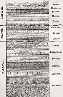
Background imageStrata Collection: A chart of strata, layers of sedimentary rock or soil. From The Worlds Foundations or Geology for

A chart of strata, layers of sedimentary rock or soil. From The Worlds Foundations or Geology for Beginners, published 1883

Background imageStrata Collection: Storm clouds and desert landscape in Sedona, Arizona, USA

Storm clouds and desert landscape in Sedona, Arizona, USA
Gathering storm clouds and dramatic light on red rock mountains with forest in foreground in Sedona; Sedona, Arizona, United States of America

Background imageStrata Collection: Sandstone Butte in Sedona, Arizona, USA

Sandstone Butte in Sedona, Arizona, USA
View of towering sandstone butte; Sedona, Arizona, United States of America

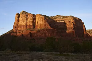
Background imageStrata Collection: Sunset on Courthouse Butte, Sedona, Arizona, USA

Sunset on Courthouse Butte, Sedona, Arizona, USA
Sunset on Courthouse Butte; Sedona, Arizona, United States of America

Background imageStrata Collection: Colorado River, Marble Canyon, Grand Canyon National Park, Arizona

Colorado River, Marble Canyon, Grand Canyon National Park, Arizona

Background imageStrata Collection: Wedge Mountain, Valley of Ten Thousand Smokes, Katmai National Park and Preserve, Alaska, USA

Wedge Mountain, Valley of Ten Thousand Smokes, Katmai National Park and Preserve, Alaska, USA
Wedge Mountain rises above one of the Knife Creek Glaciers (covered in ash at the base of the mountain) and the Valley of Ten Thousand Smokes in Katmai National Park and Preserve; Alaska

Background imageStrata Collection: Sunset On Devils Tower; Wyoming, United States of America

Sunset On Devils Tower; Wyoming, United States of America

Background imageStrata Collection: Volcanic scenery at Ardtun, Mull, Scotland

Volcanic scenery at Ardtun, Mull, Scotland
The view from Ardtun to The Burg, Mull, Scotland. This shows the horizontal volcanic strata in the distance

Background imageStrata Collection: Light falling on the rocks on Berwick beach, Northumberland, England

Light falling on the rocks on Berwick beach, Northumberland, England

Background imageStrata Collection: USA, Oregon. Landscape of the Painted Hills Unit, John Day Fossil Beds National Monument

USA, Oregon. Landscape of the Painted Hills Unit, John Day Fossil Beds National Monument. Credit as: Jean Carter / Jaynes Gallery / DanitaDelimont

Background imageStrata Collection: Dragon Rock - Port Soderick - Isle of Man

Dragon Rock - Port Soderick - Isle of Man. Date: circa 1910s

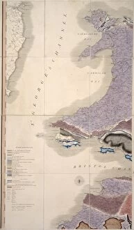
Background imageStrata Collection: First geological map of Britain, 1815 C016 / 5682

First geological map of Britain, 1815 C016 / 5682
First geological map of Britain, detail of the Welsh coast (figure 7). This map was published in 1815 by British geologist William Smith (1769-1839)

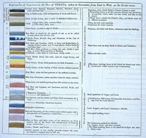
Background imageStrata Collection: William Smiths geological table

William Smiths geological table
Fig 2 from Delineation of Strata of England and Wales (1815) by William Smith

Background imageStrata Collection: USA, Utah, Grand Staircase-Escalante National Monument, Kanab, Paria

USA, Utah, Grand Staircase-Escalante National Monument, Kanab, Paria

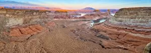
Background imageStrata Collection: USA, Utah, Glen Canyon National Recreation Area, Lake Powell, Gunsight Bay at dusk

USA, Utah, Glen Canyon National Recreation Area, Lake Powell, Gunsight Bay at dusk from Romana Mesa

Background imageStrata Collection: USA, Utah, Bryce Canyon National Park

USA, Utah, Bryce Canyon National Park. Haunting and colourful rock pinnacles known as Hoodoos at Inspiration Point

Background imageStrata Collection: USA, Utah, Capitol Reef National Park

USA, Utah, Capitol Reef National Park. Cathedral Valley sunrise at the Temple of the Sun and smaller Temple of the Moon

Background imageStrata Collection: USA Utah Capitol Reef National Park Cathedral

USA Utah Capitol Reef National Park Cathedral Valley

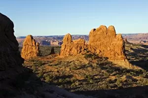
Background imageStrata Collection: USA, Utah, Arches National Park

USA, Utah, Arches National Park, pinnacles and spires of the Windows Section

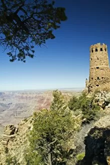
Background imageStrata Collection: USA, Arizona, Grand Canyon, South Rim

USA, Arizona, Grand Canyon, South Rim. Watch Tower

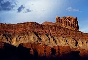
Background imageStrata Collection: Tall cliffs

Tall cliffs, layered in different coloured clays and stone, typify the landscape of Capitol Reef

Background imageStrata Collection: Fossil of a crinoid lily

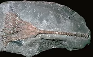
Fossil of a crinoid lily
Fossil of the crinoid lily Periechinocrinus, from the Silurian strata in England

Background imageStrata Collection: Cross-section of the Brocken, Harz Mountains, Germany, showing geological strata, 1823

Cross-section of the Brocken, Harz Mountains, Germany, showing geological strata, 1823. From Nature Displayed by Simeon Shaw. (London, 1823)


For sale as Licensed Images

Choose your image, Select your licence and Download the media

"Unveiling Earth's Layers: Exploring the Marvels of Strata" Discovering the Blueprint: William Smith Geological Map takes us back to the roots of understanding our planet's strata formations. Time Travel through Rocks: Delving into the 19th-century Geological Strata reveals a fascinating glimpse into Earth's ancient history. England Unearthed: The 1838 Geological Map by Mantell showcases the diverse geological wonders scattered across England, from The Wash to Hunstanton Cliffs. Nature's Artistry in Arizona: Behold The Wave, an awe-inspiring masterpiece carved naturally in vibrant red and yellow Navajo sandstone at Vermilion Cliffs National Monument. A Tale of Continuity and Change: Witness a captivating geological unconformity on the river Jed, where time seems to pause and layers intertwine mysteriously. Pioneering Geology: Step back in time with Britain's first-ever geological map from 1815, offering insights into the nation's rich geological heritage. Oxfordshire Revealed: Explore every nook and cranny as you navigate through the intricate details of the Geological Map of Oxfordshire, uncovering hidden stories beneath our feet. Peering Into Earth’s Depths: Embark on a visual journey through time with Mantell’s detailed 1838 Geological Strata Section, unraveling eons-old secrets layer by layer. Buckland’s Cross-Section Chronicles: Immerse yourself in Buckland’s geology cross-section from 1836, revealing nature’s complex tapestry etched deep within our planet's core. Sunset Serenade at Honeycomb Rock: Bask in nature’s symphony as Elgol’s Honeycomb Rock bids farewell to another day amidst Skye Island's breathtaking Inner Hebrides landscape. Majestic White Guardians - Seven Sisters Chalk Cliffs.