Topographic Collection (#3)

"Exploring the World's Topography: From Scotland to Mars and Beyond" Discover the stunning topographic features of Scotland

Background imageTopographic Collection: Chugoku, Japan, satellite image

Chugoku, Japan, satellite image
Chugoku, Japan. North is at top. Natural colour satellite image showing the Chugoku region of Japan, with the surrounding regions shaded out. Japan is an island nation in East Asia

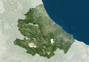
Background imageTopographic Collection: Abruzzo, Italy, satellite image

Abruzzo, Italy, satellite image
Abruzzo, Italy. North is at top. Natural colour satellite image showing the region of Abruzzo, in Italy, with the surrounding Italian regions shaded out

Background imageTopographic Collection: Uttarakhand, India, satellite image

Uttarakhand, India, satellite image
Uttarakhand, India. North is at top. Natural colour satellite image showing the state of Uttarakhand, India, with the surrounding states shaded out. India is located in South Asia

Background imageTopographic Collection: Tamil Nadu, India, satellite image

Tamil Nadu, India, satellite image
Tamil Nadu, India. North is at top. Natural colour satellite image showing the state of Tamil Nadu, India, with the surrounding states shaded out. India is located in South Asia

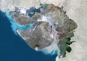
Background imageTopographic Collection: Gujarat, India, satellite image

Gujarat, India, satellite image
Gujarat, India. North is at top. Natural colour satellite image showing the state of Gujarat, India, with the surrounding states shaded out. India is located in South Asia

Background imageTopographic Collection: Delhi, India, satellite image

Delhi, India, satellite image
Delhi, India. North is at top. Natural colour satellite image showing the National Capital Territory of Delhi, India, with the surrounding states shaded out. India is located in South Asia

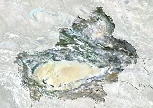
Background imageTopographic Collection: Xinjiang, China, satellite image

Xinjiang, China, satellite image
Xinjiang, China. North is at top. Natural colour satellite image showing the Xinjiang region of China, with the surrounding Chinese provinces and regions shaded out

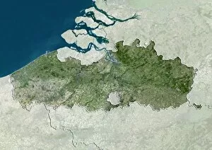
Background imageTopographic Collection: Flanders, Belgium, satellite image

Flanders, Belgium, satellite image
Flanders, Belgium. North is at top. Natural colour satellite image showing the Flemish region of Belgium, with the surrounding regions shaded out

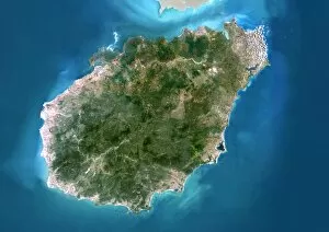
Background imageTopographic Collection: Hainan, China, satellite image

Hainan, China, satellite image
Hainan, China. North is at top. Natural colour satellite image showing Hainan Island off the coast of China (top). Hainan is located in the South China Sea (blue)

Background imageTopographic Collection: Nunavut, Canada, satellite image

Nunavut, Canada, satellite image. North is at top. Natural colour satellite image showing the Canadian province of Nunavut

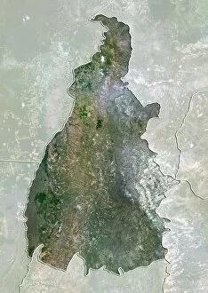
Background imageTopographic Collection: Tocantins, Brazil, satellite image

Tocantins, Brazil, satellite image
Amazonas, Brazil. North is at top. Natural colour satellite image showing the state of Tocantins in Brazil, with the surrounding states shaded out

Background imageTopographic Collection: Alberta, Canada, satellite image

Alberta, Canada, satellite image
Alberta, Canada. North is at top. Natural colour satellite image showing the Canadian province of Alberta with the surrounding provinces and territories shaded out

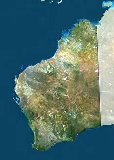
Background imageTopographic Collection: Western Australia

Western Australia. True colour satellite image showing the state of Western Australia, with the surrounding states and territories shaded out, the Great Australian Bight (blue, bottom right)

Background imageTopographic Collection: Victoria, Australia

Victoria, Australia. True colour satellite image showing the state of Victoria, Australia, with the surrounding states and territories shaded out, and the Great Australian Bight (blue) at bottom

Background imageTopographic Collection: South Australia

South Australia. True colour satellite image showing the state of South Australia, with the surrounding states and territories shaded out, and the Great Australian Bight (blue) at bottom

Background imageTopographic Collection: Northern Territory, Australia

Northern Territory, Australia. Natural colour satellite image showing Australias Northern Territory, with the surrounding states and territories shaded out

Background imageTopographic Collection: Queensland, Australia

Queensland, Australia. True colour satellite image showing the state of Queensland, Australia, with the surrounding states and territories shaded out, and the island of New Guinea at top

Background imageTopographic Collection: New South Wales, Australia

New South Wales, Australia. True colour satellite image showing the state of New South Wales, Australia, with the surrounding states and territories shaded out

Background imageTopographic Collection: West Africa, satellite image

West Africa, satellite image
West Africa. Satellite image centre over West Africa, with Spain and Portugal on the Iberian Peninsula at upper right

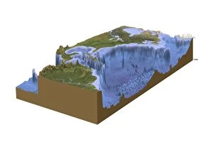
Background imageTopographic Collection: North-western Atlantic, oceanography data C016 / 3739

North-western Atlantic, oceanography data C016 / 3739
North-western Atlantic, oceanography data. Cutaway block diagram of the north-western Atlantic Ocean, showing in exaggerated form the height of land terrain and the depth of the seabed

Background imageTopographic Collection: North-western Atlantic, bathymetry model C016 / 3738

North-western Atlantic, bathymetry model C016 / 3738
North-western Atlantic, bathymetry model. Cutaway block diagram of the north-western Atlantic Ocean, showing in exaggerated form the height of land terrain and the depth of the seabed

Background imageTopographic Collection: Atlantic Ocean, cloud-free C016 / 3728

Atlantic Ocean, cloud-free C016 / 3728
Atlantic Ocean, cloud-free. Computer graphic of the Atlantic Ocean on an Earth globe, generated using satellite and mapping data

Background imageTopographic Collection: The Americas, sea floor topography C016 / 3726

The Americas, sea floor topography C016 / 3726
The Americas, sea floor topography. Computer graphic of an Earth globe centred on the Americas, generated using satellite and mapping data

Background imageTopographic Collection: Atlantic Ocean, sea floor topography C016 / 3725

Atlantic Ocean, sea floor topography C016 / 3725
Atlantic Ocean, sea floor topography. Computer graphic of an Earth globe centred on the Atlantic Ocean, generated using satellite and mapping data

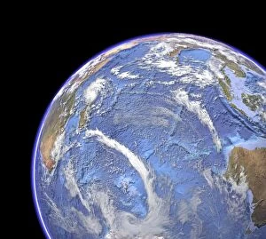
Background imageTopographic Collection: Indian Ocean, sea floor topography C016 / 3723

Indian Ocean, sea floor topography C016 / 3723
Indian Ocean, sea floor topography and clouds. Computer graphic of the Indian Ocean on an Earth globe, generated using satellite and mapping data
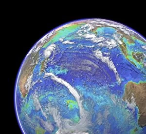
Background imageTopographic Collection: Indian Ocean, chlorophyll and bathymetry C016 / 3721

Indian Ocean, chlorophyll and bathymetry C016 / 3721
Indian Ocean, chlorophyll concentration and bathymetry with clouds. Computer graphic of the Indian Ocean on an Earth globe, generated using satellite and mapping data
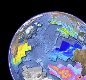
Background imageTopographic Collection: Indian Ocean, satellite imaging data C016 / 3718

Indian Ocean, satellite imaging data C016 / 3718
Indian Ocean, satellite imaging data. Computer graphic of the Indian Ocean on an Earth globe, showing the various parameters that can be measured by satellite instruments

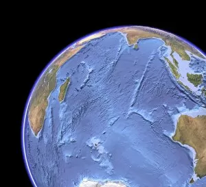
Background imageTopographic Collection: Indian Ocean, sea floor topography C016 / 3715

Indian Ocean, sea floor topography C016 / 3715
Indian Ocean, sea floor topography. Computer graphic of the Indian Ocean on an Earth globe, generated using satellite and mapping data

Background imageTopographic Collection: Mexico State, Mexico, satellite image

Mexico State, Mexico, satellite image
Mexico City, satellite image. North is at top. Natural colour satellite image showing the state of Mexico City, Mexico, with the surrounding Mexican states shaded out

Background imageTopographic Collection: Mexico State, Mexico, satellite image C014 / 0071

Mexico State, Mexico, satellite image C014 / 0071
Mexico City, satellite image. North is at top. Natural colour satellite image showing the state of Mexico City, Mexico, with the surrounding Mexican states shaded out

Background imageTopographic Collection: Chihuahua, Mexico, satellite image

Chihuahua, Mexico, satellite image
Chihuahua, satellite image. North is at top. Natural colour satellite image showing the state of Chihuahua, Mexico, with the surrounding Mexican states shaded out

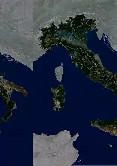
Background imageTopographic Collection: Italy, satellite image C014 / 0065

Italy, satellite image C014 / 0065
Italy, satellite image. North is at top. Natural colour satellite image showing Italy divided into its 20 regions. Italy is located in south-central Europe and is bordered by France (upper left)

Background imageTopographic Collection: Lower Saxony, Germany, satellite image

Lower Saxony, Germany, satellite image
Lower Saxony, satellite image. North is at top. Natural colour satellite image showing the state of Lower Saxony, Germany, with the surrounding German states shaded out

Background imageTopographic Collection: Madhya Pradesh, India, satellite image

Madhya Pradesh, India, satellite image
Madhya Pradesh, satellite image. North is at top. Natural colour satellite image showing the state of Madhya Pradesh, India, with the surrounding Indian states shaded out

Background imageTopographic Collection: Tibet, China, satellite image

Tibet, China, satellite image
Tibet, satellite image. North is at top. Natural colour satellite image showing the Tibet Autonomous Region (Tibet), with the surrounding Chinese provinces and regions shaded out

Background imageTopographic Collection: Quebec, Canada, satellite image

Quebec, Canada, satellite image
Quebec, satellite image. North is at top. Natural colour satellite image showing the predominantly French-speaking Canadian province of Quebec

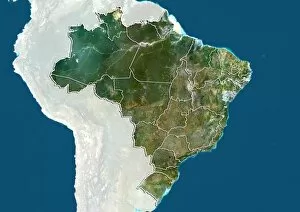
Background imageTopographic Collection: Amazonas, Brazil, satellite image

Amazonas, Brazil, satellite image
Amazonas, satellite image. North is at top. Natural colour satellite image showing the state of Amazonas in Brazil, with the surrounding states shaded out

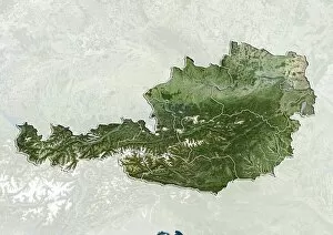
Background imageTopographic Collection: Upper Austria, Austria, satellite image

Upper Austria, Austria, satellite image
Upper Austria, satellite image. Natural colour satellite image showing the state (Bundeslander) of Upper Austria in Austria, with the surrounding states: Lower Austria, Styria, and Salzburg

Background imageTopographic Collection: Buenos Aires, Argentina, satellite image

Buenos Aires, Argentina, satellite image
Buenos Aires, satellite image. North is at top. Natural colour satellite image showing Buenos Aires in Argentina, with the countrys other provinces shaded out

Background imageTopographic Collection: Topographic view of the city of Reading Pa. 1881

Topographic view of the city of Reading Pa. 1881. Date c1881 Nov. 17

Background imageTopographic Collection: Argyre crater, Mars, computer artwork

Argyre crater, Mars, computer artwork
Argyre crater. Computer artwork of the surface of Mars, showing the Argyre impact basin (large area, centre) and the Galle crater, which lies on its eastern rim at upper right

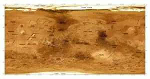
Background imageTopographic Collection: Mars topographical map, satellite image

Mars topographical map, satellite image
Mars topographical map. Three-dimensional composite satellite image of the surface of Mars. Topographical features are labelled in black. North is at top

Background imageTopographic Collection: Frozen Mars, satellite image

Frozen Mars, satellite image

Background imageTopographic Collection: Cerberus Fossae, Mars, satellite image

Cerberus Fossae, Mars, satellite image

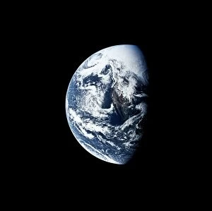
Background imageTopographic Collection: Mexico from space

Mexico from space
Apollo 13 photograph of northwest US and Mexico

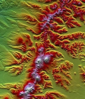
Background imageTopographic Collection: Sredinnyy Khrebet volcanoes, radar image

Sredinnyy Khrebet volcanoes, radar image
Sredinnyy Khrebet volcanoes. Coloured three- dimensional computer map of the Sredinnyy Khrebet volcanoes in Kamchatka Peninsula, Russia. North is at top

Background imageTopographic Collection: Historical Chinese map

Historical Chinese map. Pen and ink watercolour map of Xin xi ying yu tu, showing the fortress and existing military deployment of Xin xi ying in Xinping County, Yunnan, China

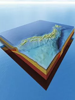
Background imageTopographic Collection: Japans plate tectonics and cyclones

Japans plate tectonics and cyclones. Computer artwork showing cyclones (white spirals) travelling over the islands of Japan and the countrys underlying tectonic plates


For sale as Licensed Images

Choose your image, Select your licence and Download the media

"Exploring the World's Topography: From Scotland to Mars and Beyond" Discover the stunning topographic features of Scotland, UK through a mesmerizing satellite image that unveils its rugged landscapes and breathtaking beauty. Embark on an extraordinary journey across Earth with a detailed topographic and bathymetric map, revealing both landforms and underwater terrain in unparalleled detail. Unleash your curiosity as you delve into the mysteries of Mars, where composite satellite images showcase its intriguing topography, offering glimpses into an alien world. Dive into Australia's diverse terrain with a comprehensive topographic map that unravels its vast deserts, lush rainforests, and iconic landmarks from coast to coast. Immerse yourself in Africa's rich tapestry of geographical wonders through a captivating topographic map that showcases its majestic mountains, expansive savannas, and winding rivers. Take a step back in time with a vintage lithograph city map of Aachen, Germany published in 1897 - witness how urban landscapes have evolved over centuries while preserving their unique charm. Marvel at the intricate patterns etched across the Middle East as captured by an awe-inspiring satellite image; explore ancient cities juxtaposed against arid deserts or fertile valleys. Return to Earth once again to uncover hidden depths beneath our oceans using an all-encompassing topographic and bathymetric map - witness the secrets held within our planet's watery realms. Venture beyond our own celestial home as you navigate through Mars' enigmatic landscape via a detailed topographical map derived from cutting-edge satellite imagery - unlocking new frontiers for exploration. Travel back in time yet again with a lithograph published in 1897 depicting the magnificent European Alps - trace mountaineering routes taken by pioneers who dared conquer these towering peaks.