mail_outline sales@mediastorehouse.com
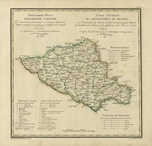
General Map of Poltava Province: Showing Postal and Major Roads, Stations and... 1821General Map of Poltava Province: Showing Postal and Major Roads, Stations and the Distance in Versts between Them, 1821. This 1821 map of Poltava Provinceis from a larger work
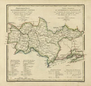
General Map of Ekaterinoslav Province: Showing Postal and Major Roads, Stations and the... 1821General Map of Ekaterinoslav Province: Showing Postal and Major Roads, Stations and the Distance in Versts between Them, 1821
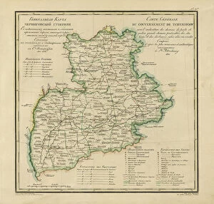
General Map of Chernigov Province: Showing Postal and Major Roads, Stations and... 1821General Map of Chernigov Province: Showing Postal and Major Roads, Stations and the Distance in Versts between Them, 1821
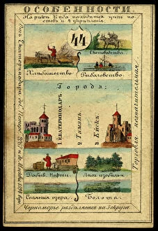
Land of the Black Sea Cossacks, 1856. Creator: UnknownLand of the Black Sea Cossacks, 1856. This card is one of a souvenir set of 82 illustrated cards-one for each province of the Russian Empire as it existed in 1856
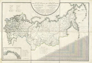
General Map of the Russian Empire and the Neighboring Polish.. 1827. Creators: Vasilii Petrovich Piadyshev, IereminGeneral Map of the Russian Empire and the Neighboring Polish Empire and Grand Duchy of Finland: With the Distance in Versts on Postal Roads between Provincial Cities;
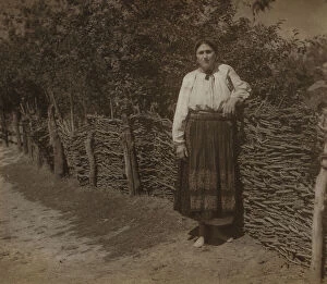
In Little Russia [i.e. Ukraine], between 1905 and 1915. Creator: Sergey Mikhaylovich Prokudin-GorskyIn Little Russia [i.e. Ukraine], between 1905 and 1915. In album: Various views and studies, Russian Empire and Europe
Choose your image, Select your licence and Download the media