
Willem Blaeu Collection

Willem Blaeu: A Master Cartographer of the 17th Century Willem Blaeu, a renowned Dutch cartographer

Background imageWillem Blaeu Collection: Map of Sicily, by Willem Blaeu, from Regionum Italiae, engraving

Map of Sicily, by Willem Blaeu, from Regionum Italiae, engraving
Cartography, Italy, 17th century. Map of Sicily. From Regionum Italiae, by Willem Blaeu. Engraving

Background imageWillem Blaeu Collection: Map of the surroundings of Zandvliet, 1642. Creator: Willem Blaeu

Map of the surroundings of Zandvliet, 1642. Creator: Willem Blaeu
Map of the surroundings of Zandvliet, 1642. The north on the left, the borders coloured, cities, buildings and flags indicated. At the top left Explanation of the symbols on the map

Background imageWillem Blaeu Collection: Map of Brabant, 1631. Creator: Willem Blaeu

Map of Brabant, 1631. Creator: Willem Blaeu
Map of Brabant, 1631. Map of the Duchy of Brabant. At the bottom right the scale in German miles. Bottom left the title between sphinxes, above it the coat of arms and woman with staff

Background imageWillem Blaeu Collection: Map of the Strait of Magellan, 1635-1664. Creator: Willem Blaeu

Map of the Strait of Magellan, 1635-1664. Creator: Willem Blaeu
Map of the Strait of Magellan, 1635-1664. At the top right a coat of arms

Background imageWillem Blaeu Collection: Map of Brabant, 1635. Creator: Michael van Langren

Map of Brabant, 1635. Creator: Michael van Langren
Map of Brabant, 1635. Prima pars Brabantiae cuius caput Lovanivm'. Top right: a coat of arms; bottom right: title in a cartouche with King David playing the harp

Background imageWillem Blaeu Collection: Map of the area between Bergen op Zoom and Steenbergen, 1630. Creator: Franciscus van Schooten

Map of the area between Bergen op Zoom and Steenbergen, 1630. Creator: Franciscus van Schooten
Map of the area between Bergen op Zoom and Steenbergen, 1630. Tabula Bergarum ad Zomam Stenbergae'. Showing fortresses, trees, hills, harbours, areas susceptible to flooding

Background imageWillem Blaeu Collection: Map of Groningen, Netherlands, 17th century

Map of Groningen, Netherlands, 17th century. A map of the Dutch province of Groningen, published by Willem Blaeu after the original design by Barthold Wicheringe

Background imageWillem Blaeu Collection: The Rhinoceros, after 1620. Creator: Albrecht Durer

The Rhinoceros, after 1620. Creator: Albrecht Durer
The Rhinoceros, after 1620

Background imageWillem Blaeu Collection: Map of the Moscow Kremlin (Castellum Urbis Moskvae), Russia, 1597. Artist: Willem Blaeu

Map of the Moscow Kremlin (Castellum Urbis Moskvae), Russia, 1597. Artist: Willem Blaeu
Map of the Moscow Kremlin (Castellum Urbis Moskvae), Russia, 1597. Found in the collection the State Museum of History, Moscow

Background imageWillem Blaeu Collection: World Map 17th Century 1634 1635 Willem Blaeu

World Map 17th Century 1634 1635 Willem Blaeu
World map dating from 1634/1635 by Willem Blaeu. Nova totius terrarum orbis geographica ac hydrographica tabula. Along the bottom of the map are illustrations of the seven wonders of the ancient world

Background imageWillem Blaeu Collection: Rio de ll Plate, Silver River and the Parana Basin in Paraguay, from Willem Blaeus Atlas, 1658

Rio de ll Plate, Silver River and the Parana Basin in Paraguay, from Willem Blaeus Atlas, 1658
Cartography, Paraguay, 17th century. Rio de ll Plate ( Silver River) and the ParanA

Background imageWillem Blaeu Collection: Map of Venetian domain, from Regionum Italiae by Willem Blaeu, engraving

Map of Venetian domain, from Regionum Italiae by Willem Blaeu, engraving
Cartography, Italy, 17th century. Venetian domain. From Regionum Italiae by Willem Blaeu. Engraving

Background imageWillem Blaeu Collection: Map of The confines of Siena from Regionum Italiae by Willem Blaeu, engraving

Map of The confines of Siena from Regionum Italiae by Willem Blaeu, engraving
Cartography, Italy, 17th century. The confines of Siena. From Regionum Italiae by Willem Blaeu. Engraving

Background imageWillem Blaeu Collection: Map of The Dukedom of Parma, engraving from Regionum Italiae by Willem Blaeu, printed in Italy

Map of The Dukedom of Parma, engraving from Regionum Italiae by Willem Blaeu, printed in Italy, 17th Century
Cartography, Italy, 17th century. The Dukedom of Parma. From Regionum Italiae by Willem Blaeu. Engraving

Background imageWillem Blaeu Collection: State of Lucca, Italy, from Regionum Italiae by Willem Blaeu

State of Lucca, Italy, from Regionum Italiae by Willem Blaeu
Cartography, Italy, 17th century. The state of Lucca. From Regionum Italiae by Willem Blaeu

Background imageWillem Blaeu Collection: Map of Duchy of Monferrato, from Regionum Italiae, by Willem Blaeu, engraving

Map of Duchy of Monferrato, from Regionum Italiae, by Willem Blaeu, engraving
Cartography, Italy, 17th century. Map of the Duchy of Monferrato. From Regionum Italiae, by Willem Blaeu. Engraving

Background imageWillem Blaeu Collection: Strait of Magellan, from Theatrum Orbis Terrarum by Willem and Joan Blaeu, 1635

Strait of Magellan, from Theatrum Orbis Terrarum by Willem and Joan Blaeu, 1635
Cartography, 17th century. The Strait of Magellan. From Theatrum Orbis Terrarum by Willem and Joan Blaeu, Amsterdam 1635

Background imageWillem Blaeu Collection: Earth globe made by Willem Blaeu, created in Amsterdam, 1645-1648

Earth globe made by Willem Blaeu, created in Amsterdam, 1645-1648
Cartography, 12th century. Earth globe made by Willem Blaeu, Amsterdam 1645-1648

Background imageWillem Blaeu Collection: European Coast, map on Parchment by Willem and Joan Blaeu, 1677

European Coast, map on Parchment by Willem and Joan Blaeu, 1677
Cartography, 17th century. European Coast. Map on Parchment by Willem and Joan Blaeu, 1677

Background imageWillem Blaeu Collection: Map of Duchy of Monferrato, by Willem Blaeu Engraving from Regionum Italiae

Map of Duchy of Monferrato, by Willem Blaeu Engraving from Regionum Italiae
Cartography, Italy, 17th century. Map of the Duchy of Monferrato. From Regionum Italiae, by Willem Blaeu. Engraving


For sale as Licensed Images

Choose your image, Select your licence and Download the media

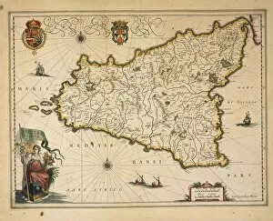
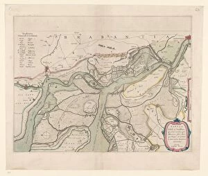
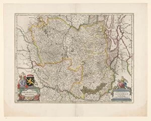
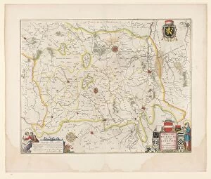
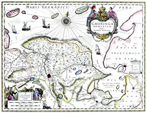
Willem Blaeu: A Master Cartographer of the 17th Century Willem Blaeu, a renowned Dutch cartographer, left an indelible mark on the world of mapmaking with his exquisite engravings and meticulous attention to detail. His maps not only served as navigational tools but also as works of art that captured the essence of various regions. One such masterpiece is his Map of Sicily, which showcases the island's intricate topography and geographical features. With precision and skill, Blaeu brings Sicily to life on paper, allowing viewers to immerse themselves in its rich history and diverse landscapes. In another remarkable creation, Blaeu presents us with a Map of Groningen in the Netherlands. This intricately designed piece offers a glimpse into the city's layout during the 17th century, providing valuable insights into its urban development over time. Blaeu's talents extended beyond land mapping; he also delved into depicting wildlife. Inspired by Albrecht Durer's famous Rhinoceros engraving from 1620, Blaeu created his own rendition that captivated audiences with its lifelike portrayal of this majestic creature. Venturing further eastward, we encounter Blaeu's Map of Moscow Kremlin in Russia. Created in 1597, this artwork showcases both artistic finesse and geographic accuracy. It serves as a testament to Blaeu's ability to capture not just physical landscapes but also cultural landmarks. As we explore further across continents through time and space on one particular World Map from 1634-1635 by Willem Blaeu himself; we witness his mastery unfold before our eyes. The intricate details meticulously etched onto this grand canvas transport us back centuries ago when exploration was at its peak. Moving towards South America now - Rio de la Plata comes alive under Blaeu’s skilled hands in his Atlas from 1658.