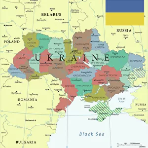
Home > Europe > Ukraine > Maps
Map of Ukraine, 1650. Creator: Le Vasseur de Beauplan, Guillaume (ca 1600-1673)
")
![]()
Wall Art and Photo Gifts from Heritage Images
Map of Ukraine, 1650. Creator: Le Vasseur de Beauplan, Guillaume (ca 1600-1673)
Map of Ukraine, 1650. Private Collection
Heritage Images features heritage image collections
Media ID 36298876
© Fine Art Images/Heritage Images
1650 Cartography Ukraine Copper Engraving
FEATURES IN THESE COLLECTIONS
> Europe
> Ukraine
> Related Images
EDITORS COMMENTS
1. Title: Map of Ukraine, 1650 by Guillaume Le Vasseur de Beauplan This exquisite map, titled "Nouvelle et Exacte Carte de l'Ukraine," is an impressive work of cartography created by Guillaume Le Vasseur de Beauplan in the year 1650. The map is a copper engraving, a technique that was widely used during the 16th and 17th centuries for producing high-quality, detailed prints. Guillaume Le Vasseur de Beauplan (ca. 1600-1673) was a renowned French cartographer, geographer, and engraver. He is known for his meticulous and accurate maps, which were widely circulated throughout Europe during the 17th century. This map of Ukraine is a testament to his exceptional skills and dedication to cartographic accuracy. The map depicts the region of Ukraine in great detail, with an emphasis on the territories controlled by the Polish-Lithuanian Commonwealth and the Ottoman Empire. The map includes numerous place names, rivers, mountains, and other geographical features, making it an invaluable resource for historians, geographers, and scholars of Eastern European history. The map is part of a private collection and is a fine example of the cartographic achievements of the 17th century. It reflects the complex political landscape of Eastern Europe during this period, with the Polish-Lithuanian Commonwealth, the Ottoman Empire, and other powers vying for control of the region. The map also provides a glimpse into the cultural and historical richness of Ukraine, which has played a significant role in the development of European civilization. This map is not only a beautiful work of art but also a valuable historical document, offering insights into the geography, politics, and culture of Ukraine during the 17th century. It is a testament to the enduring importance of cartography in understanding the world around us and the role of dedicated cartographers like Guillaume Le Vasseur de Beauplan in shaping our knowledge of the past.
MADE IN THE USA
Safe Shipping with 30 Day Money Back Guarantee
FREE PERSONALISATION*
We are proud to offer a range of customisation features including Personalised Captions, Color Filters and Picture Zoom Tools
SECURE PAYMENTS
We happily accept a wide range of payment options so you can pay for the things you need in the way that is most convenient for you
* Options may vary by product and licensing agreement. Zoomed Pictures can be adjusted in the Cart.