Home > Europe > United Kingdom > England > London > Royalty
Plan of the Attack at 5.30pm, when these were almost exclusively the Ships engaged with the... 1854 Creator: Unknown

![]()
Wall Art and Photo Gifts from Heritage Images
Plan of the Attack at 5.30pm, when these were almost exclusively the Ships engaged with the... 1854 Creator: Unknown
Plan of the Attack at 5.30pm, when these were almost exclusively the Ships engaged with the Forts, 1854. Crimean War. Map showing the besieged Black Sea port of Sebastopol. English, French and Turkish ships are ranged across the entrance to the harbour, on either side of which are the Russian Forts Constantine and Alexander. Between these is a line of sunken Russian ships obstructing passage into the port. Also marked are the Telegraph Fort, Wasp Fort and New Earth Works (defensive position). From "Illustrated London News", 1854.
From "Illustrated London News", 1854
Heritage Images features heritage image collections
Media ID 36232981
© The Print Collector/Heritage Images
Besieged Black Sea Blockade Blocking Crimean War Defence Defences Disputed Territory Earthwork Earthworks Fort Fortress Fortresses Forts Naval Ship Obstructing Obstruction Port Position Positions Royal Navy Sebastopol Krym Ukraine Sevastopol Ukraine Siege Siege Of Sebastopol Siege Of Sevastopol Territorial Territory Trench Trenches Warships
FEATURES IN THESE COLLECTIONS
> Animals
> Mammals
> Cats (Domestic)
> Russian White
> Asia
> Turkey
> Related Images
> Europe
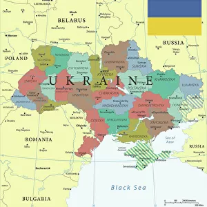
> Ukraine
> Related Images
> Europe
> United Kingdom
> England
> London
> Royalty
> Historic
> Medieval architecture
> Castles and fortresses
> Ancient fortifications
EDITORS COMMENTS
This map print, titled "Plan of the Attack at 5.30pm," offers a glimpse into the Crimean War's pivotal moment at the besieged Black Sea port of Sebastopol in 1854. The image, published in the Illustrated London News, illustrates the strategic layout of the English, French, and Turkish naval forces and the Russian forts, Constantine and Alexander, guarding the harbor entrance. The forts are connected by a line of sunken Russian ships, meticulously marked, which obstructed the passage into the port, intensifying the blockade. The map reveals the intricate details of the geographical features surrounding the port, including the Telegraph Fort, Wasp Fort, and 'New Earth Works,' a defensive position. The naval forces, anchored in the Black Sea, are poised to engage with the forts, highlighting the tense atmosphere of the siege of Sebastopol. This evocative map print, produced during the 19th century, offers a unique perspective on the Crimean War, a significant disputed territory and a turning point in European history. The intricately detailed illustration, taken from the Illustrated London News, captures the essence of the naval warfare and the strategic importance of the Black Sea port of Sebastopol during the conflict between Britain, France, and Russia.
MADE IN THE USA
Safe Shipping with 30 Day Money Back Guarantee
FREE PERSONALISATION*
We are proud to offer a range of customisation features including Personalised Captions, Color Filters and Picture Zoom Tools
SECURE PAYMENTS
We happily accept a wide range of payment options so you can pay for the things you need in the way that is most convenient for you
* Options may vary by product and licensing agreement. Zoomed Pictures can be adjusted in the Cart.