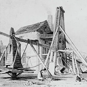
Home > Europe > Russia > Maps
Plan Vladivostokskago torgovago porta, 1916. Creator: Ministerstvo torgovli i promyshlennosti

![]()
Wall Art and Photo Gifts from Heritage Images
Plan Vladivostokskago torgovago porta, 1916. Creator: Ministerstvo torgovli i promyshlennosti
Plan Vladivostokskago torgovago porta, 1916. Karta t?s?vetnai?a?, nakleena na tkan'. Dop. karta: Likhternai?a? gavan na beregu Amurskago zal. u Pervoi? rechki. M. [1:8 400]. Uslovnye znaki: novye raboty (vydeleny krasnoi? kraskoi?). Pokazany: pakgauzy, prichaly pontonnye i likhternye, naberezhnye i pristanis nazvanii?a?mi, ulit?s?y, otd. stroenii?a?, kupal'ni, bazar, sady; gory Krestovai?a? shtrikhami, glubiny v bukhte v sazheni?a?kh, pribrezhnye izo
Heritage Images features heritage image collections
Media ID 35129259
© Heritage Art/Heritage Images
Cartographic Cartography Cyrillic Map Making Mapmaking Plan Vladivostok Primorye Rossiya Russia Meeting Of Frontiers
FEATURES IN THESE COLLECTIONS
> Maps and Charts
> Early Maps
> Maps and Charts
> Related Images
EDITORS COMMENTS
This print showcases the "Plan Vladivostokskago torgovago porta, 1916" created by Ministerstvo torgovli i promyshlennosti. The image depicts a meticulously detailed map of Vladivostok's bustling trade port during the early 20th century.
The map, printed on fabric and adorned with colorful markings denoting new developments in red ink, offers a fascinating glimpse into the city's industrial landscape. It highlights various elements such as pontoon and lighthouse docks, waterfronts, streets, buildings under construction, bathing areas, markets (bazar), gardens (sady), and even the Krestovaiya Mountains depicted with intricate hatching lines. Additionally, it provides valuable information about water depths in sazhens (a traditional Russian unit of measurement) within the bay area.
With its Cyrillic lettering and historical significance, this map serves as a testament to Russia's rich heritage and geographical evolution. Preserved by the Library of Congress' Congressional Library collection as part of their meeting of frontiers project, this artifact reflects both cartographic expertise and meticulous attention to detail.
As we gaze upon this remarkable piece from our past, we are transported back in time to an era when Vladivostok was at the forefront of international trade. This photograph not only captures a moment frozen in history but also invites us to appreciate how cities like Vladivostok have transformed over time due to economic growth and urban development.
Whether you are an avid cartography enthusiast or simply intrigued by historical artifacts that tell stories through maps, this print is sure to captivate your imagination. Let it transport you back to a vibrant era where commerce thrived amidst scenic coastal landscapes - reminding us all of our shared human journey through time.
MADE IN THE USA
Safe Shipping with 30 Day Money Back Guarantee
FREE PERSONALISATION*
We are proud to offer a range of customisation features including Personalised Captions, Color Filters and Picture Zoom Tools
SECURE PAYMENTS
We happily accept a wide range of payment options so you can pay for the things you need in the way that is most convenient for you
* Options may vary by product and licensing agreement. Zoomed Pictures can be adjusted in the Cart.