Jigsaw Puzzle > North America > Nicaragua > Lakes > Lake Nicaragua
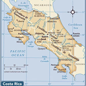
Jigsaw Puzzle : Map showing the proposed Nicaraguan Canal Map showing the proposed Nicaraguan Canal, from "The Business Encyclopaedia and Legal Adviser", published 1907 (litho)
")
")


![]()
Jigsaw Puzzles from Fine Art Finder
Map showing the proposed Nicaraguan Canal Map showing the proposed Nicaraguan Canal, from "The Business Encyclopaedia and Legal Adviser", published 1907 (litho)
6428031 Map showing the proposed Nicaraguan Canal Map showing the proposed Nicaraguan Canal, from "The Business Encyclopaedia and Legal Adviser", published 1907 (litho) by English School, (20th century); (add.info.: Map showing the Nicaraguan Canal, a proposed shipping route through Nicaragua via Lake Nicaragua in the first decade of the 20th century, which would have connected the Atlantic and the Pacific Oceans. The plan never went ahead after the building of the Panama canal, from The Business Encyclopaedia and Legal Adviser, published 1907.); Photo © Ken Welsh. All rights reserved 2023
Media ID 28651305
© Ken Welsh. All rights reserved 2023 / Bridgeman Images
Acqueducts Atlantic Atlantic Ocean Canal Central America Costa Rica Costarican Costaricans Nautical Vessel Outer Space Outerspace Pacific Ocean Planet Planetary Planets Space The Viaduct Water Transport America Continent Geographical Map Lithos Litography
Jigsaw Puzzle (1014 Pieces)
Step back in time with our intriguing jigsaw puzzle from the Media Storehouse collection. This captivating puzzle features an antique map showing the proposed Nicaraguan Canal, as published in "The Business Encyclopaedia and Legal Adviser" in 1907. With intricate details and vibrant colors, this historical puzzle is not just a fun activity but also an educational journey. Delve into the past and piece together this fascinating piece of history. Perfect for puzzle enthusiasts and history buffs alike.
Made in the USA, 1014-piece puzzles measure 20" x 30" (50.8 x 76.2 cm). Every puzzle is meticulously printed on glossy photo paper, which has a strong 1.33 mm thickness. Delivered in a black storage cardboard box, these puzzles are both stylish and practical. (Note: puzzles contain small parts and are not suitable for children under 3 years of age.)
Jigsaw Puzzles are an ideal gift for any occasion
Estimated Product Size is 76cm x 50.8cm (29.9" x 20")
These are individually made so all sizes are approximate
Artwork printed orientated as per the preview above, with landscape (horizontal) orientation to match the source image.
FEATURES IN THESE COLLECTIONS
> Fine Art Finder
> Artists
> English School
> Animals
> Mammals
> Muridae
> Water Mouse
> Arts
> Artists
> O
> Oceanic Oceanic
> Maps and Charts
> Early Maps
> Maps and Charts
> Related Images
> North America
> Costa Rica
> Maps
> North America
> Costa Rica
> Related Images
> North America
> Nicaragua
> Lakes
> Lake Nicaragua
> North America
> Nicaragua
> Lakes
> Related Images
> North America
> Nicaragua
> Maps
EDITORS COMMENTS
This print showcases a map depicting the proposed Nicaraguan Canal, taken from "The Business Encyclopaedia and Legal Adviser" published in 1907. The lithograph, created by an English School artist of the 20th century, offers a glimpse into an ambitious plan to connect the Atlantic and Pacific Oceans through Nicaragua via Lake Nicaragua. During the first decade of the 20th century, this canal project aimed to revolutionize water transport and reshape global trade routes. However, it ultimately remained unrealized due to the construction of the Panama Canal. Nevertheless, this historical artifact serves as a testament to human ingenuity and aspirations for progress. The vibrant colors on this geographical map highlight various elements such as viaducts, nautical vessels navigating through vast oceans, and even celestial bodies like planets in outer space. It also includes Costa Rica's presence within its borders. As we explore this lithograph further, we are transported back in time to witness early twentieth-century cartography techniques that beautifully capture both historic significance and geographical details. This chromolithograph is not only visually striking but also provides valuable insights into our planet's history. With all rights reserved by Ken Welsh until 2023, this remarkable piece reminds us of past endeavors that shaped our world today while serving as a reminder of what could have been if circumstances had unfolded differently.
MADE IN THE USA
Safe Shipping with 30 Day Money Back Guarantee
FREE PERSONALISATION*
We are proud to offer a range of customisation features including Personalised Captions, Color Filters and Picture Zoom Tools
SECURE PAYMENTS
We happily accept a wide range of payment options so you can pay for the things you need in the way that is most convenient for you
* Options may vary by product and licensing agreement. Zoomed Pictures can be adjusted in the Cart.