Jigsaw Puzzle > Europe > France > Canton > Landes
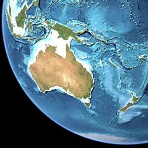
Jigsaw Puzzle : Australia c. 1760, from Atlas de Toutes Les Parties Connues du Globe Terrestre by Cartographer Rigobert Bonne pub. Geneva c. 1760


![]()
Jigsaw Puzzles from Fine Art Finder
Australia c. 1760, from Atlas de Toutes Les Parties Connues du Globe Terrestre by Cartographer Rigobert Bonne pub. Geneva c. 1760
5242663 Australia c. 1760, from Atlas de Toutes Les Parties Connues du Globe Terrestre by Cartographer Rigobert Bonne pub. Geneva c. 1760
Media ID 38514694
© Bridgeman Images
1760 18th Australia Australia Bonne Circa Eighteenth Guinea Joined Land Making North Tasmania Southern Tasmania Tasmania Tasmanian Australians Diemens
Jigsaw Puzzle (1014 Pieces)
Embark on a journey through time with our stunning jigsaw puzzle featuring an intricate map of Australia from 1760. Perfect for history buffs and puzzle enthusiasts alike, this piece is sure to provide hours of entertainment and education. Explore the world as it once was with Media Storehouse's collection of captivating puzzles.
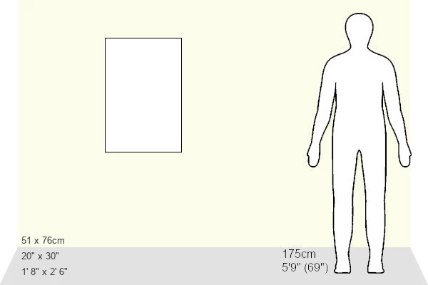
Made in the USA, 1014-piece puzzles measure 20" x 30" (50.8 x 76.2 cm). Every puzzle is meticulously printed on glossy photo paper, which has a strong 1.33 mm thickness. Delivered in a black storage cardboard box, these puzzles are both stylish and practical. (Note: puzzles contain small parts and are not suitable for children under 3 years of age.)
Jigsaw Puzzles are an ideal gift for any occasion
Estimated Product Size is 50.8cm x 76cm (20" x 29.9")
These are individually made so all sizes are approximate
Artwork printed orientated as per the preview above, with portrait (vertical) orientation to match the source image.
FEATURES IN THESE COLLECTIONS
> Fine Art Finder
> Artists
> Jean de Bosschere
> Europe
> France
> Canton
> Landes
> Maps and Charts
> Early Maps
> Maps and Charts
> Related Images
EDITORS COMMENTS
This stunning print captures a glimpse of Australia as it appeared in the year 1760, meticulously mapped out by the talented cartographer Rigobert Bonne. The intricate details and accuracy of this map from the Atlas de Toutes Les Parties Connues du Globe Terrestre are truly remarkable, showcasing the vast landmass of Australia along with its surrounding islands such as Tasmania.
In this historical snapshot, we can see how early explorers and cartographers like Bonne worked tirelessly to document and understand the world around them. The careful craftsmanship that went into creating this map is evident in every line and contour, offering us a window into what life was like during the 18th century.
As we study this image closely, we can appreciate the artistry and dedication that went into creating such a detailed representation of Australia's landscape. From the rugged coastlines to the sprawling interior regions, every part of this map tells a story about our planet's rich history.
Whether you're an avid historian or simply fascinated by cartography, this print is sure to captivate your imagination and transport you back in time to an era when exploration and discovery were at their peak.
MADE IN THE USA
Safe Shipping with 30 Day Money Back Guarantee
FREE PERSONALISATION*
We are proud to offer a range of customisation features including Personalised Captions, Color Filters and Picture Zoom Tools
SECURE PAYMENTS
We happily accept a wide range of payment options so you can pay for the things you need in the way that is most convenient for you
* Options may vary by product and licensing agreement. Zoomed Pictures can be adjusted in the Cart.