Jigsaw Puzzle > Europe > France > Brest
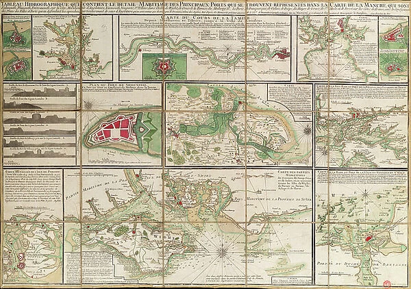
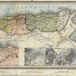
Jigsaw Puzzle : A table containing details of the main maritime ports that are represented in the map of the English Channel, c.1780 (paper, linen)
![]()

Jigsaw Puzzles from Fine Art Finder
A table containing details of the main maritime ports that are represented in the map of the English Channel, c.1780 (paper, linen)
7339430 A table containing details of the main maritime ports that are represented in the map of the English Channel, c.1780 (paper, linen) by Unknown artist, (18th century); 50x72 cm; National Maritime Museum, London, UK; (add.info.: Creator: unknown
A map of Dunkirk Port, scale circa 1:75 000, plan of the City and Port of Calais, scale circa 1:45 000, area map of the city and port of Falmouth, scale circa 1:70 000, map over the Thames from Tilbury, Shell Haven, scale circa 1:70 000, area map of the city and port of Plymouth, scale circa 1:75 000, plan of the Port of Dieppe, scale circa 1:45 000, map of Le Havre, scale circa 1:45 000, map of Fort Shirenesse, scale circa 1:20 000, (Medway) scale circa 1:100 000, map Baye and Port of the city and near Brest, scale circa 1:330 000, map of the Isle of Portsey, scale circa 1:90 000, map of the Maritime Provinces parts of Sussex, Hampshire and Isle of Wight, scale circa 1:250 000, map of the harbor and Port of the city and surroundings of St Malo, scale circa 1:60 000.
Made in Paris, France and from the Duckworth collection.); © National Maritime Museum, Greenwich, London
Media ID 38519862
© © National Maritime Museum, Greenwich, London / Bridgeman Images
Boat Dock British Channel Calais Coast Line Dunkerque Dunkirk English Channel Harbor Area Harbour Area Harbours Hauts De France Nord Pas De Calais Port Area Vue De Dunkerque
Jigsaw Puzzle (520 Pieces)
Embark on a journey through history with our Maritime Ports Jigsaw Puzzle, featuring a detailed map of the English Channel from 1780. Perfect for puzzle enthusiasts and history buffs alike!
Made in the USA, 520-piece puzzles measure 16" x 20" (40.6 x 50.8 cm). Every puzzle is meticulously printed on glossy photo paper, which has a strong 1.33 mm thickness. Delivered in a black storage cardboard box, these puzzles are both stylish and practical. (Note: puzzles contain small parts and are not suitable for children under 3 years of age.)
Jigsaw Puzzles are an ideal gift for any occasion
Estimated Product Size is 50.8cm x 40.5cm (20" x 15.9")
These are individually made so all sizes are approximate
Artwork printed orientated as per the preview above, with landscape (horizontal) or portrait (vertical) orientation to match the source image.
FEATURES IN THESE COLLECTIONS
> Fine Art Finder
> Artists
> Unknown Artist
> Europe
> France
> Canton
> Nord
> Europe
> France
> Canton
> Pas de Calais
> Europe
> France
> Heritage Sites
> Le Havre, the City Rebuilt by Auguste
> Europe
> France
> Paris
> Maps
> Europe
> Republic of Ireland
> Maps
> Europe
> United Kingdom
> England
> Hampshire
> Related Images
> Europe
> United Kingdom
> England
> London
> Boroughs
> Greenwich
EDITORS COMMENTS
This stunning print captures a table containing intricate details of the main maritime ports represented in the map of the English Channel from around 1780. The unknown artist behind this masterpiece has meticulously depicted various ports such as Dunkirk, Calais, Falmouth, Plymouth, Dieppe, Le Havre, and many more.
Each port is showcased with its own unique scale plan, offering a glimpse into the bustling activity that once filled these historic locations. From the Thames at Tilbury to Fort Shirenesse and beyond, this map provides a comprehensive view of the maritime landscape during this period.
The precision and artistry displayed in this piece are truly remarkable. Made in Paris and part of the Duckworth collection, it serves as a valuable historical record of maritime trade and navigation in the English Channel region.
As you gaze upon this photo print, let your imagination sail back in time to an era when these ports were vital hubs of commerce and exploration. Explore each detail carefully and appreciate the skillful craftsmanship that went into creating this fascinating map. It's not just a table of information; it's a window into history waiting to be discovered.
MADE IN THE USA
Safe Shipping with 30 Day Money Back Guarantee
FREE PERSONALISATION*
We are proud to offer a range of customisation features including Personalised Captions, Color Filters and Picture Zoom Tools
SECURE PAYMENTS
We happily accept a wide range of payment options so you can pay for the things you need in the way that is most convenient for you
* Options may vary by product and licensing agreement. Zoomed Pictures can be adjusted in the Cart.


