Jigsaw Puzzle > North America > Canada > Maps
Jigsaw Puzzle : Map of Ontario, Canada, c.1900 (engraving)
")
")


![]()
Jigsaw Puzzles from Fine Art Finder
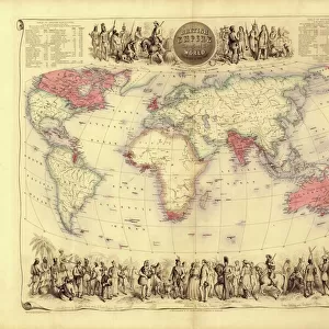
Map of Ontario, Canada, c.1900 (engraving)
533076 Map of Ontario, Canada, c.1900 (engraving); (add.info.: Map of Ontario, Canada, with an inset of Toronto, circa 1902, from the 10th edition of Encyclopaedia Britannica.); Encyclopaedia Britannica/UIG
Media ID 38310236
© Encyclopaedia Britannica/UIG / Bridgeman Images
1902 19th Century Style Boundary Geographical Border Guidance Illustration Technique Meridian Navigational Equipment Old Fashioned Ontario Physical Geography The Past Toronto Western Script Canadians
Jigsaw Puzzle (520 Pieces)
Discover the beauty and history of Ontario, Canada with our captivating jigsaw puzzle featuring a vintage map from 1900. Perfect for hours of entertainment and a unique piece of art to display in your home.
Made in the USA, 520-piece puzzles measure 16" x 20" (40.6 x 50.8 cm). Every puzzle is meticulously printed on glossy photo paper, which has a strong 1.33 mm thickness. Delivered in a black storage cardboard box, these puzzles are both stylish and practical. (Note: puzzles contain small parts and are not suitable for children under 3 years of age.)
Jigsaw Puzzles are an ideal gift for any occasion
Estimated Product Size is 50.8cm x 40.5cm (20" x 15.9")
These are individually made so all sizes are approximate
Artwork printed orientated as per the preview above, with landscape (horizontal) or portrait (vertical) orientation to match the source image.
FEATURES IN THESE COLLECTIONS
> Fine Art Finder
> Temp Classification
> North America
> Canada
> Maps
> North America
> Canada
> Related Images
> North America
> Canada
> Toronto
EDITORS COMMENTS
This engraving of a Map of Ontario, Canada from around 1900 offers a glimpse into the past, showcasing the intricate details and craftsmanship of cartography in the 19th century. The map features an inset of Toronto, providing a snapshot of the city's layout during that time period.
As we study this historical piece, we are transported back to an era when exploration and navigation were essential for understanding the world around us. The Western script used on the map adds to its old-fashioned charm, while highlighting the geographical borders and coastlines with precision.
The Map of Ontario serves as a reminder of our rich history and how far we have come in terms of technological advancements in mapping and navigation. It is a testament to human ingenuity and curiosity about our surroundings.
With no people depicted on the map, it allows us to focus solely on the land itself - its physical geography, boundaries, meridians, and seas. This illustration technique captures not only the essence of Ontario but also provides valuable insight into how maps were created over a century ago.
Overall, this print is not just a visual representation but also a historical artifact that tells a story about Canada's past and its importance in shaping our understanding of geography.
MADE IN THE USA
Safe Shipping with 30 Day Money Back Guarantee
FREE PERSONALISATION*
We are proud to offer a range of customisation features including Personalised Captions, Color Filters and Picture Zoom Tools
SECURE PAYMENTS
We happily accept a wide range of payment options so you can pay for the things you need in the way that is most convenient for you
* Options may vary by product and licensing agreement. Zoomed Pictures can be adjusted in the Cart.