Jigsaw Puzzle > Arts > Landscape paintings > Waterfall and river artworks > River artworks
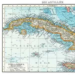
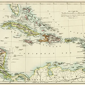
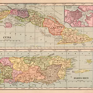
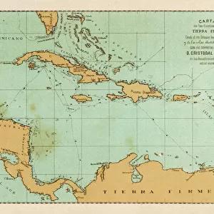
Jigsaw Puzzle : MAP: CUBA, 1900. Map of Cuba printed in the United States, c1900


![]()
Jigsaw Puzzles from Granger
MAP: CUBA, 1900. Map of Cuba printed in the United States, c1900
MAP: CUBA, 1900.
Map of Cuba printed in the United States, c1900
Granger holds millions of images spanning more than 25,000 years of world history, from before the Stone Age to the dawn of the Space Age
Media ID 6617535
1900 Cuba Cuban Island Latin America
Jigsaw Puzzle (520 Pieces)
Discover the captivating history of Cuba with our exquisite jigsaw puzzle from Media Storehouse. This intriguing puzzle features a vintage map of Cuba, printed in the United States around 1900, from The Granger Collection, New York. Add a touch of history and adventure to your home with this beautifully detailed and intricately designed puzzle. Immerse yourself in the puzzle-solving experience as you piece together the rich history of this fascinating island nation. Perfect for collectors, history enthusiasts, or anyone looking for a challenging and rewarding pastime. Bring the past to life with Media Storehouse's high-quality jigsaw puzzles.
Made in the USA, 520-piece puzzles measure 16" x 20" (40.6 x 50.8 cm). Every puzzle is meticulously printed on glossy photo paper, which has a strong 1.33 mm thickness. Delivered in a black storage cardboard box, these puzzles are both stylish and practical. (Note: puzzles contain small parts and are not suitable for children under 3 years of age.)
Jigsaw Puzzles are an ideal gift for any occasion
Estimated Product Size is 50.8cm x 40.5cm (20" x 15.9")
These are individually made so all sizes are approximate
Artwork printed orientated as per the preview above, with landscape (horizontal) or portrait (vertical) orientation to match the source image.
FEATURES IN THESE COLLECTIONS
> Granger Art on Demand
> Maps
> Arts
> Landscape paintings
> Waterfall and river artworks
> River artworks
> Maps and Charts
> Early Maps
> Maps and Charts
> Related Images
> North America
> Cuba
> Maps
> North America
> Cuba
> Related Images
EDITORS COMMENTS
This print showcases a remarkable piece of history - a map of Cuba from the year 1900. Created and printed in the United States, this meticulously detailed map offers a glimpse into the early days of this enchanting island nation. The intricate cartography beautifully captures the topography, rivers, and various regions that make up Cuba's diverse landscape. As we delve into this snapshot from the past, it is impossible not to be transported back to an era when Cuba was on the cusp of significant change. This map serves as a testament to both its historical significance and cultural importance within Latin America. The Granger Collection has expertly preserved this valuable artifact, allowing us to appreciate its beauty and educational value today. Through their careful preservation efforts, they have ensured that future generations can continue to explore and learn about Cuban history through visual representations like this one. Whether you are an avid historian or simply captivated by maps, this print is sure to spark curiosity and ignite your imagination. It invites us all to embark on a journey through time as we trace our fingers along each contour line and immerse ourselves in the rich heritage of Cuba.
MADE IN THE USA
Safe Shipping with 30 Day Money Back Guarantee
FREE PERSONALISATION*
We are proud to offer a range of customisation features including Personalised Captions, Color Filters and Picture Zoom Tools
SECURE PAYMENTS
We happily accept a wide range of payment options so you can pay for the things you need in the way that is most convenient for you
* Options may vary by product and licensing agreement. Zoomed Pictures can be adjusted in the Cart.