Jigsaw Puzzle > Europe > France > Canton > Nord
Jigsaw Puzzle : Le Djebel Nefousa; Le Nord-Est Africain, 1914. Creator: Unknown


![]()
Jigsaw Puzzles from Heritage Images
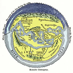
Le Djebel Nefousa; Le Nord-Est Africain, 1914. Creator: Unknown
Le Djebel Nefousa; Le Nord-Est Africain, 1914. From "Grande Geographie Bong Illustree", 1914
Heritage Images features heritage image collections
Media ID 36296357
© The Print Collector/Heritage Images
Cartography Libya Map Making Mapmaking
Jigsaw Puzzle (1014 Pieces)
Discover the enchanting beauty of North-Eastern Africa with our exquisite jigsaw puzzle from Media Storehouse. Featuring the captivating image "Le Djebel Nefousa; Le Nord-Est Africain," this puzzle transports you to the stunning landscapes of 1914. Originally from the pages of Grande Geographie Bong Illustree, this puzzle showcases the mysterious allure of a bygone era. Unknown creators captured the raw, untouched essence of this North African mountain range, inviting you on a journey of discovery. Piece together the intricate details and immerse yourself in the rich history and culture of this fascinating region.
Made in the USA, 1014-piece puzzles measure 20" x 30" (50.8 x 76.2 cm). Every puzzle is meticulously printed on glossy photo paper, which has a strong 1.33 mm thickness. Delivered in a black storage cardboard box, these puzzles are both stylish and practical. (Note: puzzles contain small parts and are not suitable for children under 3 years of age.)
Jigsaw Puzzles are an ideal gift for any occasion
Estimated Product Size is 76cm x 50.8cm (29.9" x 20")
These are individually made so all sizes are approximate
Artwork printed orientated as per the preview above, with landscape (horizontal) orientation to match the source image.
FEATURES IN THESE COLLECTIONS
> Africa
> Libya
> Related Images
> Europe
> France
> Canton
> Nord
> Maps and Charts
> Related Images
Le Djebel Nefousa; Le Nord-Est Africain,
EDITORS COMMENTS
a captivating and enigmatic map print from the early 20th century, transports us back in time to the unexplored territories of North-Eastern Africa. The creator of this masterpiece remains unknown, but it was published in the esteemed French geographical journal "Grande Geographie Bong Illustree" in 1914. This evocative map offers a glimpse into the cartographic explorations of the early 1900s, a time when the African continent was still being mapped and claimed by European powers. The map's title, "Le Djebel Nefousa; Le Nord-Est Africain," refers to the Jebel Nefousa mountain range in modern-day Libya, which forms a significant landmark in the region. The map's vibrant colors and intricate details bring the landscape to life, with the Sahara Desert depicted in shades of orange and brown, and the Nile River winding its way through the green expanse of Egypt. The map also highlights various locations of historical and geographical significance, such as the cities of Tripoli, Benghazi, and Alexandria, as well as the Red Sea and the Mediterranean Coast. The mapmaking process during this era was a testament to human curiosity and the desire to explore and understand the world around us. This print serves as a reminder of the rich history of cartography and the role it played in shaping our understanding of the world. The unknown creator of "Le Djebel Nefousa; Le Nord-Est Africain" has left us with a beautiful and intriguing piece of history that continues to fascinate and inspire.
MADE IN THE USA
Safe Shipping with 30 Day Money Back Guarantee
FREE PERSONALISATION*
We are proud to offer a range of customisation features including Personalised Captions, Color Filters and Picture Zoom Tools
SECURE PAYMENTS
We happily accept a wide range of payment options so you can pay for the things you need in the way that is most convenient for you
* Options may vary by product and licensing agreement. Zoomed Pictures can be adjusted in the Cart.