Jigsaw Puzzle > Arts > Artists > T > John Tallis
Jigsaw Puzzle : Persia, or Iran 1851


![]()
Jigsaw Puzzles from MapSeeker
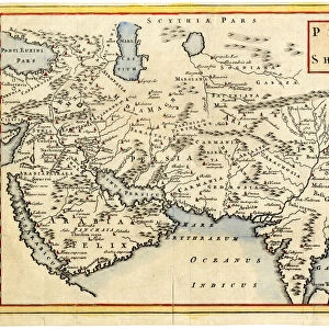
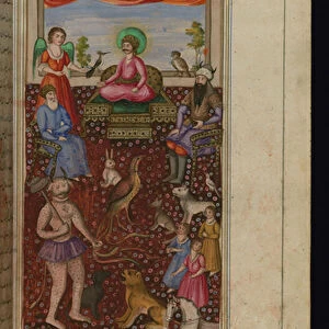
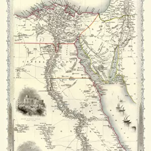
Persia, or Iran 1851
A fine facimile artworked from an antique original map of Persia, or later (1935) Iran issued as part of the 1851 edition of John Tallis and Companys " The Illustrated Atlas and Modern History of the World"
Welcome to the Mapseeker Image library and enter an historic gateway to one of the largest on-line collections of Historic Maps, Nostalgic Views, Vista's and Panorama's from a World gone by.
Media ID 20347346
© Mapseeker Publishing Ltd
John Tallis John Tallis Map Tallis Map Persia
Jigsaw Puzzle (1014 Pieces)
Discover the rich history and culture of Persia, or Iran, with our exquisite jigsaw puzzles from Media Storehouse. Featuring the intricate and detailed artwork of "Persia, or Iran 1851" by John Tallis and John Rapkin from MapSeeker, this puzzle offers a captivating journey into the past. This fine facsimile, artfully reproduced from an antique original map issued in the 1851 edition of John Tallis and Company's "The Illustrated Atlas," invites you to piece together history, geography, and artistry. Immerse yourself in the beauty of this vintage map, and let the puzzle-solving experience transport you to another time and place.
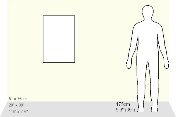
Made in the USA, 1014-piece puzzles measure 20" x 30" (50.8 x 76.2 cm). Every puzzle is meticulously printed on glossy photo paper, which has a strong 1.33 mm thickness. Delivered in a black storage cardboard box, these puzzles are both stylish and practical. (Note: puzzles contain small parts and are not suitable for children under 3 years of age.)
Jigsaw Puzzles are an ideal gift for any occasion
Estimated Product Size is 50.8cm x 76cm (20" x 29.9")
These are individually made so all sizes are approximate
Artwork printed orientated as per the preview above, with portrait (vertical) orientation to match the source image.
FEATURES IN THESE COLLECTIONS
> Arts
> Artists
> T
> John Tallis
> Asia
> Iran
> Related Images
> Maps and Charts
> Related Images
> Maps and Charts
> World
> MapSeeker
> Maps of Asia and Middle East
> Maps of the Middle East and East Indies
EDITORS COMMENTS
This print showcases a remarkable piece of history: a fine facsimile artworked from an antique original map of Persia, or later Iran, dating back to 1851. This exquisite map was originally issued as part of the renowned 1851 edition of John Tallis and Company's "The Illustrated Atlas and Modern History of the World". With intricate details and stunning craftsmanship, this old map provides a glimpse into the rich cultural heritage and geographical landscape of Persia during that era. It serves as a testament to the meticulous cartographic skills employed by John Tallis and his collaborator, John Rapkin. As you explore this mesmerizing print, your eyes will be drawn to the delicate lines tracing ancient trade routes, majestic mountain ranges stretching across vast territories, and elegant calligraphy labeling cities steeped in centuries-old traditions. The faded hues evoke nostalgia for times long gone while inviting contemplation on how much has changed since then. Whether you are an avid historian or simply appreciate artistry at its finest, this print is sure to captivate your imagination. It transports you back in time to witness Persia's grandeur through the lens of one talented cartographer's vision. Let it serve as a reminder that maps not only guide us physically but also connect us emotionally with our shared human story.
MADE IN THE USA
Safe Shipping with 30 Day Money Back Guarantee
FREE PERSONALISATION*
We are proud to offer a range of customisation features including Personalised Captions, Color Filters and Picture Zoom Tools
SECURE PAYMENTS
We happily accept a wide range of payment options so you can pay for the things you need in the way that is most convenient for you
* Options may vary by product and licensing agreement. Zoomed Pictures can be adjusted in the Cart.