Jigsaw Puzzle > Europe > United Kingdom > England > Bristol > Bristol
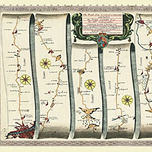
Jigsaw Puzzle : Old Road Strip Map (PLATE 10) The Road from London to the City of Bristol
 The Road from London to the City of Bristol")
 The Road from London to the City of Bristol")


![]()
Jigsaw Puzzles from MapSeeker
Old Road Strip Map (PLATE 10) The Road from London to the City of Bristol
OLG010
Welcome to the Mapseeker Image library and enter an historic gateway to one of the largest on-line collections of Historic Maps, Nostalgic Views, Vista's and Panorama's from a World gone by.
Media ID 20346965
John Ogilby Ogilby Old Road Strip Map Strip Map
Jigsaw Puzzle (1014 Pieces)
Step back in time with the Old Road Strip Map Jigsaw Puzzle from Media Storehouse and MapSeeker! This intriguing puzzle features Plate 10 from the historic "The Road from London to the City of Bristol" series. Travel back to an era of horse-drawn carriages and stagecoaches as you piece together this detailed representation of a road map from London to Bristol. With authentic period illustrations and intricate cartography, this jigsaw puzzle offers a fun and educational challenge for puzzle enthusiasts of all ages. Get ready to embark on a journey through history with the Old Road Strip Map Jigsaw Puzzle - Plate 10 (OLG010) from Media Storehouse and MapSeeker.
Made in the USA, 1014-piece puzzles measure 20" x 30" (50.8 x 76.2 cm). Every puzzle is meticulously printed on glossy photo paper, which has a strong 1.33 mm thickness. Delivered in a black storage cardboard box, these puzzles are both stylish and practical. (Note: puzzles contain small parts and are not suitable for children under 3 years of age.)
Jigsaw Puzzles are an ideal gift for any occasion
Estimated Product Size is 76cm x 50.8cm (29.9" x 20")
These are individually made so all sizes are approximate
Artwork printed orientated as per the preview above, with landscape (horizontal) orientation to match the source image.
FEATURES IN THESE COLLECTIONS
> Arts
> Artists
> O
> John Ogilby
> Europe
> United Kingdom
> England
> Bristol
> Bristol
> MapSeeker
> Old Railway and Canal Map Collection
> Early Coaching Routes and Canal Maps
EDITORS COMMENTS
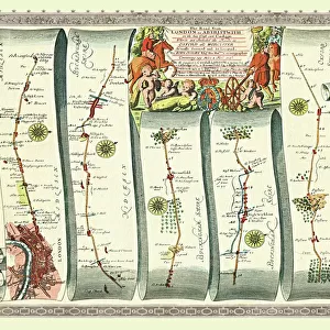
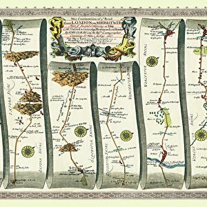
This print showcases an exquisite piece of history, the "Old Road Strip Map (PLATE 10) The Road from London to the City of Bristol" by John Ogilby. This remarkable strip map, dating back centuries, offers a fascinating glimpse into the past and provides invaluable insights into the road network connecting two iconic cities. As we gaze upon this meticulously crafted map, we are transported back in time to an era when travel was arduous and roads were treacherous. With intricate details and precise measurements, Ogilby's masterpiece served as a vital guide for weary travelers seeking safe passage between London and Bristol. The delicate lines etched on this antique document trace the winding path through picturesque English countryside. Each milestone along the way is meticulously recorded, allowing us to envision horse-drawn carriages traversing these very routes centuries ago. Beyond its historical significance, this print also serves as a testament to John Ogilby's immense talent as a cartographer. His attention to detail and dedication to accuracy shine through every inch of this beautifully preserved strip map. Whether you are an avid historian or simply appreciate artistry in all its forms, this mesmerizing print will undoubtedly captivate your imagination. It stands as a tangible link between our modern world and the rich tapestry of England's past—a true treasure for any admirer of cartography or lover of nostalgia.
MADE IN THE USA
Safe Shipping with 30 Day Money Back Guarantee
FREE PERSONALISATION*
We are proud to offer a range of customisation features including Personalised Captions, Color Filters and Picture Zoom Tools
SECURE PAYMENTS
We happily accept a wide range of payment options so you can pay for the things you need in the way that is most convenient for you
* Options may vary by product and licensing agreement. Zoomed Pictures can be adjusted in the Cart.