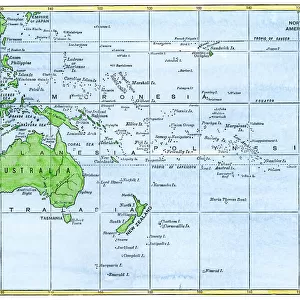
Jigsaw Puzzle > Oceania > Papua New Guinea > Maps
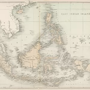
Jigsaw Puzzle : Map / East India Islands


![]()
Jigsaw Puzzles from Mary Evans Picture Library
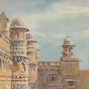
Map / East India Islands
Map of the East India Islands, including Borneo, the Celebes, Sumatra, Papua New Guinea, the Philippines
Mary Evans Picture Library makes available wonderful images created for people to enjoy over the centuries
Media ID 608840
© Mary Evans Picture Library 2015 - https://copyrighthub.org/s0/hub1/creation/maryevans/MaryEvansPictureID/10114142
1864 Borneo Celebes Guinea Including Maps Papua Philippines Sumatra
Jigsaw Puzzle (520 Pieces)
Discover the wonders of the East Indies with our captivating jigsaw puzzle from the Media Storehouse collection, featuring the intricately detailed "Map / East India Islands" by Mary Evans Picture Library from Mary Evans Prints Online. This beautiful puzzle showcases an historical map, dating back to the 19th century, depicting the East India Islands, including Borneo, the Celebes, Sumatra, Papua New Guinea, and the Philippines. Engage in a stimulating and educational experience as you piece together this intricate puzzle, bringing the rich history and diverse cultures of the East Indies right to your living room. Immerse yourself in the intricacies of this captivating map and transport yourself to a world of discovery with Media Storehouse's jigsaw puzzles.
Made in the USA, 520-piece puzzles measure 16" x 20" (40.6 x 50.8 cm). Every puzzle is meticulously printed on glossy photo paper, which has a strong 1.33 mm thickness. Delivered in a black storage cardboard box, these puzzles are both stylish and practical. (Note: puzzles contain small parts and are not suitable for children under 3 years of age.)
Jigsaw Puzzles are an ideal gift for any occasion
Estimated Product Size is 50.8cm x 40.5cm (20" x 15.9")
These are individually made so all sizes are approximate
Artwork printed orientated as per the preview above, with landscape (horizontal) or portrait (vertical) orientation to match the source image.
FEATURES IN THESE COLLECTIONS
> Asia
> India
> Related Images
> Asia
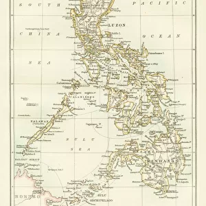
> Philippines
> Maps
> Asia
> Philippines
> Related Images
> Asia
> Related Images
> Maps and Charts
> Early Maps
> Maps and Charts
> India
> Maps and Charts
> Related Images
> Oceania
> Papua New Guinea
> Maps
EDITORS COMMENTS
This stunning vintage map print showcases the intricate details of the East India Islands, including Borneo, the Celebes, Sumatra, Papua New Guinea, and the Philippines. Dating back to 1864, this historical piece offers a glimpse into the past with its depiction of Asia's diverse geography.
The careful craftsmanship of this map is evident in its precise borders and labels, providing a comprehensive overview of these exotic islands. From the lush landscapes of Sumatra to the rugged terrain of Borneo, each island is uniquely represented on this artwork.
As you study this map closely, you can almost imagine embarking on a journey through these remote and mysterious lands. The rich history and cultural significance of each island come to life through this detailed illustration.
Whether you are a history buff or simply appreciate fine artistry, this Map of the East India Islands is sure to captivate your imagination. Display it proudly in your home or office as a conversation piece that will spark curiosity and admiration from all who see it.
Experience a piece of history with this remarkable print from Mary Evans Picture Library - a true treasure for any collector or enthusiast.
MADE IN THE USA
Safe Shipping with 30 Day Money Back Guarantee
FREE PERSONALISATION*
We are proud to offer a range of customisation features including Personalised Captions, Color Filters and Picture Zoom Tools
SECURE PAYMENTS
We happily accept a wide range of payment options so you can pay for the things you need in the way that is most convenient for you
* Options may vary by product and licensing agreement. Zoomed Pictures can be adjusted in the Cart.