Jigsaw Puzzle > Europe > United Kingdom > Wales > Gwynedd > Caernarfon
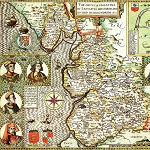
Jigsaw Puzzle : 17th Century (1610) Map of Caernarvon Caernarvonshire
 Map of Caernarvon Caernarvonshire")
 Map of Caernarvon Caernarvonshire")


![]()
Jigsaw Puzzles from Mary Evans Picture Library
17th Century (1610) Map of Caernarvon Caernarvonshire
Mary Evans Picture Library makes available wonderful images created for people to enjoy over the centuries
Media ID 32350966
© The Keasbury-Gordon Photograph Archive / Mary Evans
1610 Anglesey Bangor Caernarfon Caernarvon Caernarvonshire Speed
Jigsaw Puzzle (520 Pieces)
Discover the rich history of Caernarvon Caernarvonshire with our captivating jigsaw puzzle from Media Storehouse. This intricately detailed puzzle features a rare 17th century (1610) map of the region, taken from The Keasbury-Gordon Photograph Archive Collection at Mary Evans Prints Online. Immerse yourself in the intricacies of the map's design, bringing the history of this beautiful area to life. A perfect activity for puzzle enthusiasts, history buffs, or anyone seeking a challenging and engaging pastime. Piece together the past and create a stunning display for your home or office.
Made in the USA, 520-piece puzzles measure 16" x 20" (40.6 x 50.8 cm). Every puzzle is meticulously printed on glossy photo paper, which has a strong 1.33 mm thickness. Delivered in a black storage cardboard box, these puzzles are both stylish and practical. (Note: puzzles contain small parts and are not suitable for children under 3 years of age.)
Jigsaw Puzzles are an ideal gift for any occasion
Estimated Product Size is 50.8cm x 40.5cm (20" x 15.9")
These are individually made so all sizes are approximate
Artwork printed orientated as per the preview above, with landscape (horizontal) or portrait (vertical) orientation to match the source image.
FEATURES IN THESE COLLECTIONS
> Arts
> Artists
> S
> John Speed
> Europe
> United Kingdom
> Northern Ireland
> County Down
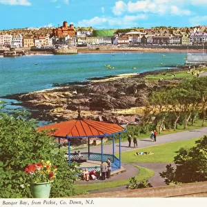
> Bangor
> Europe
> United Kingdom
> Wales
> Anglesey
> Related Images
> Europe
> United Kingdom
> Wales
> Bangor
> Europe
> United Kingdom
> Wales
> Gwynedd
> Bangor
> Europe
> United Kingdom
> Wales
> Gwynedd
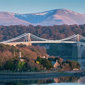
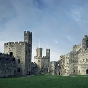
> Caernarfon
> Europe
> United Kingdom
> Wales
> Maps
> Europe
> United Kingdom
> Wales
> Posters
> Europe
> United Kingdom
> Wales
> Related Images
> Maps and Charts
> Early Maps
> Mary Evans Prints Online
> New Images July 2023
EDITORS COMMENTS
This stunning vintage print showcases a 17th-century map of Caernarvon, Caernarvonshire from the year 1610. The intricate details and historical significance of this map are truly captivating, offering a glimpse into the past of this Welsh town.
The map features not only Caernarfon itself but also surrounding areas such as Anglesey and Bangor, providing a comprehensive view of the region during that time period. Created by renowned cartographer John Speed, this piece is a true work of art that reflects the early mapping techniques used in the 17th century.
As you gaze upon this print, you can't help but be transported back in time to an era of Victorian and Edwardian charm. The faded colors and aged paper give it an authentic feel, making it a perfect addition to any history lover's collection.
Whether you have roots in Wales or simply appreciate historical maps, this piece is sure to spark your curiosity and imagination. Let yourself get lost in the streets and landmarks of Caernarvon as they were over 400 years ago with this beautifully preserved map print from The Keasbury-Gordon Photograph Archive Collection at Mary Evans Prints Online.
MADE IN THE USA
Safe Shipping with 30 Day Money Back Guarantee
FREE PERSONALISATION*
We are proud to offer a range of customisation features including Personalised Captions, Color Filters and Picture Zoom Tools
SECURE PAYMENTS
We happily accept a wide range of payment options so you can pay for the things you need in the way that is most convenient for you
* Options may vary by product and licensing agreement. Zoomed Pictures can be adjusted in the Cart.