Home > Maps and Charts > Related Images
Leeds LS16 9 Map

![]()
Wall Art and Photo Gifts from Map Marketing
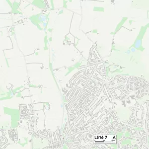
Leeds LS16 9 Map
Postcode Sector Map of Leeds LS16 9
Media ID 19974806
Camp Road Church Hill Churchgate Eastgate Hall Close Hall Drive Harrogate Road Kings Drive Kings Road Leeds Leeds Road Long Meadows Manor Close Meadow End Moor Road Moorland Road North Drive Occupation Lane Old Lane Parklands School Green Southfield Sycamore Close The Birches The Cedars The Poplars The Rowans The Sycamores Bramhope
FEATURES IN THESE COLLECTIONS
> Map Marketing
> Postcode Sector Maps
> LS - Leeds
> Maps and Charts
> Related Images
MADE IN THE USA
Safe Shipping with 30 Day Money Back Guarantee
FREE PERSONALISATION*
We are proud to offer a range of customisation features including Personalised Captions, Color Filters and Picture Zoom Tools
SECURE PAYMENTS
We happily accept a wide range of payment options so you can pay for the things you need in the way that is most convenient for you
* Options may vary by product and licensing agreement. Zoomed Pictures can be adjusted in the Cart.