
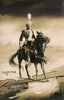
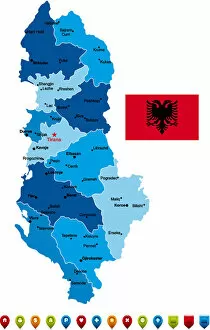
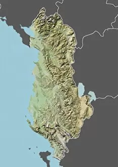
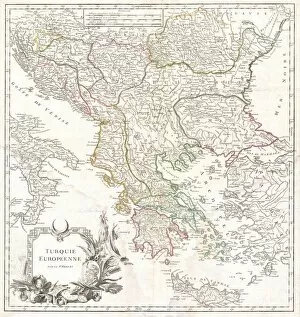
Albania Collection
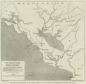
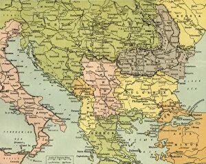
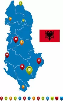
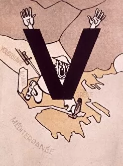
Albania is a small country located in Southeast Europe, bordered by Montenegro to the northwest, Kosovo to the northeast
Choose a picture from our Albania Collection for your Wall Art and Photo Gifts
47 items

All Professionally Made to Order for Quick Shipping
-
Albania Collection
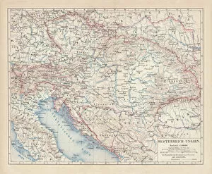
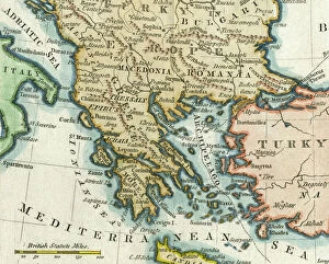
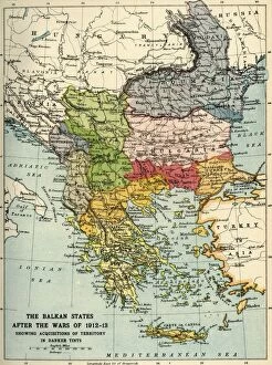
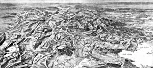
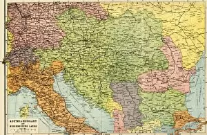
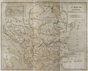
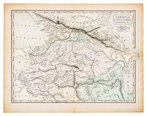
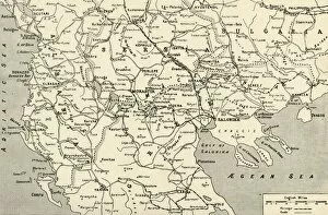
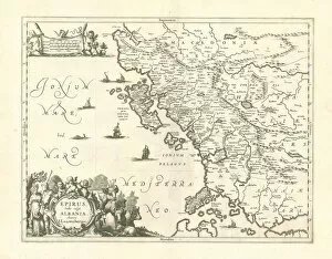
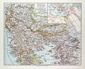
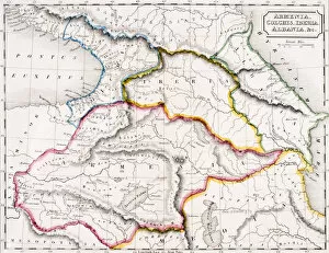
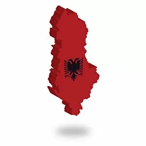
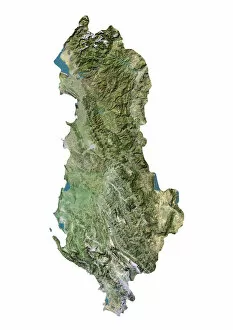
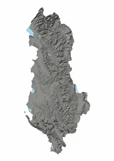
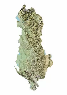
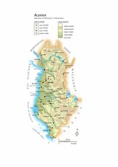
Albania is a small country located in Southeast Europe, bordered by Montenegro to the northwest, Kosovo to the northeast, North Macedonia to the east and Greece to the south. The country has a population of approximately 2.8 million people and covers an area of 28,748 square kilometers. Albania's landscape is characterized by rugged mountains and beautiful beaches along its Adriatic and Ionian coastlines. The capital city Tirana is home to over 800,000 people and serves as the economic hub of Albania. Despite being one of Europe's poorest countries, it has made significant progress in recent years towards modernization and integration into international markets.
+
Our beautiful pictures are available as Framed Prints, Photos, Wall Art and Photo Gifts
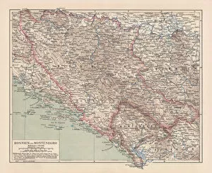
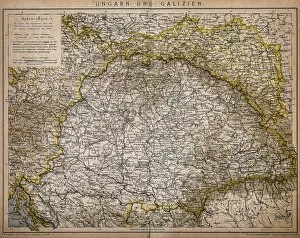
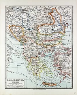
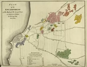
The Albania collection from Media Storehouse is a stunning compilation of wall art and framed prints that showcase the beauty and history of Albania. Our collection features an array of maps, charts, and vintage illustrations that provide a unique glimpse into the country's geography, culture, and heritage. From detailed topographical maps to colorful tourist guides, our collection offers something for everyone interested in exploring Albania's rich history. The artwork is printed on high-quality paper using state-of-the-art printing technology to ensure vibrant colors and sharp details. Whether you're looking to decorate your home or office with beautiful Albanian scenery or want to learn more about this fascinating country through its historical maps and charts, the Albania collection has something for you. With its wide selection of sizes and framing options available at affordable prices, it's easy to find the perfect piece for any space.
+
What are Albania (Maps and Charts) art prints?
Albania art prints are a collection of high-quality, visually stunning prints that showcase the geography and history of Albania. These prints feature detailed maps and charts that highlight important landmarks, cities, regions, and other significant features of Albania's landscape. They are perfect for anyone who has an interest in Albanian culture or history. These art prints are produced using state-of-the-art printing technology to ensure that they capture every detail with incredible clarity and precision. They come in a variety of sizes to suit any space or decor style, making them ideal for home or office display. Whether you're looking to decorate your living room, study area or office space with beautiful artwork that celebrates the rich heritage of Albania; these Maps and Charts art prints from Media Storehouse offer a unique way to do so. With their exceptional quality and attention to detail, they make excellent gifts for friends or family members who share your passion for Albanian culture.
+
What Albania (Maps and Charts) art prints can I buy from Media Storehouse?
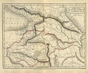
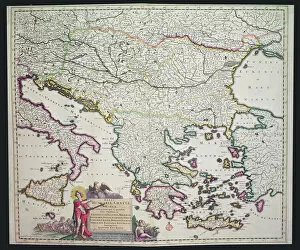
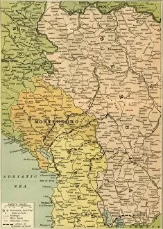
We offer a wide range of Albania maps and charts art prints that are perfect for decorating your home or office. You can choose from various styles, including vintage, modern, and artistic interpretations of the country's geography. One popular option is the detailed topographical map of Albania, which showcases the country's mountainous terrain and coastline. Another great choice is the antique-style map that features intricate illustrations of cities and landmarks. Media Storehouse also offers nautical charts that highlight Albania's coastal waters and ports. These prints are ideal for those who love sailing or have an interest in maritime history. In addition to traditional maps and charts, we have unique artwork inspired by Albania. For example, there are colorful abstract paintings featuring Albanian motifs as well as photographs showcasing stunning landscapes like Lake Ohrid or Butrint National Park. With so many options available at Media Storehouse, you're sure to find an Albania map or chart art print that suits your style and interests.
+
How do I buy Albania (Maps and Charts) art prints?
To buy Albania art prints from Media Storehouse, you can browse through our extensive collection of high-quality images featuring the country's topographical maps and charts. Once you have found the artwork that suits your taste, simply select the size and format of your choice. You can choose from a range of options including canvas prints, framed prints or unframed prints. To complete your purchase, add the selected item to your cart and proceed to checkout. At this stage, you will be required to provide some basic information such as your shipping address and payment details. After completing these steps, confirm your order and wait for it to be processed. We offer a hassle-free shopping experience with secure online transactions ensuring that all orders are handled efficiently. Their Albania art print collection is perfect for those who appreciate fine art pieces depicting geographical locations around the world.
+
How much do Albania (Maps and Charts) art prints cost?
We offer a wide range of Albania maps and charts art prints that are available at affordable prices. Our collection features high-quality reproductions of vintage and contemporary maps and charts depicting the geography, topography, history, and culture of Albania. Whether you're looking for a detailed map of Tirana or an artistic representation of the Albanian flag, our selection has something to suit every taste and budget. Our Albania maps and charts art prints come in various sizes to fit any space in your home or office. They are printed on premium quality paper using state-of-the-art printing technology to ensure excellent color accuracy, sharpness, and clarity. You can choose from different framing options to enhance the presentation of your artwork. Our Albania maps and charts art prints provide an affordable way to add some cultural flair to your decor while celebrating this beautiful Balkan country's rich heritage.
+
How will my Albania (Maps and Charts) art prints be delivered to me?
Your Albania art prints will be delivered to you in a safe and secure manner. We take great care in packaging your order so that it arrives at your doorstep undamaged. Our team uses high-quality materials to ensure that your prints are protected during transit. We offer various shipping options depending on the destination of your order. You can choose from standard or express delivery, both of which come with tracking information so that you can keep an eye on the progress of your package. Once your order has been dispatched, we will send you an email confirmation along with the tracking details. This way, you'll know exactly when to expect your Albania art prints. We pride ourselves on providing excellent customer service and delivering quality products. If for any reason you're not satisfied with your purchase, please don't hesitate to contact us and we'll do our best to resolve any issues as quickly as possible.