
Ireland Collection
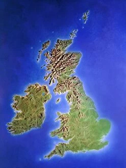
Ireland is an island nation located in the northwestern part of Europe
Choose a picture from our Ireland Collection for your Wall Art and Photo Gifts
1,433 items
All Professionally Made to Order for Quick Shipping
-
Ireland Collection
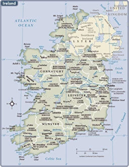
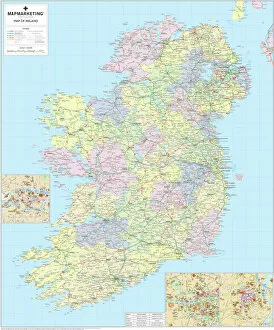
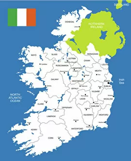
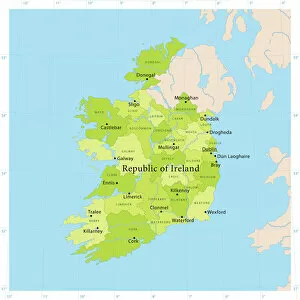
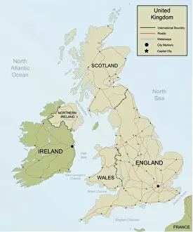
Ireland is an island nation located in the northwestern part of Europe. It covers an area of 70,273 square kilometers and has a population of approximately 4.9 million people. The country is divided into four provinces: Leinster, Munster, Connacht, and Ulster. Ireland's capital city is Dublin which is also its largest city. The official languages are Irish and English with Catholicism being the predominant religion. Ireland's economy relies heavily on exports particularly in pharmaceuticals, software development, and financial services sectors. Its natural beauty attracts millions of tourists annually to explore its rugged coastline, rolling hillsides dotted with sheep farms as well as ancient castles and ruins dating back centuries ago.
+
Our beautiful pictures are available as Framed Prints, Photos, Wall Art and Photo Gifts
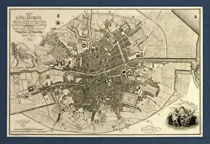
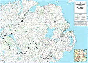
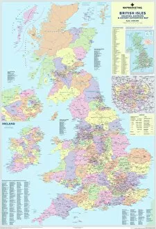
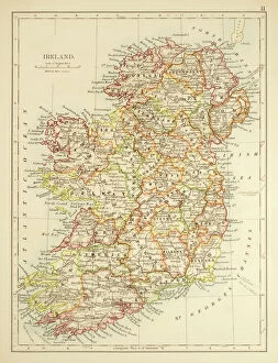
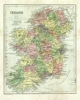
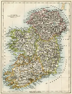
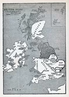
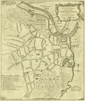
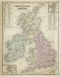
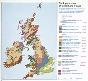
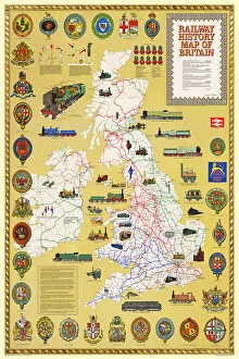
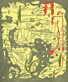
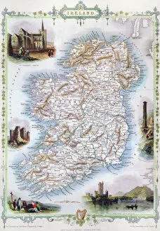
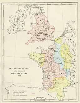
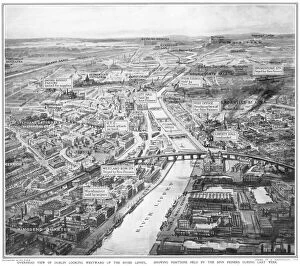
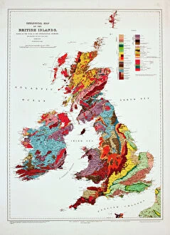
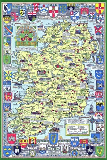
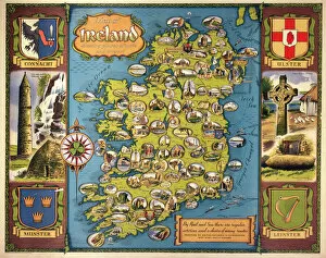
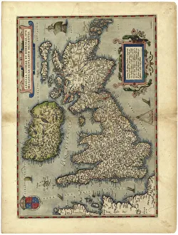
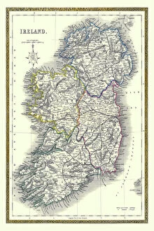
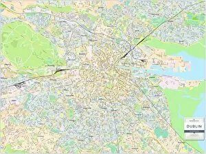
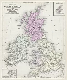
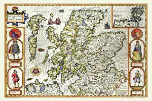
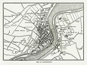
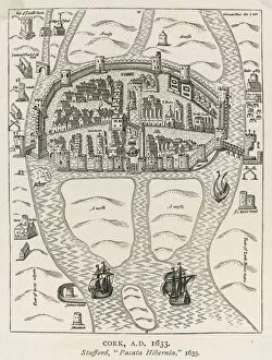
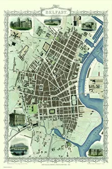
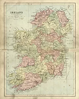
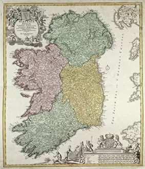
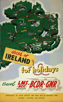
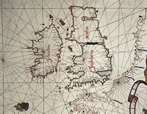
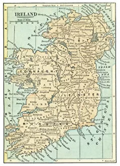
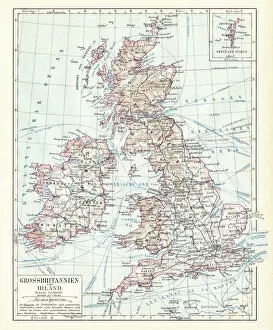
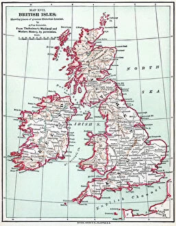
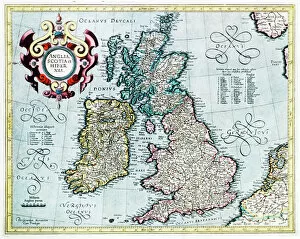
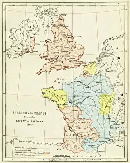
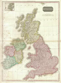
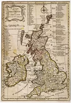
The Ireland collection from Media Storehouse is a stunning compilation of vintage maps and charts that depict the beautiful landscapes, cities, towns, and coastlines of Ireland. Our collection features an extensive range of prints that showcase different regions in Ireland, including Dublin City Centre, Cork Harbour, Galway Bay, Connemara National Park, Ring of Kerry and many more. These maps are carefully curated to provide a unique perspective on the history and geography of Ireland. They offer a glimpse into the past with their intricate details such as old road networks or historical landmarks. Our collection includes both black-and-white and color prints which can be customized to suit any decor style. Whether you're looking for wall art for your home or office space or searching for unique gifts for loved ones who have an affinity towards Irish culture or heritage - our collection has something special to offer everyone. These high-quality framed prints make perfect additions to any room's decor while also being educational pieces that spark conversations about Irish history and geography.
+
What are Ireland (Maps and Charts) art prints?
Ireland art prints are high-quality reproductions of antique maps and charts depicting the geography, topography, and history of Ireland. These prints showcase the intricate details of Ireland's landscape, including its mountains, rivers, lakes, cities, towns, and historical landmarks. We offer a fascinating glimpse into Ireland's past as well as its present-day layout. These art prints are perfect for anyone with an interest in Irish history or geography. They make great gifts for those who have a connection to Ireland or simply appreciate beautiful artwork. The prints come in a variety of sizes to suit any space or decor style. We offer a wide selection of these stunning art prints that can be easily ordered online from their website. Each print is made using high-quality materials to ensure longevity and durability over time. Whether you're looking for something to hang on your wall at home or in your office space, these Ireland art prints will add character and charm to any room they're displayed in.
+
What Ireland (Maps and Charts) art prints can I buy from Media Storehouse?
We offer a wide range of Ireland art prints that are perfect for adding a touch of Irish charm to your home or office. These prints feature detailed maps and charts of various regions in Ireland, showcasing the country's rich history and culture. Some popular options include vintage maps of Dublin, Cork, Galway, and Belfast, as well as antique charts depicting the coastlines and waterways around Ireland. You can also find contemporary designs featuring colorful illustrations of iconic landmarks like the Cliffs of Moher or the Giant's Causeway. Whether you're looking for a unique gift for an Irish friend or simply want to decorate your own space with some beautiful artwork inspired by this stunning country, we have plenty of options to choose from. With high-quality printing on premium paper stock, these art prints are sure to impress anyone who sees them.
+
How do I buy Ireland (Maps and Charts) art prints?
To purchase Ireland art prints from Media Storehouse, you can browse our extensive collection of prints online. Simply search for the specific print you are interested in or browse through their categories to find a print that catches your eye. Once you have found the perfect print, select the size and format that suits your needs. We offer a range of formats including framed prints, canvas prints, and photographic prints. You can also choose to customize your order by selecting different framing options or adding a mount. Once you have made your selection, simply add it to your cart and proceed to checkout. At this point, you will be prompted to enter your shipping information and payment details. Buying Ireland art prints from Media Storehouse is an easy process that allows you to bring beautiful artwork into your home or office with just a few clicks of a button.
+
How much do Ireland (Maps and Charts) art prints cost?
We offer a wide range of Ireland art prints that are available at varying prices. Our collection includes high-quality prints featuring detailed maps and charts of different regions in Ireland, showcasing the country's rich history and culture. Our pricing is competitive and affordable, ensuring that everyone can find something they love within their budget. We have options for every taste and preference, from vintage-style prints to modern designs. Each print is produced using premium materials to ensure longevity and durability. They are printed on high-quality paper with vibrant colors that will not fade over time. Whether you're looking for a unique piece of art to decorate your home or office or searching for the perfect gift for an Irish enthusiast, our Ireland art prints are an excellent choice. With our extensive selection of designs at various price points, you're sure to find the perfect print to suit your needs.
+
How will my Ireland (Maps and Charts) art prints be delivered to me?
We take great care in delivering your Ireland art prints to you. We use high-quality packaging materials to ensure that your print arrives in perfect condition. Depending on the size of the print, it will either be delivered flat or rolled up in a sturdy tube. We work with trusted courier partners who provide reliable and secure delivery services. Once your order has been dispatched, you will receive an email notification with tracking information so that you can keep track of its progress. We understand how important it is for our customers to receive their orders promptly and safely. That's why we strive to deliver all orders as quickly as possible while ensuring they are well-protected during transit. Whether you're ordering for yourself or as a gift for someone else, rest assured that your Ireland art prints will be delivered to you with the utmost care and attention from Media Storehouse.