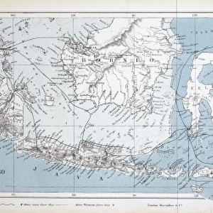
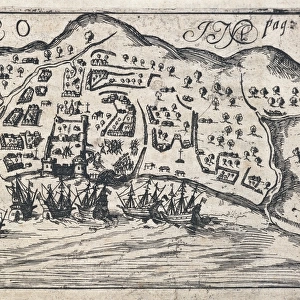
Krakatau map

![]()
Wall Art and Photo Gifts from Mary Evans Picture Library
Krakatau map
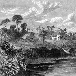
Figure 1 from Krakatau by R D M Verbeek showing the group of islands
Mary Evans Picture Library makes available wonderful images created for people to enjoy over the centuries
Media ID 8579815
© Mary Evans Picture Library 2015 - https://copyrighthub.org/s0/hub1/creation/maryevans/MaryEvansPictureID/10706336
Chart Eruption Geological Geology Geomorphology Indonesia Krakatoa Landform Southeast Asia Stratovolcano Volcanic Volcano Krakatau
EDITORS COMMENTS
1. Title: Krakatau Island Group: A Geological Testament to Indonesia's Volcanic Legacy Figure 1, taken from the seminal work "Krakatau" by R.D.M. Verbeek, presents a captivating map of the Krakatau island group, located in the Sunda Strait between Java and Sumatra in Indonesia. This geological chart offers a unique perspective on the complex volcanic landscape that has been shaped by the dynamic forces beneath the Earth's surface. The Krakatau archipelago, consisting of Krakatau, Rakata, Danan, and other smaller islands, is a testament to the power and beauty of volcanic activity. The map reveals the intricate details of the islands' geomorphology, with their landforms and stratovolcanoes clearly defined. The most prominent feature is the iconic Krakatau volcano, which gained global notoriety following its cataclysmic eruption in 1883. The eruption, one of the most violent and destructive in recorded history, caused widespread devastation and claimed thousands of lives. The map, however, also illustrates the islands' remarkable ability to recover and rebuild, as new land continues to emerge from the sea. The geology of the Krakatau island group is a fascinating study in plate tectonics, with the Eurasian and Indo-Australian plates colliding to create this unique volcanic landscape. The map serves as a valuable resource for geologists, volcanologists, and researchers, providing insights into the geological processes that have shaped the region and continue to influence its dynamic landscape. In summary, Figure 1 from "Krakatau" by R.D.M. Verbeek offers a captivating glimpse into the geological wonders of the Krakatau island group in Indonesia. The map's intricate details and historical significance make it an essential resource for anyone interested in the geology, geomorphology, and volcanic activity of Southeast Asia.
MADE IN THE USA
Safe Shipping with 30 Day Money Back Guarantee
FREE PERSONALISATION*
We are proud to offer a range of customisation features including Personalised Captions, Color Filters and Picture Zoom Tools
SECURE PAYMENTS
We happily accept a wide range of payment options so you can pay for the things you need in the way that is most convenient for you
* Options may vary by product and licensing agreement. Zoomed Pictures can be adjusted in the Cart.