Metal Print > Historic > World War I and II > Naval warfare
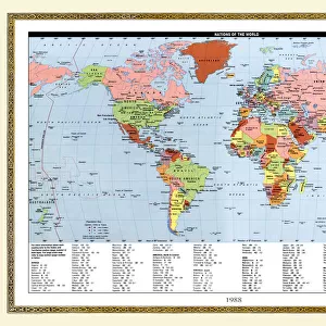
Metal Print : Map showing the naval bases of the North Sea during World War One, from The History of the Great War, pub.c.1919
![]()

Metal Prints from Fine Art Finder
Map showing the naval bases of the North Sea during World War One, from The History of the Great War, pub.c.1919
3502817 Map showing the naval bases of the North Sea during World War One, from The History of the Great War, pub.c.1919; (add.info.: Map showing the naval bases of the North Sea during World War One, from The History of the Great War, pub.c. 1919); Photo © Hilary Morgan
Media ID 38321178
© © Hilary Morgan / Bridgeman Images
1914 1918 Bases Chart North Showing
16"x20" (51x41cm) Metal Print
Step into history with our Metal Prints featuring vintage maps like this one: 'Map showing the naval bases of the North Sea during World War One' (1919). This stunning piece from Bridgeman Images is now available in a durable metal finish, perfect for adding a touch of nostalgia to any room. Bring home a piece of the past and relive moments that shaped our world.
Made with durable metal and luxurious printing techniques, our metal photo prints go beyond traditional canvases, adding a cool, modern touch to your space. Wall mount on back. Eco-friendly 100% post-consumer recycled ChromaLuxe aluminum surface. The thickness of the print is 0.045". Featuring a Scratch-resistant surface and Rounded corners. Backing hangers are attached to the back of the print and float the print 1/2-inch off the wall when hung, the choice of hanger may vary depending on size and International orders will come with Float Mount hangers only. Finished with a brilliant white high gloss surface for unsurpassed detail and vibrance. Printed using Dye-Sublimation and for best care we recommend a non-ammonia glass cleaner, water, or isopropyl (rubbing) alcohol to prevent harming the print surface. We recommend using a clean, lint-free cloth to wipe off the print. The ultra-hard surface is scratch-resistant, waterproof and weatherproof. Avoid direct sunlight exposure.
Made with durable metal and luxurious printing techniques, metal prints bring images to life and add a modern touch to any space
Estimated Image Size (if not cropped) is 40.6cm x 50.8cm (16" x 20")
Estimated Product Size is 41.2cm x 51.4cm (16.2" x 20.2")
These are individually made so all sizes are approximate
Artwork printed orientated as per the preview above, with portrait (vertical) orientation to match the source image.
FEATURES IN THESE COLLECTIONS
> Fine Art Finder
> America & American Art (+canada)
> Historic
> World War I and II
> Naval warfare
> Maps and Charts
> Early Maps
> Maps and Charts
> Related Images
> Maps and Charts
> World
> Services
> Royal Navy
EDITORS COMMENTS
This print showcases a detailed map depicting the naval bases of the North Sea during World War One, offering a glimpse into the strategic importance of these locations during one of the most significant conflicts in history. Published around 1919 as part of The History of the Great War, this image provides valuable insight into the military operations and movements that took place in this region during the early 20th century.
The intricate chart highlights key naval bases that played a crucial role in shaping the outcome of the war, serving as vital hubs for both offensive and defensive maneuvers. From major ports to smaller outposts, each location represented on this map tells a story of bravery, sacrifice, and determination exhibited by those who served their countries with unwavering dedication.
As we study this historical artifact, we are reminded of the immense impact that naval warfare had on shaping global events during World War One. The meticulous attention to detail and accuracy displayed in this map serve as a testament to the significance of understanding our past in order to navigate our future with wisdom and foresight.
MADE IN THE USA
Safe Shipping with 30 Day Money Back Guarantee
FREE PERSONALISATION*
We are proud to offer a range of customisation features including Personalised Captions, Color Filters and Picture Zoom Tools
SECURE PAYMENTS
We happily accept a wide range of payment options so you can pay for the things you need in the way that is most convenient for you
* Options may vary by product and licensing agreement. Zoomed Pictures can be adjusted in the Cart.


