Metal Print > Historic > Colonial history > Colonial art and artists
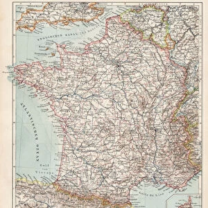
Metal Print : French map of territories controlled by the colonial empires in Africa, 1899
![]()

Metal Prints from Fine Art Finder
French map of territories controlled by the colonial empires in Africa, 1899
3480879 French map of territories controlled by the colonial empires in Africa, 1899; (add.info.: French map of territories controlled by the colonial empires in Africa 1899.); Universal History Archive/UIG
Media ID 38462002
© Universal History Archive/UIG / Bridgeman Images
Control Empires Imperialism Imperialist Territories
16"x20" (51x41cm) Metal Print
Uncover the complex history of African colonization with our Metal Prints from Media Storehouse. This striking print features a vintage map from Bridgeman Images, showcasing the territorial control of European powers on the continent in 1899. A thought-provoking addition to any room or office, this metal-printed masterpiece is sure to spark conversation and inspire curiosity.
Made with durable metal and luxurious printing techniques, our metal photo prints go beyond traditional canvases, adding a cool, modern touch to your space. Wall mount on back. Eco-friendly 100% post-consumer recycled ChromaLuxe aluminum surface. The thickness of the print is 0.045". Featuring a Scratch-resistant surface and Rounded corners. Backing hangers are attached to the back of the print and float the print 1/2-inch off the wall when hung, the choice of hanger may vary depending on size and International orders will come with Float Mount hangers only. Finished with a brilliant white high gloss surface for unsurpassed detail and vibrance. Printed using Dye-Sublimation and for best care we recommend a non-ammonia glass cleaner, water, or isopropyl (rubbing) alcohol to prevent harming the print surface. We recommend using a clean, lint-free cloth to wipe off the print. The ultra-hard surface is scratch-resistant, waterproof and weatherproof. Avoid direct sunlight exposure.
Made with durable metal and luxurious printing techniques, metal prints bring images to life and add a modern touch to any space
Estimated Image Size (if not cropped) is 40.6cm x 50.8cm (16" x 20")
Estimated Product Size is 41.2cm x 51.4cm (16.2" x 20.2")
These are individually made so all sizes are approximate
Artwork printed orientated as per the preview above, with portrait (vertical) orientation to match the source image.
FEATURES IN THESE COLLECTIONS
> Fine Art Finder
> Artists
> Edmund Dulac
> Europe
> United Kingdom
> Maps
> Historic
> Colonial history
> Colonial art and artists
> Maps and Charts
> British Empire Maps
> Maps and Charts
> Early Maps
> Maps and Charts
> Related Images
EDITORS COMMENTS
This striking print of a French map from 1899 showcases the vast territories controlled by colonial empires in Africa during the late nineteenth century. The intricate details and precise borders depicted on this map offer a glimpse into the complex web of imperialism that dominated the continent at that time.
As we study this historical document, we are reminded of the power dynamics at play as European nations like France and Britain sought to expand their influence and control over African lands. The lines drawn on this map represent more than just geographical boundaries – they symbolize the exploitation, oppression, and suffering inflicted upon countless African peoples by their colonial rulers.
The legacy of colonization continues to shape Africa's political, social, and economic landscape today. This image serves as a poignant reminder of the lasting impact of imperialism on the continent and its people.
Through examining artifacts like this French map, we gain a deeper understanding of our shared history and are challenged to confront uncomfortable truths about our past. It is essential that we acknowledge these injustices in order to move towards a more equitable future for all.
MADE IN THE USA
Safe Shipping with 30 Day Money Back Guarantee
FREE PERSONALISATION*
We are proud to offer a range of customisation features including Personalised Captions, Color Filters and Picture Zoom Tools
SECURE PAYMENTS
We happily accept a wide range of payment options so you can pay for the things you need in the way that is most convenient for you
* Options may vary by product and licensing agreement. Zoomed Pictures can be adjusted in the Cart.


