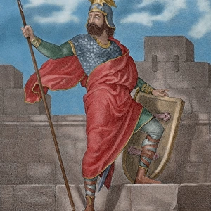
Metal Print > Maps and Charts > Early Maps
Metal Print : Map of Europe after the Peace of Luneville, 1801, from A Short History of the


![]()
Metal Prints from Fine Art Finder
Map of Europe after the Peace of Luneville, 1801, from A Short History of the
KW392528 Map of Europe after the Peace of Luneville, 1801, from A Short History of the English People by J. R. Green, published 1893 (colour litho) by English School, (19th century); Private Collection; Ken Welsh; English, out of copyright
Media ID 12871980
© www.bridgemanimages.com
Borders Countries Diagram Empires Frontiers Region Regions Territories Territory Treaty
16"x24" (61x41cm) Metal Print
Step back in time with our stunning Metal Prints featuring the Map of Europe after the Peace of Luneville, 1801. This intricately detailed map, sourced from A Short History of the English People by J.R. Green, showcases the political landscape of Europe following the historic peace treaty. The vibrant colors and sharp lines are beautifully preserved in our premium metal print, creating a captivating piece of historical art for your home or office. Add a touch of history to your space with this unique and eye-catching display.
Made with durable metal and luxurious printing techniques, our metal photo prints go beyond traditional canvases, adding a cool, modern touch to your space. Wall mount on back. Eco-friendly 100% post-consumer recycled ChromaLuxe aluminum surface. The thickness of the print is 0.045". Featuring a Scratch-resistant surface and Rounded corners. Backing hangers are attached to the back of the print and float the print 1/2-inch off the wall when hung, the choice of hanger may vary depending on size and International orders will come with Float Mount hangers only. Finished with a brilliant white high gloss surface for unsurpassed detail and vibrance. Printed using Dye-Sublimation and for best care we recommend a non-ammonia glass cleaner, water, or isopropyl (rubbing) alcohol to prevent harming the print surface. We recommend using a clean, lint-free cloth to wipe off the print. The ultra-hard surface is scratch-resistant, waterproof and weatherproof. Avoid direct sunlight exposure.
Made with durable metal and luxurious printing techniques, metal prints bring images to life and add a modern touch to any space
Estimated Product Size is 61.5cm x 41.2cm (24.2" x 16.2")
These are individually made so all sizes are approximate
Artwork printed orientated as per the preview above, with landscape (horizontal) orientation to match the source image.
FEATURES IN THESE COLLECTIONS
> Fine Art Finder
> Maps (celestial & Terrestrial)
> Fine Art Finder
> Schools
> English School
> Maps and Charts
> Early Maps
> Maps and Charts
> Related Images
EDITORS COMMENTS
This print showcases the "Map of Europe after the Peace of Luneville, 1801" a significant historical artifact from J. R. Green's renowned book, A Short History of the English People. Published in 1893, this color lithograph offers a fascinating glimpse into the political landscape of Europe during that time. The map vividly depicts the various countries, regions, and territories that emerged following the signing of the Peace of Luneville treaty. It serves as a visual representation of how borders and frontiers were redrawn after this pivotal moment in European history. The intricate details on this illustration provide valuable insights into different empires' extents and their influence over specific areas. As we delve into this image, we are transported back to an era where diplomacy played a crucial role in shaping nations' destinies. The Map of Europe after the Peace of Luneville not only highlights territorial changes but also symbolizes hope for lasting peace among these powerful entities. Preserved within a private collection and made available by Ken Welsh through Fine Art Finder at www. bridgemanimages. com, this photograph print allows us to appreciate both its artistic beauty and historical significance. It serves as a reminder that even centuries later, maps continue to be invaluable tools for understanding our world's complex pasts while offering glimpses into future possibilities.
MADE IN THE USA
Safe Shipping with 30 Day Money Back Guarantee
FREE PERSONALISATION*
We are proud to offer a range of customisation features including Personalised Captions, Color Filters and Picture Zoom Tools
SECURE PAYMENTS
We happily accept a wide range of payment options so you can pay for the things you need in the way that is most convenient for you
* Options may vary by product and licensing agreement. Zoomed Pictures can be adjusted in the Cart.