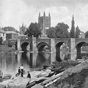
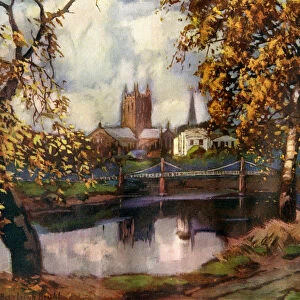
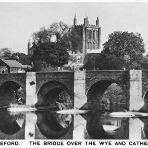
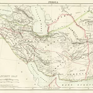
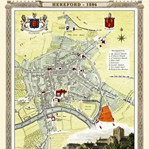
Metal Print > Europe > United Kingdom > England > Herefordshire > Worcester
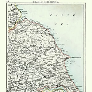
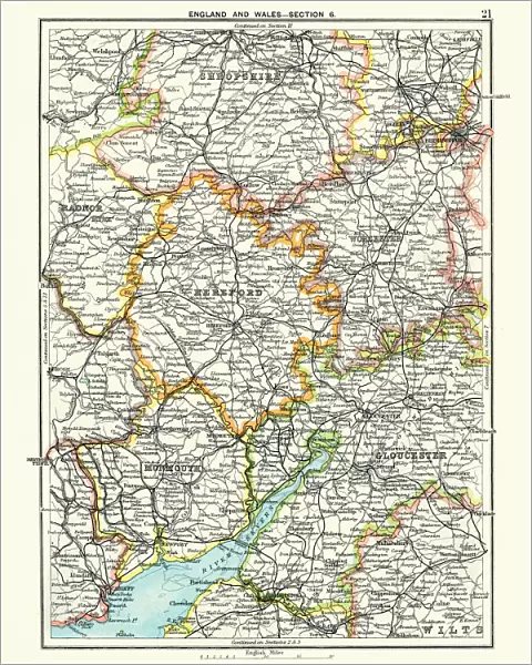
Metal Print : Antique map, Hereford, Worester, Monmouth, Gloucester, Shropshire, 19th Century


![]()
Metal Prints from Fine Art Storehouse
Antique map, Hereford, Worester, Monmouth, Gloucester, Shropshire, 19th Century
Antique map, Hereford, Worester, Monmouth, Gloucester, Shropshire, England and Wales 19th Century
Unleash your creativity and transform your space into a visual masterpiece!
duncan1890
Media ID 15107387
© This content is subject to copyright
1890s Colour Colours Equipment Gloucestershire Great Britain Image Created 1890 1899 Midlands Navigational Equipment Northern Europe Retro Shropshire Styles Supplies United Kingdom Victorian Wales Worcester Gloucester Hereford Herefordshire Monmouth Monmouthshire Obsolete South Wales South West England Worcestershire
16"x20" (51x41cm) Metal Print
Step back in time with our stunning Antique Map Metal Print from the Media Storehouse collection. This beautifully detailed map, created by duncan1890 from Fine Art Storehouse, showcases Hereford, Worcester, Monmouth, Gloucester, and Shropshire in England and Wales during the 19th century. Each metal print is meticulously crafted, giving the map a unique, three-dimensional appearance that adds depth and character to any space. Bring history into your home with this captivating and timeless piece.
Made with durable metal and luxurious printing techniques, our metal photo prints go beyond traditional canvases, adding a cool, modern touch to your space. Wall mount on back. Eco-friendly 100% post-consumer recycled ChromaLuxe aluminum surface. The thickness of the print is 0.045". Featuring a Scratch-resistant surface and Rounded corners. Backing hangers are attached to the back of the print and float the print 1/2-inch off the wall when hung, the choice of hanger may vary depending on size and International orders will come with Float Mount hangers only. Finished with a brilliant white high gloss surface for unsurpassed detail and vibrance. Printed using Dye-Sublimation and for best care we recommend a non-ammonia glass cleaner, water, or isopropyl (rubbing) alcohol to prevent harming the print surface. We recommend using a clean, lint-free cloth to wipe off the print. The ultra-hard surface is scratch-resistant, waterproof and weatherproof. Avoid direct sunlight exposure.
Made with durable metal and luxurious printing techniques, metal prints bring images to life and add a modern touch to any space
Estimated Image Size (if not cropped) is 40.6cm x 50.8cm (16" x 20")
Estimated Product Size is 41.2cm x 51.4cm (16.2" x 20.2")
These are individually made so all sizes are approximate
Artwork printed orientated as per the preview above, with portrait (vertical) orientation to match the source image.
FEATURES IN THESE COLLECTIONS
> Fine Art Storehouse
> Map
> Historical Maps
> Europe
> United Kingdom
> England
> Gloucester
> Europe
> United Kingdom
> England
> Gloucestershire
> Gloucester
> Europe
> United Kingdom
> England
> Gloucestershire
> Related Images
> Europe
> United Kingdom
> England
> Hereford
> Europe
> United Kingdom
> England
> Herefordshire
> Hereford
> Europe
> United Kingdom
> England
> Herefordshire
> Maps
> Europe
> United Kingdom
> England
> Herefordshire
> Related Images
> Europe
> United Kingdom
> England
> Herefordshire
> Worcester
> Europe
> United Kingdom
> England
> Maps
> Europe
> United Kingdom
> England
> Paintings
EDITORS COMMENTS
This antique map print takes us back to the 19th century, immersing us in the rich history and charm of Hereford, Worcester, Monmouth, Gloucester, and Shropshire. With its vibrant colors and intricate details, this lithograph captures the essence of a bygone era. The map showcases the beautiful counties of England and Wales with utmost precision. From the rolling hills of Gloucestershire to the picturesque landscapes of Worcestershire, every region is meticulously depicted. This illustration serves as a testament to the artistry involved in cartography during that time. As we gaze upon this vintage masterpiece, we are transported to an age when navigational equipment was simpler yet essential for exploration. The obsolete tools showcased here remind us of how far we have come in terms of technological advancements. With its old-fashioned style and Victorian aesthetic, this print evokes a sense of nostalgia for a time long gone. It allows us to appreciate our roots while marveling at how much has changed over the years. Whether you are an avid collector or simply intrigued by history's allure, this antique map print is sure to captivate your imagination. Let it transport you back in time as you explore these enchanting regions that hold countless stories from centuries past.
MADE IN THE USA
Safe Shipping with 30 Day Money Back Guarantee
FREE PERSONALISATION*
We are proud to offer a range of customisation features including Personalised Captions, Color Filters and Picture Zoom Tools
SECURE PAYMENTS
We happily accept a wide range of payment options so you can pay for the things you need in the way that is most convenient for you
* Options may vary by product and licensing agreement. Zoomed Pictures can be adjusted in the Cart.