Metal Print > Europe > United Kingdom > Northern Ireland > Railways
Metal Print : Ireland Political Road Map


![]()
Metal Prints from Map Marketing
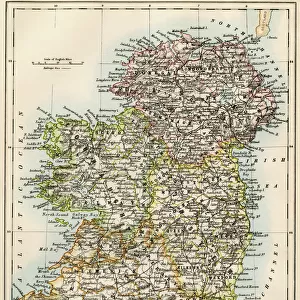
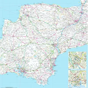
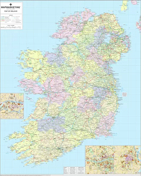
Ireland Political Road Map
A detailed road map of the island of Ireland colour coded by county/district. The detailed map base consists of a comprehensive road network and all main towns as a backdrop with each county shaded in a different colour for ease of identification. In Ulster the county boundaries are marked and named to include the county changes that came into effect in April 2015. Major railway lines, ferry routes and rivers are also shown. City centre street insets are included for Dublin, Belfast and Cork. Information concerning physical features, population, surface area and currency is shown in an inset box
Media ID 19949310
© Map Marketing Ltd 2019, Map derived from Collins Bartholomew Digital Data Collins Bartholomew Ltd 2020
Belfast Cork Counties Dublin Eire Motorways Northern Ireland
16"x20" (51x41cm) Metal Print
Made with durable metal and luxurious printing techniques, our metal photo prints go beyond traditional canvases, adding a cool, modern touch to your space. Wall mount on back. Eco-friendly 100% post-consumer recycled ChromaLuxe aluminum surface. The thickness of the print is 0.045". Featuring a Scratch-resistant surface and Rounded corners. Backing hangers are attached to the back of the print and float the print 1/2-inch off the wall when hung, the choice of hanger may vary depending on size and International orders will come with Float Mount hangers only. Finished with a brilliant white high gloss surface for unsurpassed detail and vibrance. Printed using Dye-Sublimation and for best care we recommend a non-ammonia glass cleaner, water, or isopropyl (rubbing) alcohol to prevent harming the print surface. We recommend using a clean, lint-free cloth to wipe off the print. The ultra-hard surface is scratch-resistant, waterproof and weatherproof. Avoid direct sunlight exposure.
Made with durable metal and luxurious printing techniques, metal prints bring images to life and add a modern touch to any space
Estimated Image Size (if not cropped) is 40.6cm x 50.8cm (16" x 20")
Estimated Product Size is 41.2cm x 51.4cm (16.2" x 20.2")
These are individually made so all sizes are approximate
Artwork printed orientated as per the preview above, with portrait (vertical) orientation to match the source image.
FEATURES IN THESE COLLECTIONS
> Arts
> Contemporary art
> Digital artwork
> Street art
> Arts
> Photorealistic artworks
> Detailed art pieces
> Masterful detailing in art
> Europe
> Republic of Ireland
> Cork
> Europe
> Republic of Ireland
> Dublin
> Europe
> Republic of Ireland
> Maps
> Europe
> United Kingdom
> Northern Ireland
> Belfast
> Europe
> United Kingdom
> Northern Ireland
> Maps
> Europe
> United Kingdom
> Northern Ireland
> Politics
> Europe
> United Kingdom
> Northern Ireland
> Posters
> Europe
> United Kingdom
> Northern Ireland
> Railways
MADE IN THE USA
Safe Shipping with 30 Day Money Back Guarantee
FREE PERSONALISATION*
We are proud to offer a range of customisation features including Personalised Captions, Color Filters and Picture Zoom Tools
SECURE PAYMENTS
We happily accept a wide range of payment options so you can pay for the things you need in the way that is most convenient for you
* Options may vary by product and licensing agreement. Zoomed Pictures can be adjusted in the Cart.