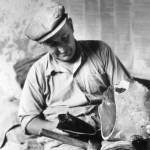
Metal Print > Arts > Artists > K > Thomas Kitchin
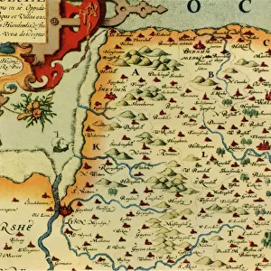
Metal Print : County of Suffolk by Christopher Saxton, c. 1569. Reprint dated c. 1650


![]()
Metal Prints from Sheffield City Archives
County of Suffolk by Christopher Saxton, c. 1569. Reprint dated c. 1650
SVFFOLCIAE COMITATVS ACC VRATA DESCRIPTIO, VNA CVM SINGVLIS HVNDREDIS ET FLVMINIBUS ET EODEM. Auctore Chriftophoro Saxton [c.1569] Printed and sould by P. Stent [c.1650] sould by Iohn Overton at ye white horfe without Newgate neore ye fountaine tavern.
From an original at Sheffield City Archives: VWM/MAPS/103
Sheffield City Archives and Local Studies Library has an unrivalled collection of images of Sheffield, England
Media ID 27958390
© Sheffield City Council - All Rights Reserved
Antique Map County Map Old Map Thomas Kitchin Beccles Brandon Bury St Edmunds Christopher Saxton Felixstowe Hadleigh Haverhill Ipswich Lowestoft Mildenhall Newmarket Stowmarket Sudbury Woodbridge
16"x20" (51x41cm) Metal Print
Step back in time with our exquisite Metal Print of the County of Suffolk, a rare reprint from the 1650s. This stunning piece showcases an intricately detailed map created by Christopher Saxton in 1569, with the original Latin title "SVFFOLCIAE COMITATVS ACC VRATA DESCRIPTIO, VNA CVM SINGVLIS HVNDREDIS ET FLVMINIBUS ET EODEM." This historic map, housed in Sheffield City Archives, has been beautifully reproduced onto a high-quality metal print, adding a unique and elegant touch to any space. The intricate lines and textures of the map are brought to life in vivid detail, making this a must-have for history enthusiasts, collectors, or anyone who appreciates the beauty of historical cartography.
Made with durable metal and luxurious printing techniques, our metal photo prints go beyond traditional canvases, adding a cool, modern touch to your space. Wall mount on back. Eco-friendly 100% post-consumer recycled ChromaLuxe aluminum surface. The thickness of the print is 0.045". Featuring a Scratch-resistant surface and Rounded corners. Backing hangers are attached to the back of the print and float the print 1/2-inch off the wall when hung, the choice of hanger may vary depending on size and International orders will come with Float Mount hangers only. Finished with a brilliant white high gloss surface for unsurpassed detail and vibrance. Printed using Dye-Sublimation and for best care we recommend a non-ammonia glass cleaner, water, or isopropyl (rubbing) alcohol to prevent harming the print surface. We recommend using a clean, lint-free cloth to wipe off the print. The ultra-hard surface is scratch-resistant, waterproof and weatherproof. Avoid direct sunlight exposure.
Made with durable metal and luxurious printing techniques, metal prints bring images to life and add a modern touch to any space
Estimated Image Size (if not cropped) is 50.8cm x 40.6cm (20" x 16")
Estimated Product Size is 51.4cm x 41.2cm (20.2" x 16.2")
These are individually made so all sizes are approximate
Artwork printed orientated as per the preview above, with landscape (horizontal) orientation to match the source image.
FEATURES IN THESE COLLECTIONS
> Arts
> Artists
> K
> Thomas Kitchin
> Arts
> Artists
> S
> Christopher Saxton
> Europe
> United Kingdom
> England
> Suffolk
> Beccles
> Europe
> United Kingdom
> England
> Suffolk
> Brandon
> Europe
> United Kingdom
> England
> Suffolk
> Bury St Edmunds
> Europe
> United Kingdom
> England
> Suffolk
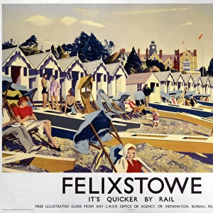
> Felixstowe
> Europe
> United Kingdom
> England
> Suffolk
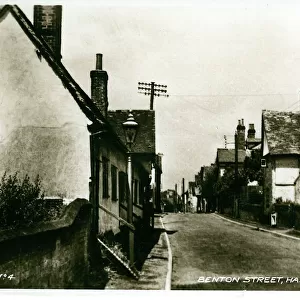
> Hadleigh
> Europe
> United Kingdom
> England
> Suffolk
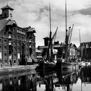
> Ipswich
> Europe
> United Kingdom
> England
> Suffolk
> Kesgrave
> Europe
> United Kingdom
> England
> Suffolk
> Lowestoft
> Sheffield City Archives
> Maps and Plans
> Christopher Saxton's County Maps
EDITORS COMMENTS
This print showcases the historic "County of Suffolk" map created by Christopher Saxton around 1569. The reprint, dated approximately 1650, offers a glimpse into the detailed cartographic work of Saxton during that era. The map, titled "SVFFOLCIAE COMITATVS ACC VRATA DESCRIPTIO, VNA CVM SINGVLIS HVNDREDIS ET FLVMINIBUS ET EODEM" provides an intricate depiction of Suffolk's geographical features. Printed and sold by P. Stent in the mid-17th century, this particular copy was later made available for purchase from Iohn Overton at ye white horse without Newgate near ye fountaine tavern. Preserved at Sheffield City Archives under reference number VWM/MAPS/103, this antique map is a valuable historical artifact. The map encompasses various notable locations within Suffolk such as Ipswich, Lowestoft, Bury St Edmunds, Haverhill, Felixstowe, Sudbury, Newmarket, Stowmarket, Kesgrave Beccles Mildenhall Woodbridge Brandon Hadleigh and more. It offers a fascinating insight into how these towns and cities were positioned centuries ago
MADE IN THE USA
Safe Shipping with 30 Day Money Back Guarantee
FREE PERSONALISATION*
We are proud to offer a range of customisation features including Personalised Captions, Color Filters and Picture Zoom Tools
SECURE PAYMENTS
We happily accept a wide range of payment options so you can pay for the things you need in the way that is most convenient for you
* Options may vary by product and licensing agreement. Zoomed Pictures can be adjusted in the Cart.