Mouse Mat > Europe > Belgium > Maps
Mouse Mat : Map titled Flandria


![]()
Home Decor from Fine Art Finder
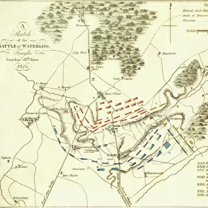
Map titled Flandria
1578206 Map titled Flandria'; (add.info.: Map titled Flandria by Frederik de wit (1630-1706). Dated 17th Century.); Universal History Archive/UIG
Media ID 38452446
© Universal History Archive/UIG / Bridgeman Images
1670s Flanders Belgians Belgium Belgian Frederik De Wit
Mouse Pad
Standard Size Mouse Pad 7.75" x 9..25". High density Neoprene w linen surface. Easy to clean, stain resistant finish. Rounded corners.
Archive quality photographic print in a durable wipe clean mouse mat with non slip backing. Works with all computer mice
Estimated Product Size is 23.7cm x 20.2cm (9.3" x 8")
These are individually made so all sizes are approximate
Artwork printed orientated as per the preview above, with landscape (horizontal) or portrait (vertical) orientation to match the source image.
FEATURES IN THESE COLLECTIONS
> Fine Art Finder
> Temp Classification
> Europe
> Belgium
> Related Images
> Maps and Charts
> Early Maps
> Maps and Charts
> Related Images
EDITORS COMMENTS
This stunning print of a 17th-century map titled 'Flandria' by Frederik de Wit transports us back in time to the intricate world of cartography. The detailed depiction of Flanders, Belgium, showcases the skill and artistry of de Wit, a renowned mapmaker of his time.
As we gaze upon this historical treasure, we are reminded of the importance of maps in shaping our understanding of the world. Each line and symbol on this map tells a story - from trade routes to political boundaries, every detail is meticulously crafted to provide a comprehensive view of Flanders in the 1670s.
The rich history and culture of Belgium come alive through this beautifully preserved piece, offering us a glimpse into the past and allowing us to appreciate the craftsmanship that went into creating such works of art. The delicate calligraphy and ornate illustrations add an element of beauty to what is ultimately a practical tool for navigation and exploration.
In today's digital age, where maps are readily available at our fingertips, it is humbling to see how much effort was put into creating these hand-drawn masterpieces centuries ago. This print serves as both a historical artifact and a work of art, reminding us of the enduring power and beauty found in traditional cartography.
MADE IN THE USA
Safe Shipping with 30 Day Money Back Guarantee
FREE PERSONALISATION*
We are proud to offer a range of customisation features including Personalised Captions, Color Filters and Picture Zoom Tools
SECURE PAYMENTS
We happily accept a wide range of payment options so you can pay for the things you need in the way that is most convenient for you
* Options may vary by product and licensing agreement. Zoomed Pictures can be adjusted in the Cart.