Mouse Mat > Fine Art Storehouse > Map
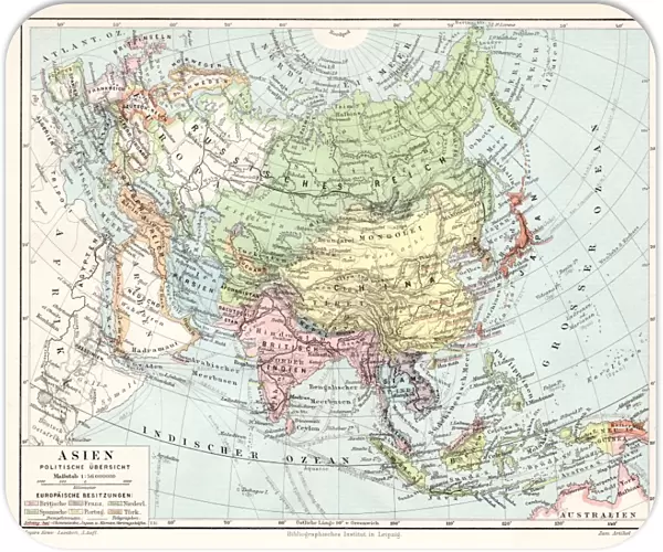
Mouse Mat : Asia political map 1895
![]()

Home Decor from Fine Art Storehouse
Asia political map 1895
Meyers Konversations-Lexikon. Ein Nachschlagewerk des allgemeinen Wissens, 5th edition 17 volumes Bibliographisches Institut - Leipzig 1895-1897
Unleash your creativity and transform your space into a visual masterpiece!
THEPALMER
Media ID 13611841
© This content is subject to copyright
Atlas Mythological Figure East Asia India Indochina Japan Paper Vietnam World Map China East Asia
Mouse Pad
Standard Size Mouse Pad 7.75" x 9..25". High density Neoprene w linen surface. Easy to clean, stain resistant finish. Rounded corners.
Archive quality photographic print in a durable wipe clean mouse mat with non slip backing. Works with all computer mice
Estimated Product Size is 23.7cm x 20.2cm (9.3" x 8")
These are individually made so all sizes are approximate
Artwork printed orientated as per the preview above, with landscape (horizontal) or portrait (vertical) orientation to match the source image.
FEATURES IN THESE COLLECTIONS
> Fine Art Storehouse
> The Magical World of Illustration
> Palmer Illustrated Collection
> Fine Art Storehouse
> Map
> Historical Maps
EDITORS COMMENTS
This print showcases an exquisite piece of history - the Asia political map from 1895. Taken from Meyers Konversations-Lexikon, a renowned encyclopedia of general knowledge, this particular edition was published in Leipzig between 1895 and 1897. The map itself is a stunning example of cartography, meticulously engraved on paper with intricate details. The map encompasses various regions including Indochina, East Asia, China, Japan, Vietnam, and India. It offers a glimpse into the geopolitical landscape of that era when colonial powers were vying for control over vast territories across the continent. With its antique charm and rich illustration style, it transports us back to a time where physical geography played a crucial role in shaping world politics. What makes this print even more intriguing is the presence of an atlas mythological figure adorning its borders. This mythical character adds an air of mystique to the already enchanting artwork. Whether you are a lover of history or simply appreciate fine artistry, this vintage map print is sure to captivate your imagination. Display it proudly on your wall as both an educational tool and a conversation starter about our ever-evolving world.
MADE IN THE USA
Safe Shipping with 30 Day Money Back Guarantee
FREE PERSONALISATION*
We are proud to offer a range of customisation features including Personalised Captions, Color Filters and Picture Zoom Tools
SECURE PAYMENTS
We happily accept a wide range of payment options so you can pay for the things you need in the way that is most convenient for you
* Options may vary by product and licensing agreement. Zoomed Pictures can be adjusted in the Cart.


