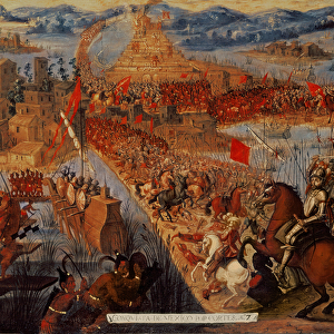
Mouse Mat > Arts > Artists > M > Mexican School Mexican School
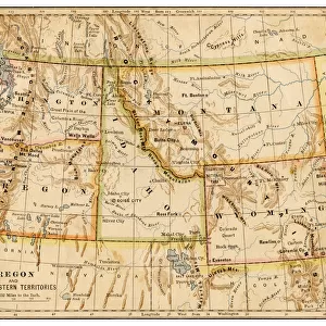
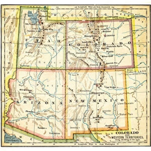
Mouse Mat : Map of Pacific states USA 1883


![]()
Home Decor from Fine Art Storehouse
Map of Pacific states USA 1883
Warrens Common School Geography
Unleash your creativity and transform your space into a visual masterpiece!
THEPALMER
Media ID 13669327
© This content is subject to copyright
California Colorado Montana Western Usa New Mexico North America Oregon Us State Pacific Ocean Paper Washington Dc Wyoming
Mouse Pad
Standard Size Mouse Pad 7.75" x 9..25". High density Neoprene w linen surface. Easy to clean, stain resistant finish. Rounded corners.
Archive quality photographic print in a durable wipe clean mouse mat with non slip backing. Works with all computer mice
Estimated Product Size is 23.7cm x 20.2cm (9.3" x 8")
These are individually made so all sizes are approximate
Artwork printed orientated as per the preview above, with landscape (horizontal) or portrait (vertical) orientation to match the source image.
FEATURES IN THESE COLLECTIONS
> Fine Art Storehouse
> The Magical World of Illustration
> Palmer Illustrated Collection
> Fine Art Storehouse
> Map
> Historical Maps
> Fine Art Storehouse
> Map
> USA Maps
> Animals
> Mammals
> Cricetidae
> California Mouse
> Animals
> Mammals
> Muridae
> Western Mouse
> Arts
> Artists
> M
> Mexican School Mexican School
> Arts
> Artists
> O
> Oceanic Oceanic
> Maps and Charts
> Related Images
> North America
> Mexico
> Related Images
> North America
> Related Images
> North America
> United States of America
> California
> Related Images
> North America
> United States of America
> Colorado
> Related Images
EDITORS COMMENTS
This print takes us back in time to the year 1883, showcasing a beautifully detailed "Map of Pacific states USA". A relic from Warrens Common School Geography, this antique piece of cartography offers a glimpse into the past and invites us to explore the vast landscapes of North America. The horizontal composition allows for an immersive experience as we traverse across the United States. The map highlights various states including California, Washington DC, Oregon, Colorado, Montana, Wyoming, and New Mexico. Its intricate engravings capture not only geographical boundaries but also physical features such as rivers and mountains. The expertly illustrated details bring depth and life to this historical artifact. Printed on aged paper with warm hues reminiscent of bygone eras, this image exudes nostalgia. It serves as a reminder of how far we have come in understanding our world's geography while appreciating the craftsmanship that went into creating maps during a time when technology was limited. As we gaze upon this enchanting piece from THEPALMER collection at Fine Art Storehouse, we are transported back to an era where exploration and discovery were paramount. This photograph preserves history within its frame and reminds us of the importance of cherishing our past while embracing progress towards an ever-evolving future.
MADE IN THE USA
Safe Shipping with 30 Day Money Back Guarantee
FREE PERSONALISATION*
We are proud to offer a range of customisation features including Personalised Captions, Color Filters and Picture Zoom Tools
SECURE PAYMENTS
We happily accept a wide range of payment options so you can pay for the things you need in the way that is most convenient for you
* Options may vary by product and licensing agreement. Zoomed Pictures can be adjusted in the Cart.