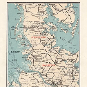
Mouse Mat > Europe > Germany > Maps
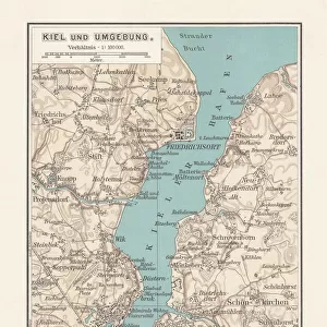
Mouse Mat : Old city map of Kiel, Schleswig-Holstein, Germany, lithograph, published 1897

![]()
Home Decor from Fine Art Storehouse
Old city map of Kiel, Schleswig-Holstein, Germany, lithograph, published 1897
Old city map of Kiel - capital city of northern German state Schleswig-Holstein. Lithograph, published in 1897
Unleash your creativity and transform your space into a visual masterpiece!
ZU_09
Media ID 18292295
Mouse Pad
Standard Size Mouse Pad 7.75" x 9..25". High density Neoprene w linen surface. Easy to clean, stain resistant finish. Rounded corners.
Archive quality photographic print in a durable wipe clean mouse mat with non slip backing. Works with all computer mice
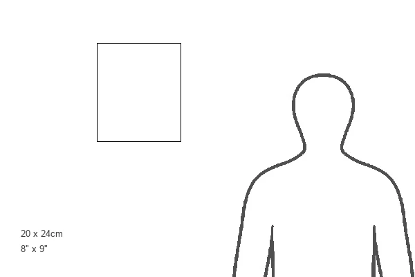
Estimated Image Size (if not cropped) is 16.9cm x 23.7cm (6.7" x 9.3")
Estimated Product Size is 20.2cm x 23.7cm (8" x 9.3")
These are individually made so all sizes are approximate
Artwork printed orientated as per the preview above, with portrait (vertical) orientation to match the source image.
FEATURES IN THESE COLLECTIONS
> Fine Art Storehouse
> Map
> Historical Maps
> Maps and Charts
> Related Images
EDITORS COMMENTS
This print showcases an exquisite old city map of Kiel, the capital city of Schleswig-Holstein in Germany. The lithograph, published in 1897, offers a fascinating glimpse into the historical layout and intricate details of this charming northern German state. With its delicate lines and meticulous craftsmanship, this vintage map is a true testament to the artistry and precision of cartography from that era. As we delve into this mesmerizing piece, our eyes are drawn to the fine contours tracing every street and alleyway within Kiel's boundaries. Each building is meticulously depicted with remarkable accuracy, allowing us to envision how the cityscape appeared more than a century ago. The map's subtle color palette adds depth and character to its overall composition, evoking a sense of nostalgia for times long gone. Beyond its aesthetic appeal lies an invaluable resource for historians and enthusiasts alike. This detailed representation provides valuable insights into Kiel's urban development during a pivotal period in history. It serves as a window into the past – offering glimpses into architectural styles prevalent at that time while also highlighting key landmarks that have stood the test of time. Whether you're an avid collector or simply appreciate historical artifacts, this stunning print transports you back in time to experience Kiel's rich heritage firsthand. Its timeless beauty makes it an ideal addition to any space seeking both elegance and historical significance.
MADE IN THE USA
Safe Shipping with 30 Day Money Back Guarantee
FREE PERSONALISATION*
We are proud to offer a range of customisation features including Personalised Captions, Color Filters and Picture Zoom Tools
SECURE PAYMENTS
We happily accept a wide range of payment options so you can pay for the things you need in the way that is most convenient for you
* Options may vary by product and licensing agreement. Zoomed Pictures can be adjusted in the Cart.