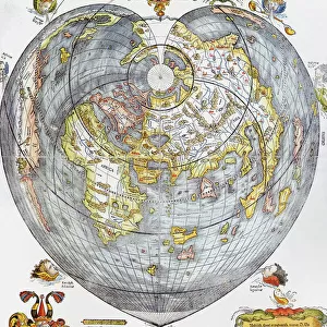
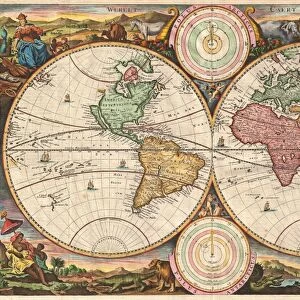
Mouse Mat : 1707, Homann and Doppelmayr Map of the Moon, topography, cartography, geography, land


![]()
Home Decor from Liszt Collection
1707, Homann and Doppelmayr Map of the Moon, topography, cartography, geography, land
1707, Homann and Doppelmayr Map of the Moon
Liszt Collection of nineteenth-century engravings and images to browse and enjoy
Media ID 14006575
© Artokoloro Quint Lox Limited
1707 Antique Map Latitude Longitude Mappa Mundi Old Antique Plan Old Antique View Ols Antique Map Rare Old Maps Topo
Mouse Pad
Standard Size Mouse Pad 7.75" x 9..25". High density Neoprene w linen surface. Easy to clean, stain resistant finish. Rounded corners.
Archive quality photographic print in a durable wipe clean mouse mat with non slip backing. Works with all computer mice
Estimated Product Size is 23.7cm x 20.2cm (9.3" x 8")
These are individually made so all sizes are approximate
Artwork printed orientated as per the preview above, with landscape (horizontal) or portrait (vertical) orientation to match the source image.
EDITORS COMMENTS
This print showcases the remarkable "1707, Homann and Doppelmayr Map of the Moon" a true masterpiece in topography, cartography, and geography. With intricate details meticulously etched onto its surface, this ancient map offers a fascinating glimpse into our lunar neighbor's mesmerizing landscape. The map's exquisite illustration transports us back to an era when exploration and discovery were at their peak. Its geographic accuracy is truly commendable, as it presents the moon's diverse regions with precision. The carefully plotted grid lines reveal latitude and longitude coordinates that aid in navigation across this celestial body. As we gaze upon this vintage artifact, we are reminded of how far humanity has come in unraveling the mysteries of space. This old antique plan serves as a testament to our ancestors' relentless pursuit of knowledge about worlds beyond our own. Adorned with historical charm, this decorative piece takes us on a journey through time. Its aged appearance adds an air of authenticity while evoking nostalgia for bygone eras. A rare find indeed, this antique map from Homann and Doppelmayr holds immense value for collectors and enthusiasts alike. Whether you're an avid historian or simply fascinated by the wonders of our universe, this stunning print will transport you to another world – one where imagination meets scientific curiosity. Let your eyes wander across its delicate contours and let your mind embark on an extraordinary lunar expedition like no other.
MADE IN THE USA
Safe Shipping with 30 Day Money Back Guarantee
FREE PERSONALISATION*
We are proud to offer a range of customisation features including Personalised Captions, Color Filters and Picture Zoom Tools
SECURE PAYMENTS
We happily accept a wide range of payment options so you can pay for the things you need in the way that is most convenient for you
* Options may vary by product and licensing agreement. Zoomed Pictures can be adjusted in the Cart.