Fraud Blocker Skip to main content

Mouse Mat > Africa > Uganda > Maps

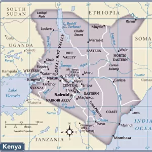
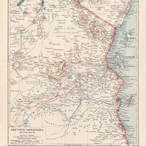
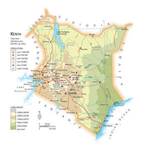
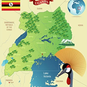
Mouse Mat : Map of Kenya and Uganda

Map of Kenya and Uganda


We accept all major credit cards


Canvas Prints
Fine Art Prints
Metal Prints
Home Decor


Mary Evans Prints Online

Home Decor from Mary Evans Picture Library

Map of Kenya and Uganda

Map of Kenya Uganda boundary, 1926 Date: 1926

Mary Evans Picture Library makes available wonderful images created for people to enjoy over the centuries

Media ID 7401295

© Mary Evans Picture Library 2015 - https://copyrighthub.org/s0/hub1/creation/maryevans/MaryEvansPictureID/10473848

Maps


Mouse Pad

Standard Size Mouse Pad 7.75" x 9..25". High density Neoprene w linen surface. Easy to clean, stain resistant finish. Rounded corners.

Archive quality photographic print in a durable wipe clean mouse mat with non slip backing. Works with all computer mice

Estimated Product Size is 20.2cm x 23.7cm (8" x 9.3")

These are individually made so all sizes are approximate

Artwork printed orientated as per the preview above, with portrait (vertical) orientation to match the source image.


FEATURES IN THESE COLLECTIONS

> Mary Evans Prints Online > National Archives

> Africa > Kenya > Maps

> Africa > Kenya > Related Images

> Africa > Related Images

> Africa > Uganda > Maps

> Africa > Uganda > Related Images

> Maps and Charts > Africa

> Maps and Charts > Related Images


MADE IN THE USA
Safe Shipping with 30 Day Money Back Guarantee

FREE PERSONALISATION*
We are proud to offer a range of customisation features including Personalised Captions, Color Filters and Picture Zoom Tools

SECURE PAYMENTS
We happily accept a wide range of payment options so you can pay for the things you need in the way that is most convenient for you

* Options may vary by product and licensing agreement. Zoomed Pictures can be adjusted in the Cart.


public
Made in USA
thumb_up
Professional quality finish
diamond
Made with high-grade materials
inventory_2
Carefully packed to aid safe arrival


Related Images


Kenya country map
Kenya country map
Africa Political Map
Uganda country map
Uganda country map
Map of formerly German colony East Africa, lithograph, published 1897
The Amazon
The Amazon
Map of Kenya
Map of Kenya
Africa Political Map
Political Map of Africa
Uganda, Relief Map with Border and Mask
Cartoon map of Kenya
Cartoon map of Uganda
The native market at Port Florence, Lake Victoria, Kenya, c1901-c1903(?). Artist: Keystone View Company

+

Shipping

+

Choices

+

Reviews

+

Guaranteed


Related Collections


National Archives
National Archives
Browse 768 Prints
Africa Related Images
Browse 40,639 Prints
Kenya Related Images
Browse 5,848 Prints
Uganda Related Images
Browse 866 Prints
Maps
Maps
Browse 23 Prints
Maps
Maps
Browse 13 Prints
Maps and Charts Related Images
Browse 46,659 Prints
Africa
Africa
Browse 1,604 Prints