Mouse Mat > Europe > United Kingdom > England > Kent > Monkton
Mouse Mat : 1840s Victorian Map of Isle Of Thanet


![]()
Home Decor from Mary Evans Picture Library
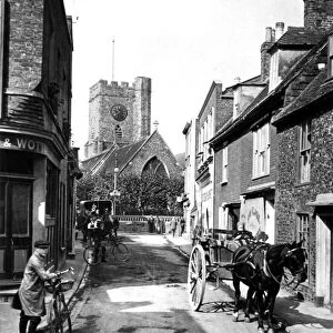
1840s Victorian Map of Isle Of Thanet
Mary Evans Picture Library makes available wonderful images created for people to enjoy over the centuries
Media ID 32350834
© The Keasbury-Gordon Photograph Archive / Mary Evans
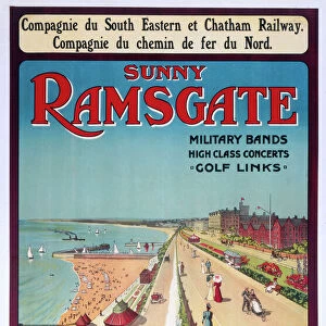
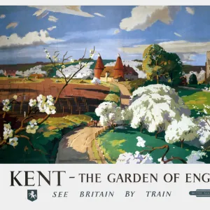
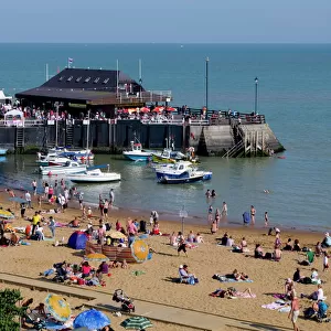
1840s Birchington Broadstairs Isle Margate Minster Peters Railways Ramsgate Sandwich Thanet Monkton
Mouse Pad
Standard Size Mouse Pad 7.75" x 9..25". High density Neoprene w linen surface. Easy to clean, stain resistant finish. Rounded corners.
Archive quality photographic print in a durable wipe clean mouse mat with non slip backing. Works with all computer mice
Estimated Image Size (if not cropped) is 23.7cm x 19.8cm (9.3" x 7.8")
Estimated Product Size is 23.7cm x 20.2cm (9.3" x 8")
These are individually made so all sizes are approximate
Artwork printed orientated as per the preview above, with landscape (horizontal) orientation to match the source image.
FEATURES IN THESE COLLECTIONS
> Mary Evans Prints Online
> New Images July 2023
> Animals
> Mammals
> Muridae
> Peters Mouse
> Europe
> United Kingdom
> England
> Kent
> Birchington
> Europe
> United Kingdom
> England
> Kent
> Broadstairs
> Europe
> United Kingdom
> England
> Kent
> Margate
> Europe
> United Kingdom
> England
> Kent
> Minster
> Europe
> United Kingdom
> England
> Kent
> Monkton
> Europe
> United Kingdom
> England
> Kent
> Ramsgate
> Europe
> United Kingdom
> England
> Kent
> Related Images
> Europe
> United Kingdom
> England
> Kent
> Sandwich
> Europe
> United Kingdom
> England
> Kent
> St Peters
EDITORS COMMENTS
Step back in time with this stunning print of a 1840s Victorian map of the Isle of Thanet. This vintage lantern slide captures the intricate details and charm of a bygone era, showcasing the towns and villages that make up this historic region in Kent, England.
From Monkton to Ramsgate, Minster to Sandwich, Broadstairs to Margate, Birchington to St. Peters, every corner of the Isle is meticulously depicted on this map. The Edwardian style adds an extra layer of nostalgia to this piece, transporting you back to a simpler time when horse-drawn carriages roamed the streets and steam trains chugged along the railways.
As you study each line and contour on this old county map, you can almost hear the sounds of bustling markets and seaside promenades that once filled these charming towns. Whether you have roots in Thanet or simply appreciate historical cartography, this print is sure to spark your curiosity and imagination.
Add a touch of vintage elegance to your home or office with this unique piece from The Keasbury-Gordon Photograph Archive Collection. Let it serve as a reminder of days gone by and a testament to the enduring beauty of Victorian craftsmanship.
MADE IN THE USA
Safe Shipping with 30 Day Money Back Guarantee
FREE PERSONALISATION*
We are proud to offer a range of customisation features including Personalised Captions, Color Filters and Picture Zoom Tools
SECURE PAYMENTS
We happily accept a wide range of payment options so you can pay for the things you need in the way that is most convenient for you
* Options may vary by product and licensing agreement. Zoomed Pictures can be adjusted in the Cart.