
Maps Collection
The Dominican Republic is a Caribbean nation located on the island of Hispaniola, which it shares with Haiti, and is known for its beautiful beaches
Choose a picture from our Maps Collection for your Wall Art and Photo Gifts
40 items


All Professionally Made to Order for Quick Shipping
-
Maps Collection
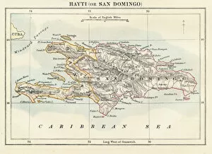
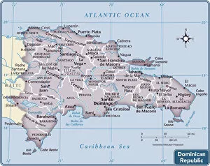
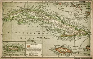
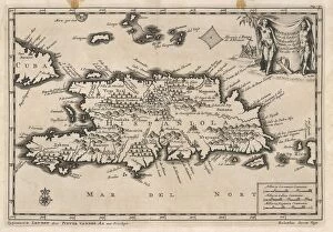
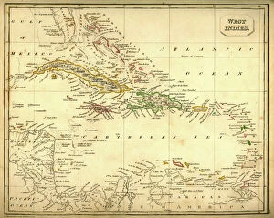
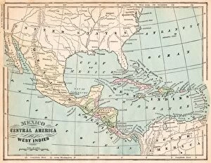
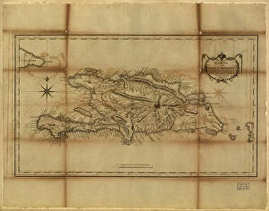
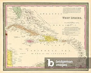
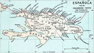
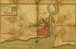
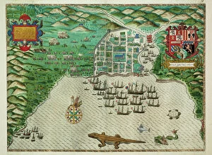
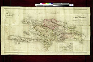
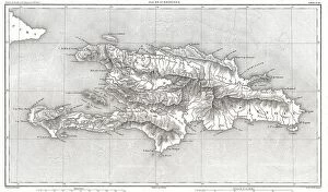
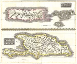
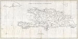
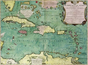
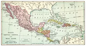
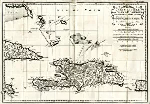
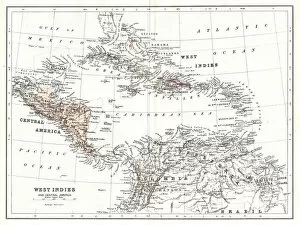
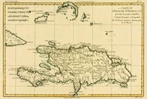
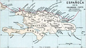
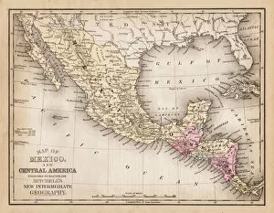
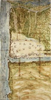
The Dominican Republic is a Caribbean nation located on the island of Hispaniola, which it shares with Haiti, and is known for its beautiful beaches, lush rainforests and mountainous terrain. Maps of the Dominican Republic show its varied topography, including the Cordillera Central mountain range that runs through the center of the country and divides it into two regions: Cibao in the north and Enriquillo in the south. The country also has numerous rivers, lakes and bays along its coasts. Its capital city is Santo Domingo, located on the southern coast near Haiti. The Dominican Republic has a tropical climate with warm temperatures year-round and an abundance of sunshine throughout much of the year. Its diverse landscape makes it an ideal destination for outdoor activities like hiking, swimming or exploring its many national parks.
+
Our beautiful pictures are available as Framed Prints, Photos, Wall Art and Photo Gifts
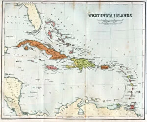
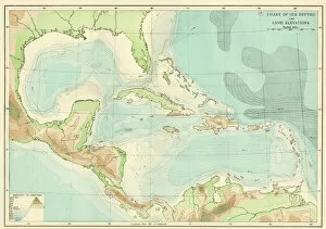
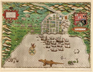
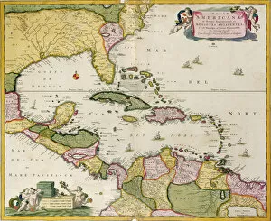
Media Storehouse offers a collection of Maps of Dominican Republic North America that are perfect for wall art and framed prints. Our collection includes an array of maps, ranging from vintage to modern, showcasing the geography and topography of the Dominican Republic. These maps provide insight into the country's history, culture, and natural resources. The Maps of Dominican Republic North America collection is ideal for those who love travel or have a special connection to this Caribbean nation. Each map is carefully selected by our team of experts to ensure high-quality printing on premium paper stock. Whether you're looking to decorate your home with unique artwork or want to give a thoughtful gift to someone special, these maps make an excellent choice. With their intricate details and vibrant colors, they are sure to capture attention and spark conversation wherever they are displayed.
+
What are Maps of Dominican Republic North America art prints?
Maps of Dominican Republic North America art prints are high-quality reproductions of maps that depict the geography and topography of the Dominican Republic. These art prints are created using advanced printing techniques to ensure accurate reproduction of details, colors, and textures. They are printed on premium quality paper or canvas, making them suitable for framing and display in homes, offices, or public spaces. These maps showcase the natural beauty and diversity of the Dominican Republic's landscape, including its mountains, rivers, forests, beaches, and cities. They also provide valuable information about the country's history, culture, economy, and infrastructure. Whether you're a traveler looking to explore this Caribbean nation or an art lover seeking unique wall decor for your home or office space – Maps of Dominican Republic North America art prints offer something special for everyone. With their stunning visual appeal and informative content – these artworks make great gifts for friends or family members who share a passion for travel or geography.
+
What Maps of Dominican Republic North America art prints can I buy from Media Storehouse?
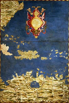
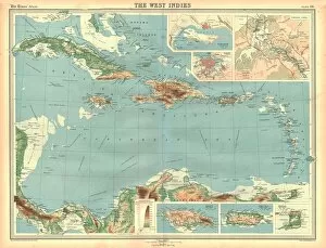
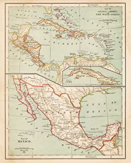
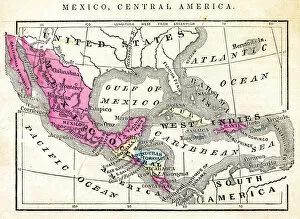
We offer a wide range of art prints featuring maps of the Dominican Republic in North America. These maps showcase the country's geography, topography, and political boundaries, providing an informative and decorative addition to any space. You can choose from vintage or modern designs that vary in color schemes, styles, and sizes to suit your preferences. Some popular options include detailed road maps that highlight major cities and landmarks such as Santo Domingo, Punta Cana or Puerto Plata; satellite imagery showcasing natural features like mountains ranges or rivers; historical maps depicting colonial times with Spanish influence on architecture and culture. Additionally, Media Storehouse also provides custom framing services for your chosen print to match your home decor style. Whether you're looking for a unique gift idea or want to add some character to your living room or office space, we have an extensive collection of Dominican Republic North America map art prints that are sure to impress anyone who sees them.
+
How do I buy Maps of Dominican Republic North America art prints?
To buy maps of Dominican Republic North America art prints from Media Storehouse, you can browse our online gallery and select the print that you like. We offer a wide variety of options to choose from, including different sizes and framing options. Once you have made your selection, simply add it to your cart and proceed to checkout. During the checkout process, you will be prompted to enter your shipping information and payment details. We accept various forms of payment, such as credit cards and PayPal. After completing your purchase, your map art print will be printed on high-quality paper using state-of-the-art printing technology. It will then be carefully packaged for shipment to ensure its safe arrival at your doorstep. Whether you are looking for a decorative piece for your home or office or a unique gift for someone special, buying maps of Dominican Republic North America art prints from Media Storehouse is an easy and convenient way to get exactly what you want.
+
How much do Maps of Dominican Republic North America art prints cost?
The cost of Maps of Dominican Republic North America art prints can vary depending on various factors such as the size, quality, and type of print. Generally, prices may range from affordable to high-end options. However, it is important to note that the price does not necessarily reflect the value or beauty of the artwork. We offer a wide selection of Maps of Dominican Republic North America art prints that are perfect for adding a touch of elegance and sophistication to any space. These prints feature intricate details and vibrant colors that capture the essence and beauty of this stunning location. Whether you're looking for a small print or a large statement piece, we have something for everyone's taste and budget. With our extensive collection and competitive pricing, finding your ideal Map of Dominican Republic North America art print has never been easier.
+
How will my Maps of Dominican Republic North America art prints be delivered to me?
Your Maps of Dominican Republic North America art prints will be delivered to you in a safe and secure manner. The delivery method will depend on the size and quantity of your order. Smaller orders may be shipped in sturdy cardboard envelopes, while larger orders may require more robust packaging. Regardless of the delivery method, all packages are carefully prepared to ensure that your art prints arrive at their destination undamaged. You can expect your package to include protective materials such as bubble wrap or foam inserts. Once your package is ready for shipment, it will be sent out via a reputable courier service. You will receive tracking information so that you can monitor the progress of your shipment until it arrives at its final destination. You can rest assured that Media Storehouse takes great care in delivering high-quality art prints to our customers around the world.