Photo Mug > Europe > Belgium > Maps
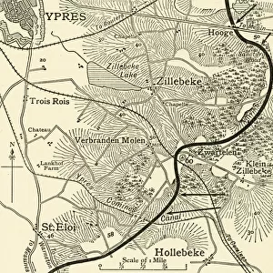
Photo Mug : Map Showing The Ypres Salient Before And After The Second Battle Of Ypres April And May 13 1915. From The Great World War A History Volume Iii, Published 1916


![]()
Home Decor from Design Pics
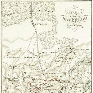
Map Showing The Ypres Salient Before And After The Second Battle Of Ypres April And May 13 1915. From The Great World War A History Volume Iii, Published 1916
Design Pics offers Distinctively Different Imagery representing over 1,500 contributors
Media ID 18190122
© Ken Welsh / Design Pics
Battle Belgian Belgium Fields First Flanders Flemish Great Second World Salient
Large Photo Mug (15 oz)
"Step back in time with our Media Storehouse Photo Mug featuring a historic map from Ken Welsh's "The Great World War A History Volume Iii," published in 1916. This unique mug showcases the Ypres Salient before and after the Second Battle of Ypres, which took place from April 13 to May 25, 1915. Perfect for history enthusiasts, this mug is not only a great conversation starter but also a functional and stylish addition to your daily routine. Embrace the past while enjoying your favorite beverage."
Elevate your coffee or tea experience with our premium white ceramic mug. Its wide, comfortable handle makes drinking easy, and you can rely on it to be both microwave and dishwasher safe. Sold in single units, preview may show both sides of the same mug so you can see how the picture wraps around.
Elevate your coffee or tea experience with our premium white ceramic mug. Its wide, comfortable handle makes drinking easy, and you can rely on it to be both microwave and dishwasher safe. Sold in single units, preview may show both sides of the same mug so you can see how the picture wraps around.
These are individually made so all sizes are approximate
FEATURES IN THESE COLLECTIONS
> Europe
> Belgium
> Related Images
> Historic
> Battles
> Related Images
> Maps and Charts
> Related Images
> Maps and Charts
> World
EDITORS COMMENTS
This print showcases a historically significant map depicting the Ypres Salient before and after the intense Second Battle of Ypres in April and May 1915. Published in 1916 as part of "The Great World War: A History Volume III" this illustration offers a glimpse into the dramatic changes that occurred during this pivotal moment in history. Located in Belgium's Flanders region, the Ypres Salient was an area of strategic importance during World War I. The map vividly portrays how the landscape transformed due to relentless warfare, with fields once teeming with life now scarred by trenches and craters. Ken Welsh's expert craftsmanship brings out every detail, allowing viewers to appreciate both the historical significance and artistic beauty of this piece. The intricate lines and precise labeling offer valuable insights into military tactics employed during one of the most brutal battles fought on Belgian soil. As we reflect upon these events from over a century ago, it is crucial to remember the sacrifices made by countless soldiers who fought bravely within this very salient. This print serves as a poignant reminder of their courage and resilience amidst unimaginable adversity. Whether you are a history enthusiast or simply appreciate fine art, this remarkable image transports you back to an era defined by conflict but also marked by humanity's unwavering spirit.
MADE IN THE USA
Safe Shipping with 30 Day Money Back Guarantee
FREE PERSONALISATION*
We are proud to offer a range of customisation features including Personalised Captions, Color Filters and Picture Zoom Tools
SECURE PAYMENTS
We happily accept a wide range of payment options so you can pay for the things you need in the way that is most convenient for you
* Options may vary by product and licensing agreement. Zoomed Pictures can be adjusted in the Cart.