Photo Mug > Europe > United Kingdom > England > London > Sport > Sailing
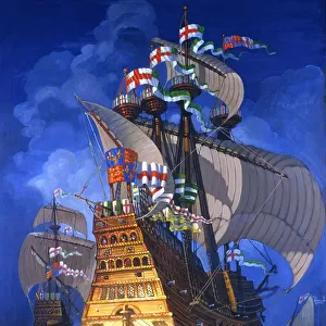
Photo Mug : Chart of Mediterranean Sea, with part of the Black Sea, 1626 (vellum)
")
")
![]()
Home Decor from Fine Art Finder
Chart of Mediterranean Sea, with part of the Black Sea, 1626 (vellum)
7340473 Chart of Mediterranean Sea, with part of the Black Sea, 1626 (vellum) by Oliva, Placido Caloiro e (c.1621-65); 68x43 cm; National Maritime Museum, London, UK; (add.info.: Creator: Placido Caloiro y Oliva
This is a Portulan or Portolan chart. These charts originated in the Mediterranean in the thirteenth century and take their name from the written sailing directions, portolani, which they supplemented and superseded. They were drawn and painted on vellum, using a network of intersecting rhumb (direction) lines radiating out from compass roses. Characteristic features include place names tightly packed onto the coast, together with flags and banners and vignettes of cities.); © National Maritime Museum, Greenwich, London
Media ID 38268606
© © National Maritime Museum, Greenwich, London / Bridgeman Images
Black Sea Mediterranean Sea Mediterrean Sea
Large Photo Mug (15 oz)
Sip your favorite beverage in style with our Photo Mug featuring a stunning vintage chart of the Mediterranean Sea and part of the Black Sea from 1626. A unique and eye-catching addition to your drinkware collection.
Elevate your coffee or tea experience with our premium white ceramic mug. Its wide, comfortable handle makes drinking easy, and you can rely on it to be both microwave and dishwasher safe. Sold in single units, preview may show both sides of the same mug so you can see how the picture wraps around.
Elevate your coffee or tea experience with our premium white ceramic mug. Its wide, comfortable handle makes drinking easy, and you can rely on it to be both microwave and dishwasher safe. Sold in single units, preview may show both sides of the same mug so you can see how the picture wraps around.
These are individually made so all sizes are approximate
FEATURES IN THESE COLLECTIONS
> Fine Art Finder
> Artists
> John Burston
> Europe
> United Kingdom
> England
> London
> Boroughs
> Greenwich
> Europe
> United Kingdom
> England
> London
> Museums
> Greenwich Heritage Centre
> Europe
> United Kingdom
> England
> London
> Museums
> National Maritime Museum
> Europe
> United Kingdom
> England
> London
> Sport
> Sailing
> Europe
> United Kingdom
> England
> London
> Towns
> Greenwich
> Europe
> United Kingdom
> Heritage Sites
> Maritime Greenwich
> Europe
> United Kingdom
> Maps
> Maps and Charts
> Early Maps
> Maps and Charts
> Related Images
EDITORS COMMENTS
This stunning print of a Chart of the Mediterranean Sea, with part of the Black Sea, dating back to 1626, offers a fascinating glimpse into the intricate world of cartography during the seventeenth century. Created by Placido Caloiro y Oliva, this 'Portulan' chart is a true work of art on vellum.
The detailed network of intersecting rhumb lines radiating from compass roses provides sailors with essential navigational information for their journeys across these historic waters. Place names are densely packed along the coastlines, accompanied by flags, banners, and vignettes of cities that add to the visual richness of the map.
As we gaze upon this piece from the National Maritime Museum in London, we are transported back in time to an era when exploration and discovery were at their peak. The vibrant colors and meticulous attention to detail showcase both the practicality and beauty inherent in early cartographic works.
Whether you're a history buff or simply appreciate fine art, this print is sure to captivate your imagination and spark curiosity about the seafaring adventures that once took place in these legendary seas. It serves as a reminder of our enduring fascination with maps as windows into worlds both real and imagined.
MADE IN THE USA
Safe Shipping with 30 Day Money Back Guarantee
FREE PERSONALISATION*
We are proud to offer a range of customisation features including Personalised Captions, Color Filters and Picture Zoom Tools
SECURE PAYMENTS
We happily accept a wide range of payment options so you can pay for the things you need in the way that is most convenient for you
* Options may vary by product and licensing agreement. Zoomed Pictures can be adjusted in the Cart.