Photo Mug > Europe > Italy > Maps
Photo Mug : Map of North Italy 1900


![]()
Home Decor from Fine Art Storehouse
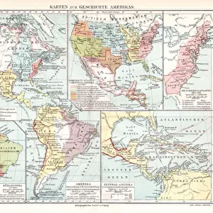
Map of North Italy 1900
Meyers hand-Atlas Leipzig und Wien Verlag des Bibliographischen Instituts 1900
Unleash your creativity and transform your space into a visual masterpiece!
THEPALMER
Media ID 18106851
© 2014 Roberto Adrian Photography
Large Photo Mug (15 oz)
Add a touch of history to your daily routine with our Media Storehouse Photo Mugs, featuring the captivating Map of North Italy 1900 by THEPALMER from the Fine Art Storehouse. This vintage map, taken from the Meyers Hand-Atlas published by the Bibliographisches Institut in Leipzig and Wien in 1900, is now transformed into a functional and stylish mug. Each mug is printed with high-quality, vibrant colors, ensuring your favorite beverage not only warms you up but also transports you back in time. Perfect for history enthusiasts, travelers, or anyone who appreciates the beauty of old maps, our Photo Mugs make for unique and thoughtful gifts. Embrace the past, one sip at a time.
Elevate your coffee or tea experience with our premium white ceramic mug. Its wide, comfortable handle makes drinking easy, and you can rely on it to be both microwave and dishwasher safe. Sold in single units, preview may show both sides of the same mug so you can see how the picture wraps around.
Elevate your coffee or tea experience with our premium white ceramic mug. Its wide, comfortable handle makes drinking easy, and you can rely on it to be both microwave and dishwasher safe. Sold in single units, preview may show both sides of the same mug so you can see how the picture wraps around.
These are individually made so all sizes are approximate
FEATURES IN THESE COLLECTIONS
> Fine Art Storehouse
> Map
> Historical Maps
> Fine Art Storehouse
> Map
> Italian Maps
> Maps and Charts
> Italy
EDITORS COMMENTS
In this print titled "Map of North Italy 1900" we are transported back in time to the turn of the century. The intricate details and delicate craftsmanship of this vintage map, sourced from Meyers hand-Atlas Leipzig und Wien Verlag des Bibliographischen Instituts in 1900, truly capture the essence of a bygone era. The map showcases the northern region of Italy, unveiling its rich history and cultural heritage. From the majestic peaks of the Alps to the picturesque coastlines along the Adriatic Sea, every contour and boundary is meticulously depicted with utmost precision. As our eyes wander across its surface, we can almost feel ourselves embarking on a journey through time. This piece serves as a testament to both artistry and cartography, reminding us that maps were once cherished works of art rather than mere navigational tools. It invites us to explore not only geographical landscapes but also historical narratives embedded within them. "The Map of North Italy 1900" transports us beyond physical boundaries into an enchanting world where imagination intertwines with reality. Its presence on display at Fine Art Storehouse allows us to appreciate how art can transcend time and bring forth a sense of nostalgia for eras long past. THEPALMER's skillful photography has beautifully captured this print's intricate details and vibrant colors, ensuring that its historical significance remains preserved for generations to come.
MADE IN THE USA
Safe Shipping with 30 Day Money Back Guarantee
FREE PERSONALISATION*
We are proud to offer a range of customisation features including Personalised Captions, Color Filters and Picture Zoom Tools
SECURE PAYMENTS
We happily accept a wide range of payment options so you can pay for the things you need in the way that is most convenient for you
* Options may vary by product and licensing agreement. Zoomed Pictures can be adjusted in the Cart.