Photo Mug > Arts > Artists > M > Juan Martinez
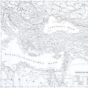
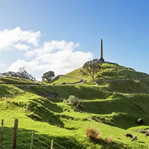
Photo Mug : WORLD MAP, 1587. Map of the world by Juan Martinez from Atlas Portulano, Madrid, 1587


![]()
Home Decor from Granger
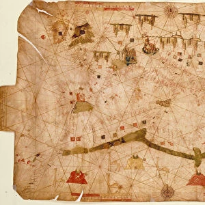
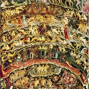
WORLD MAP, 1587. Map of the world by Juan Martinez from Atlas Portulano, Madrid, 1587
WORLD MAP, 1587.
Map of the world by Juan Martinez from Atlas Portulano, Madrid, 1587
Granger holds millions of images spanning more than 25,000 years of world history, from before the Stone Age to the dawn of the Space Age
Media ID 12321231
1587 Earth Eastern Geography Globe Hemisphere Juan Martinez Spanish Western World
Large Photo Mug (15 oz)
Step back in time with our Media Storehouse Photo Mug featuring a captivating image of a 1587 World Map. This vintage map, taken from the Atlas Portulano in Madrid, is a stunning representation of geographical knowledge during the late Renaissance period. Juan Martinez's intricate cartography comes to life on this mug, making each sip an adventure. Perfect for history enthusiasts, globetrotters, or anyone who appreciates the beauty of the past, this mug is not just a beverage container, but a conversation starter and a work of art. Embrace the rich history of cartography with every use.
Elevate your coffee or tea experience with our premium white ceramic mug. Its wide, comfortable handle makes drinking easy, and you can rely on it to be both microwave and dishwasher safe. Sold in single units, preview may show both sides of the same mug so you can see how the picture wraps around.
Elevate your coffee or tea experience with our premium white ceramic mug. Its wide, comfortable handle makes drinking easy, and you can rely on it to be both microwave and dishwasher safe. Sold in single units, preview may show both sides of the same mug so you can see how the picture wraps around.
These are individually made so all sizes are approximate
FEATURES IN THESE COLLECTIONS
> Granger Art on Demand
> Maps
> Arts
> Art Movements
> Renaissance Art
> Arts
> Artists
> M
> Juan Martinez
> Europe
> Spain
> Related Images
> Maps and Charts
> Related Images
> Maps and Charts
> Spain
> Maps and Charts
> World
EDITORS COMMENTS
This print showcases the intricate "WORLD MAP, 1587" created by Juan Martinez for the Atlas Portulano in Madrid during the late Renaissance period. The map, a true testament to the artistry and scientific knowledge of its time, offers a glimpse into how people perceived and understood the world nearly five centuries ago. With its rich details and vibrant colors, this map takes us back to an era when exploration was at its peak. It presents both familiar territories and mysterious lands yet to be discovered, labeled as "terra incognita". As we examine it closely, we can't help but marvel at how different our understanding of geography is today. The map's significance lies not only in its depiction of continents and oceans but also in its portrayal of cultural connections between Eastern and Western civilizations. It serves as a reminder that even in the 16th century, there were extensive trade routes connecting distant corners of the globe. As we gaze upon this remarkable piece of history suspended on our walls, it sparks curiosity about those who came before us - their ambitions, their thirst for knowledge, and their relentless pursuit of discovery. This World Map from 1587 allows us to appreciate how far humanity has come while reminding us that there will always be more to explore beyond what meets the eye.
MADE IN THE USA
Safe Shipping with 30 Day Money Back Guarantee
FREE PERSONALISATION*
We are proud to offer a range of customisation features including Personalised Captions, Color Filters and Picture Zoom Tools
SECURE PAYMENTS
We happily accept a wide range of payment options so you can pay for the things you need in the way that is most convenient for you
* Options may vary by product and licensing agreement. Zoomed Pictures can be adjusted in the Cart.